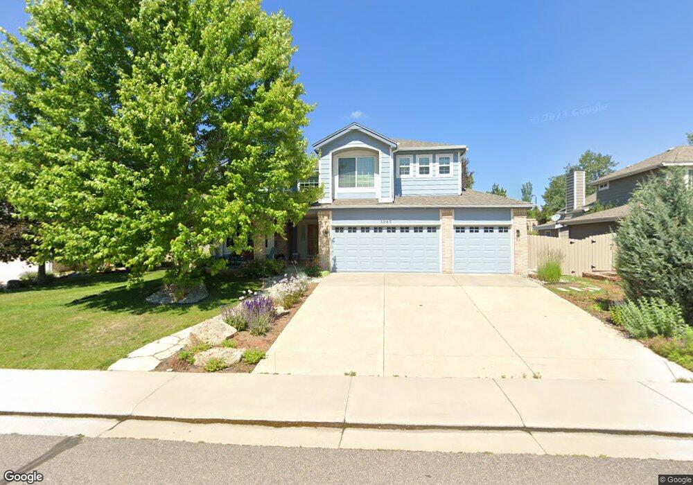
1067 Rand Way Superior, CO 80027
Estimated Value: $1,068,000 - $1,167,000
6
Beds
4
Baths
3,572
Sq Ft
$311/Sq Ft
Est. Value
About This Home
This home is located at 1067 Rand Way, Superior, CO 80027 and is currently estimated at $1,110,201, approximately $310 per square foot. 1067 Rand Way is a home located in Boulder County with nearby schools including Eldorado K-8 School, Superior Elementary School, and Monarch High School.
Ownership History
Date
Name
Owned For
Owner Type
Purchase Details
Closed on
Oct 30, 2012
Sold by
Shucker Brian D
Bought by
Shucker Brian
Current Estimated Value
Home Financials for this Owner
Home Financials are based on the most recent Mortgage that was taken out on this home.
Original Mortgage
$378,383
Outstanding Balance
$261,594
Interest Rate
3.4%
Mortgage Type
New Conventional
Estimated Equity
$848,607
Purchase Details
Closed on
Oct 4, 2011
Sold by
Mcfadden Charles T and Mcfadden Barbara A
Bought by
Shucker Brian D
Home Financials for this Owner
Home Financials are based on the most recent Mortgage that was taken out on this home.
Original Mortgage
$384,000
Interest Rate
4.28%
Mortgage Type
New Conventional
Purchase Details
Closed on
Dec 18, 1995
Sold by
Abel Dan R and Abel Peggy E
Bought by
Mcfadden Charles T
Home Financials for this Owner
Home Financials are based on the most recent Mortgage that was taken out on this home.
Original Mortgage
$160,000
Interest Rate
7.4%
Create a Home Valuation Report for This Property
The Home Valuation Report is an in-depth analysis detailing your home's value as well as a comparison with similar homes in the area
Home Values in the Area
Average Home Value in this Area
Purchase History
| Date | Buyer | Sale Price | Title Company |
|---|---|---|---|
| Shucker Brian | -- | Stewart Title | |
| Shucker Brian D | $480,000 | Land Title Guarantee Company | |
| Mcfadden Charles T | $259,950 | Land Title |
Source: Public Records
Mortgage History
| Date | Status | Borrower | Loan Amount |
|---|---|---|---|
| Open | Shucker Brian | $378,383 | |
| Closed | Shucker Brian D | $384,000 | |
| Previous Owner | Mcfadden Charles T | $160,000 |
Source: Public Records
Tax History Compared to Growth
Tax History
| Year | Tax Paid | Tax Assessment Tax Assessment Total Assessment is a certain percentage of the fair market value that is determined by local assessors to be the total taxable value of land and additions on the property. | Land | Improvement |
|---|---|---|---|---|
| 2025 | $6,906 | $66,026 | $26,763 | $39,263 |
| 2024 | $6,906 | $66,026 | $26,763 | $39,263 |
| 2023 | $6,811 | $66,645 | $23,618 | $46,712 |
| 2022 | $5,385 | $51,479 | $18,800 | $32,679 |
| 2021 | $5,689 | $56,342 | $20,578 | $35,764 |
| 2020 | $5,253 | $50,000 | $21,093 | $28,907 |
| 2019 | $5,180 | $50,000 | $21,093 | $28,907 |
| 2018 | $4,415 | $42,214 | $14,544 | $27,670 |
| 2017 | $4,513 | $46,669 | $16,079 | $30,590 |
| 2016 | $4,538 | $41,010 | $15,124 | $25,886 |
| 2015 | $4,313 | $35,876 | $14,328 | $21,548 |
| 2014 | $3,809 | $35,876 | $14,328 | $21,548 |
Source: Public Records
Map
Nearby Homes
- 1825 Keota Ln
- 1899 Breen Ln
- 1820 Vernon Ln
- 888 Northern Way
- 2204 Lasalle St
- 1009 Monarch Way
- 2112 Grayden Ct
- 1637 Reliance Cir
- 1812 Eldorado Dr
- 882 Eldorado Dr
- 1540 Masters Ct
- 977 Eldorado Dr
- 520 Campo Way
- 1842 Reliance Cir
- 1122 Eldorado Dr
- 1302 Eldorado Dr
- 2225 Clayton Cir
- 1220 S Boyero Ct
- 1340 Stoneham St
- 1485 Stoneham St