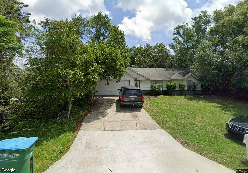
1067 Swanson Dr Deltona, FL 32738
Estimated Value: $274,000 - $308,000
3
Beds
2
Baths
1,732
Sq Ft
$171/Sq Ft
Est. Value
About This Home
This home is located at 1067 Swanson Dr, Deltona, FL 32738 and is currently estimated at $295,796, approximately $170 per square foot. 1067 Swanson Dr is a home located in Volusia County with nearby schools including Deltona Lakes Elementary School, Heritage Middle School, and Pine Ridge High School.
Ownership History
Date
Name
Owned For
Owner Type
Purchase Details
Closed on
Jul 16, 2004
Sold by
Kula Michael A and Kula Mary C
Bought by
May Adrian
Current Estimated Value
Home Financials for this Owner
Home Financials are based on the most recent Mortgage that was taken out on this home.
Original Mortgage
$103,900
Outstanding Balance
$50,302
Interest Rate
5.75%
Mortgage Type
Purchase Money Mortgage
Estimated Equity
$245,494
Purchase Details
Closed on
Jan 15, 1991
Bought by
May Adrian
Purchase Details
Closed on
Jun 15, 1990
Bought by
May Adrian
Purchase Details
Closed on
Jun 15, 1988
Bought by
May Adrian
Purchase Details
Closed on
Sep 15, 1983
Bought by
May Adrian
Purchase Details
Closed on
Oct 15, 1982
Bought by
May Adrian
Create a Home Valuation Report for This Property
The Home Valuation Report is an in-depth analysis detailing your home's value as well as a comparison with similar homes in the area
Home Values in the Area
Average Home Value in this Area
Purchase History
| Date | Buyer | Sale Price | Title Company |
|---|---|---|---|
| May Adrian | $129,900 | Brokers Title Of Orlando Ltd | |
| May Adrian | $71,300 | -- | |
| May Adrian | $14,500 | -- | |
| May Adrian | $100 | -- | |
| May Adrian | $6,000 | -- | |
| May Adrian | $100 | -- |
Source: Public Records
Mortgage History
| Date | Status | Borrower | Loan Amount |
|---|---|---|---|
| Open | May Adrian | $103,900 | |
| Closed | May Adrian | $26,000 |
Source: Public Records
Tax History Compared to Growth
Tax History
| Year | Tax Paid | Tax Assessment Tax Assessment Total Assessment is a certain percentage of the fair market value that is determined by local assessors to be the total taxable value of land and additions on the property. | Land | Improvement |
|---|---|---|---|---|
| 2025 | $989 | $81,224 | -- | -- |
| 2024 | $989 | $78,935 | -- | -- |
| 2023 | $989 | $76,636 | $0 | $0 |
| 2022 | $969 | $74,404 | $0 | $0 |
| 2021 | $1,000 | $72,237 | $0 | $0 |
| 2020 | $998 | $71,240 | $0 | $0 |
| 2019 | $1,017 | $69,638 | $0 | $0 |
| 2018 | $1,007 | $68,340 | $0 | $0 |
| 2017 | $995 | $66,934 | $0 | $0 |
| 2016 | $983 | $65,557 | $0 | $0 |
| 2015 | $1,002 | $65,101 | $0 | $0 |
| 2014 | $979 | $64,584 | $0 | $0 |
Source: Public Records
Map
Nearby Homes
- 1082 Worthington Dr
- 1113 Fort Smith Blvd
- 1057 Fort Smith Blvd
- 2067 Everest St
- 968 Fort Smith Blvd
- 1961 Paragon St
- 973 Radford Dr
- 2046 Galahad Dr
- 1922 Marlow St
- 732 Fort Smith Blvd
- 747 Fort Smith Blvd
- 1771 S Village Dr
- 1901 Odham Dr
- 2180 MacHardy Rd
- 884 Fort Smith Blvd
- 1656 Brentlawn St
- 985 N Village Dr
- 1179 Snowden Ave
- 1788 E Normandy Blvd
- 1649 Weybridge St
- 1051 Swanson Dr
- 1075 Swanson Dr
- 1066 Worthington Dr
- 1058 Worthington Dr
- 1083 Swanson Dr
- 1047 Swanson Dr
- 1074 Worthington Dr
- 1074 Swanson Dr
- 1058 Swanson Dr
- 1050 Worthington Dr
- 1082 Swanson Dr
- 1091 Swanson Dr
- 1050 Swanson Dr
- 1042 Swanson Dr
- 1073 Worthington Dr
- 1075 Fort Smith Blvd
- 1090 Swanson Dr
- 1081 Fort Smith Blvd
- 1043 Swanson Dr
- 1090 Worthington Dr