S
Seller's Agent in 2015
Sidney Smyth
Long & Foster - Victoria

Estimated Value: $123,000 - $327,000
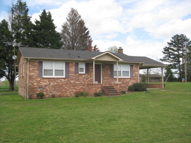
87+ acres with 50 acres open pasture land. Partially fenced. Pond and some outbuilding. House on excellent condition with large eat in kitchen and a small wood stove that's usable. This farm is currently in operation for hay and cattle production.
Last Agent to Sell the Property
Sidney Smyth
Long & Foster - Victoria Brokerage Phone: 4346962118 License #0225213845 Listed on: 08/12/2015

Last Buyer's Agent
Sidney Smyth
Long & Foster - Victoria Brokerage Phone: 4346962118 License #0225213845 Listed on: 08/12/2015
| Date | Event | Price | List to Sale | Price per Sq Ft |
|---|---|---|---|---|
| 08/12/2015 08/12/15 | Sold | $225,000 | -- | $225 / Sq Ft |
S
Seller's Agent in 2015
Sidney Smyth
Long & Foster - Victoria
Source: South Central Association of REALTORS®
MLS Number: 36583
APN: 8496
Disclaimer: Certain information contained herein is derived from information provided by parties other than Homes.com. All information provided is deemed reliable, but is not guaranteed to be accurate and should be independently verified.
![]() IDX information is provided exclusively for personal, non-commercial use, and may not be used for any purpose other than to identify prospective properties consumers may be interested in purchasing. Information is deemed reliable but not guaranteed.
IDX information is provided exclusively for personal, non-commercial use, and may not be used for any purpose other than to identify prospective properties consumers may be interested in purchasing. Information is deemed reliable but not guaranteed.
Ask me questions while you tour the home.