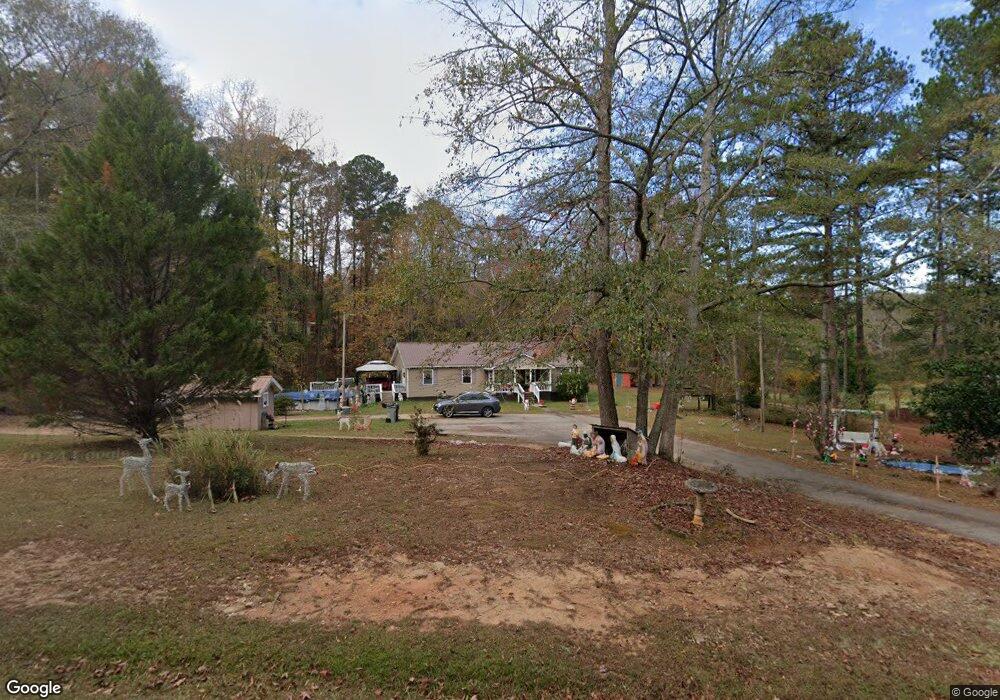
1067 Warner Rd West Point, GA 31833
Estimated Value: $195,793 - $370,000
3
Beds
2
Baths
2,128
Sq Ft
$149/Sq Ft
Est. Value
About This Home
This home is located at 1067 Warner Rd, West Point, GA 31833 and is currently estimated at $316,198, approximately $148 per square foot. 1067 Warner Rd is a home located in Troup County with nearby schools including Long Cane Elementary School, West Point Elementary School, and Whitesville Road Elementary School.
Ownership History
Date
Name
Owned For
Owner Type
Purchase Details
Closed on
Jun 15, 1999
Sold by
Emett Head
Bought by
Colson Steven D and Colson Christine
Current Estimated Value
Purchase Details
Closed on
Apr 30, 1993
Sold by
Ray Colson
Bought by
Emett Head
Purchase Details
Closed on
Mar 10, 1988
Bought by
Ray Colson
Purchase Details
Closed on
Mar 1, 1987
Purchase Details
Closed on
Mar 27, 1980
Purchase Details
Closed on
Oct 13, 1979
Purchase Details
Closed on
Jan 26, 1976
Purchase Details
Closed on
Jan 1, 1901
Create a Home Valuation Report for This Property
The Home Valuation Report is an in-depth analysis detailing your home's value as well as a comparison with similar homes in the area
Home Values in the Area
Average Home Value in this Area
Purchase History
| Date | Buyer | Sale Price | Title Company |
|---|---|---|---|
| Colson Steven D | $50,000 | -- | |
| Emett Head | $30,000 | -- | |
| Ray Colson | $32,600 | -- | |
| Ray Colson | $32,600 | -- | |
| -- | -- | -- | |
| -- | -- | -- | |
| -- | -- | -- | |
| -- | -- | -- | |
| -- | -- | -- |
Source: Public Records
Tax History
| Year | Tax Paid | Tax Assessment Tax Assessment Total Assessment is a certain percentage of the fair market value that is determined by local assessors to be the total taxable value of land and additions on the property. | Land | Improvement |
|---|---|---|---|---|
| 2025 | $1,746 | $78,692 | $12,600 | $66,092 |
| 2024 | $1,746 | $66,012 | $12,600 | $53,412 |
| 2023 | $1,008 | $56,852 | $12,600 | $44,252 |
| 2022 | $1,461 | $54,332 | $12,600 | $41,732 |
| 2021 | $1,241 | $43,128 | $12,320 | $30,808 |
| 2020 | $1,231 | $42,808 | $12,000 | $30,808 |
| 2019 | $1,224 | $42,560 | $12,000 | $30,560 |
| 2018 | $1,141 | $39,836 | $12,000 | $27,836 |
| 2017 | $1,142 | $39,836 | $12,000 | $27,836 |
| 2016 | $1,115 | $38,946 | $12,000 | $26,946 |
| 2015 | $1,055 | $36,890 | $12,000 | $24,890 |
| 2014 | $1,056 | $36,864 | $12,000 | $24,864 |
| 2013 | -- | $36,838 | $12,000 | $24,838 |
Source: Public Records
Map
Nearby Homes
- 0 Warner Rd Unit 10686116
- 648 Warner Rd
- 101 Garden Walk
- 4172 Bartley Rd
- 107 Amhurst Dr
- Sandtown Road Unit: 1 2+ - Acre
- 0 Sandtown Rd Unit 10255987
- 0 Cannonville Rd
- 209 Harris Walk
- 211 Harris Walk
- 215 Harris Walk
- 223 Harris Walk
- 225 Harris Walk
- 221 Harris Walk
- 1248 Cannonville Rd
- 0 Lambert Rd
- 5714 W Point Rd
- 0 Johns Rd Unit 10615130
- 2067 Bartley Rd
- 90 Hickory Ln
- 1101 Warner Rd
- 1037 Warner Rd
- 1005 Warner Rd
- 0 Warner Rd Unit 7520351
- 1110 Warner Rd
- 995 & 1015 Warner Rd
- 1006 Warner Rd
- 1133 Warner Rd
- 1147 Warner Rd
- 957 Warner Rd
- 992 Warner Rd
- 885 Warner Rd
- 1168 Warner Rd
- 917 Warner Rd
- 887 Warner Rd
- 887 Warner Rd Unit D
- 662 Gray Hill School Rd
- 684 Gray Hill School Rd
- 1239 Warner Rd
- 584 Gray Hill School Rd
Your Personal Tour Guide
Ask me questions while you tour the home.