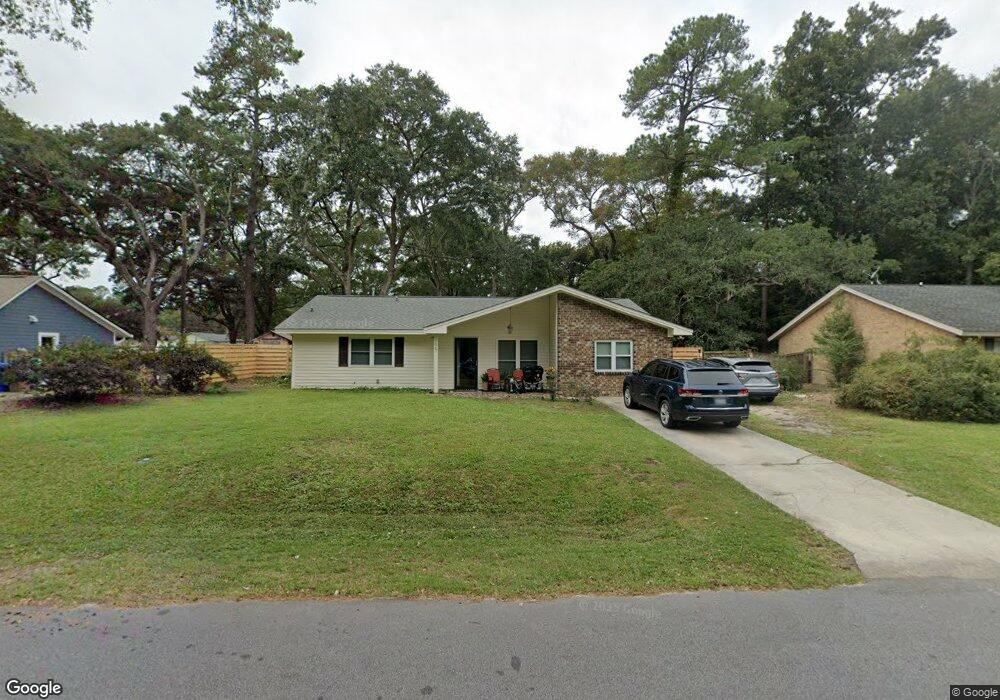
1067 Yorktown Dr Charleston, SC 29412
James Island NeighborhoodEstimated Value: $592,000 - $676,000
4
Beds
2
Baths
1,988
Sq Ft
$319/Sq Ft
Est. Value
About This Home
This home is located at 1067 Yorktown Dr, Charleston, SC 29412 and is currently estimated at $634,044, approximately $318 per square foot. 1067 Yorktown Dr is a home located in Charleston County with nearby schools including James Island Elementary School, Camp Road Middle, and Septima P Clark Corporate Academy.
Ownership History
Date
Name
Owned For
Owner Type
Purchase Details
Closed on
Jan 20, 2017
Sold by
Mcloud Philip Andrew
Bought by
Mcloud Philip Andrew and Nelson Bonnie Claire
Current Estimated Value
Purchase Details
Closed on
Mar 19, 2010
Sold by
Joyce Thomas M
Bought by
Mcloud Philip Andrew
Home Financials for this Owner
Home Financials are based on the most recent Mortgage that was taken out on this home.
Original Mortgage
$235,483
Outstanding Balance
$160,074
Interest Rate
5.5%
Mortgage Type
FHA
Estimated Equity
$473,970
Purchase Details
Closed on
Jun 12, 2000
Sold by
Butler Steven C and Butler Karen L
Bought by
Joyce Thomas M
Create a Home Valuation Report for This Property
The Home Valuation Report is an in-depth analysis detailing your home's value as well as a comparison with similar homes in the area
Home Values in the Area
Average Home Value in this Area
Purchase History
| Date | Buyer | Sale Price | Title Company |
|---|---|---|---|
| Mcloud Philip Andrew | -- | None Available | |
| Mcloud Philip Andrew | $225,000 | -- | |
| Joyce Thomas M | $132,000 | -- |
Source: Public Records
Mortgage History
| Date | Status | Borrower | Loan Amount |
|---|---|---|---|
| Open | Mcloud Philip Andrew | $235,483 |
Source: Public Records
Tax History Compared to Growth
Tax History
| Year | Tax Paid | Tax Assessment Tax Assessment Total Assessment is a certain percentage of the fair market value that is determined by local assessors to be the total taxable value of land and additions on the property. | Land | Improvement |
|---|---|---|---|---|
| 2024 | $1,838 | $13,680 | $0 | $0 |
| 2023 | $1,838 | $13,680 | $0 | $0 |
| 2022 | $1,702 | $13,680 | $0 | $0 |
| 2021 | $1,784 | $13,680 | $0 | $0 |
| 2020 | $1,482 | $10,810 | $0 | $0 |
| 2019 | $1,322 | $9,400 | $0 | $0 |
| 2017 | $1,278 | $9,400 | $0 | $0 |
| 2016 | $1,226 | $9,400 | $0 | $0 |
| 2015 | $1,266 | $9,400 | $0 | $0 |
| 2014 | $1,151 | $0 | $0 | $0 |
| 2011 | -- | $0 | $0 | $0 |
Source: Public Records
Map
Nearby Homes
- 1056 Yorktown Dr
- 1039 Yorktown Dr
- 0 Turkey Pen Rd Unit 16023532
- 1815 Walsingham Way
- 1047 Bradford Ave
- 1827 S Mayflower Dr
- 1662 Dexter Ln
- 1814 S Mayflower Dr
- 1182 Folly Rd Unit A,B,C,D
- 1152 Bradford Ave
- 1570 Blaze Ln
- 1153 Pauline Ave
- 1291 Apex Ln
- 1206 Folly Rd
- 1262 Apex Ln
- 1030 Pauline Ave
- 1527 Blaze Ln
- 1137 Rivercrest Dr
- 1135 Bellwood Rd
- 1014 Arborwood Dr
- 1063 Yorktown Dr
- 1071 Yorktown Dr
- 1059 Yorktown Dr
- 1075 Yorktown Dr
- 1779 Turkey Pen Rd
- 1068 Yorktown Dr
- 1064 Yorktown Dr
- 1072 Yorktown Dr
- 1079 Yorktown Dr
- 1055 Yorktown Dr
- 1785 Turkey Pen Rd
- 1076 Yorktown Dr
- 1789 Turkey Pen Rd
- 1084 Yorktown Dr
- 1051 Yorktown Dr
- 1083 Yorktown Dr
- 1080 Yorktown Dr
- 1786 Turkey Pen Rd
- 1784 Turkey Pen Rd
- 1776 Turkey Pen Rd