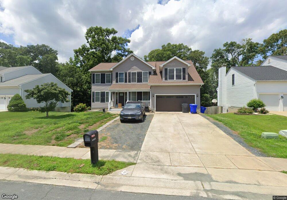
10672 Ashford Cir Waldorf, MD 20603
Estimated Value: $523,000 - $571,000
4
Beds
4
Baths
2,356
Sq Ft
$235/Sq Ft
Est. Value
About This Home
This home is located at 10672 Ashford Cir, Waldorf, MD 20603 and is currently estimated at $554,546, approximately $235 per square foot. 10672 Ashford Cir is a home located in Charles County with nearby schools including Berry Elementary School, Mattawoman Middle School, and North Point High School.
Ownership History
Date
Name
Owned For
Owner Type
Purchase Details
Closed on
Jun 8, 2010
Sold by
Dobbs Shaki
Bought by
Burney Kim L and Burney Pierre
Current Estimated Value
Purchase Details
Closed on
Jul 8, 2005
Sold by
Weatherman Dan V and Weatherman Mary A
Bought by
Dobbs Shaki
Home Financials for this Owner
Home Financials are based on the most recent Mortgage that was taken out on this home.
Original Mortgage
$397,600
Interest Rate
6.95%
Mortgage Type
Adjustable Rate Mortgage/ARM
Purchase Details
Closed on
Jun 30, 2004
Sold by
Lowas Albert F and Lowas Rosemary
Bought by
Weatherman Dan V and Weatherman Mary A
Purchase Details
Closed on
Jul 2, 1996
Sold by
Bch Partners Limited Partnership
Bought by
Lowas Albert F and Lowas Rosemary
Create a Home Valuation Report for This Property
The Home Valuation Report is an in-depth analysis detailing your home's value as well as a comparison with similar homes in the area
Home Values in the Area
Average Home Value in this Area
Purchase History
| Date | Buyer | Sale Price | Title Company |
|---|---|---|---|
| Burney Kim L | $292,500 | -- | |
| Dobbs Shaki | $497,000 | -- | |
| Weatherman Dan V | $394,672 | -- | |
| Lowas Albert F | $211,275 | -- |
Source: Public Records
Mortgage History
| Date | Status | Borrower | Loan Amount |
|---|---|---|---|
| Previous Owner | Dobbs Shaki | $397,600 | |
| Previous Owner | Dobbs Shaki | $99,400 | |
| Closed | Burney Kim L | -- |
Source: Public Records
Tax History Compared to Growth
Tax History
| Year | Tax Paid | Tax Assessment Tax Assessment Total Assessment is a certain percentage of the fair market value that is determined by local assessors to be the total taxable value of land and additions on the property. | Land | Improvement |
|---|---|---|---|---|
| 2025 | $13,640 | $471,500 | -- | -- |
| 2024 | $6,047 | $453,600 | $126,200 | $327,400 |
| 2023 | $6,005 | $420,200 | $0 | $0 |
| 2022 | $5,258 | $386,800 | $0 | $0 |
| 2021 | $4,806 | $353,400 | $110,200 | $243,200 |
| 2020 | $4,806 | $348,500 | $0 | $0 |
| 2019 | $4,722 | $343,600 | $0 | $0 |
| 2018 | $4,630 | $338,700 | $100,200 | $238,500 |
| 2017 | $4,359 | $318,800 | $0 | $0 |
| 2016 | -- | $298,900 | $0 | $0 |
| 2015 | $3,435 | $279,000 | $0 | $0 |
| 2014 | $3,435 | $279,000 | $0 | $0 |
Source: Public Records
Map
Nearby Homes
- 10515 Berry Rd
- 2325 Ashford Ln
- 10602 Ashford Cir
- 2304 Leyton Ct
- 10403 Halmstad Dr
- 10395 Halmstad Dr
- 10391 Halmstad Dr
- 10411 Halmstad Dr
- 10387 Halmstad Dr
- 10415 Halmstad Dr
- 10383 Halmstad Dr
- 2322 Alava Ct
- 2323 Springdale Ln
- 10400 Halmstad Dr
- 10379 Halmstad Dr
- 10394 Halmstad Dr
- 2461 Streamview Dr
- The Elizabeth Plan at Sunstone Preserve - Single Family Homes
- 10386 Halmstad Dr
- 10367 Halmstad Dr
- 10670 Ashford Cir
- 10674 Ashford Cir
- 10668 Ashford Cir
- 10676 Ashford Cir
- 10673 Ashford Cir
- 10669 Ashford Cir
- 10678 Ashford Cir
- 10451 Kelso Ct
- 10667 Ashford Cir
- 2360 Ashford Ln
- 10675 Ashford Cir
- 2422 Grantham Ct
- 2363 Kanegis Dr
- 10665 Ashford Cir
- 2423 Grantham Ct
- 10680 Ashford Cir
- 10677 Ashford Cir
- 2424 Grantham Ct
- 2358 Ashford Ln
- 10663 Ashford Cir