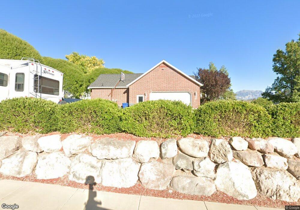
1068 N 610 W American Fork, UT 84003
Estimated Value: $704,000 - $965,000
3
Beds
3
Baths
1,883
Sq Ft
$442/Sq Ft
Est. Value
About This Home
This home is located at 1068 N 610 W, American Fork, UT 84003 and is currently estimated at $833,093, approximately $442 per square foot. 1068 N 610 W is a home located in Utah County with nearby schools including Shelley Elementary School, American Fork Junior High School, and American Fork High School.
Ownership History
Date
Name
Owned For
Owner Type
Purchase Details
Closed on
Jun 19, 2020
Sold by
Searle Jeffery Lynn and Searle Myra Leann
Bought by
Searle Jeffrey L and Searle Leanne
Current Estimated Value
Home Financials for this Owner
Home Financials are based on the most recent Mortgage that was taken out on this home.
Original Mortgage
$262,000
Outstanding Balance
$184,184
Interest Rate
3.2%
Mortgage Type
New Conventional
Estimated Equity
$648,909
Purchase Details
Closed on
Dec 15, 2006
Sold by
Wentworth Development Llc
Bought by
Searle Jeffrey Lynn and Searle Myra Leann
Create a Home Valuation Report for This Property
The Home Valuation Report is an in-depth analysis detailing your home's value as well as a comparison with similar homes in the area
Home Values in the Area
Average Home Value in this Area
Purchase History
| Date | Buyer | Sale Price | Title Company |
|---|---|---|---|
| Searle Jeffrey L | -- | Gt Title Services | |
| Searle Jeffrey Lynn | -- | First American Title Co |
Source: Public Records
Mortgage History
| Date | Status | Borrower | Loan Amount |
|---|---|---|---|
| Open | Searle Jeffrey L | $262,000 |
Source: Public Records
Tax History Compared to Growth
Tax History
| Year | Tax Paid | Tax Assessment Tax Assessment Total Assessment is a certain percentage of the fair market value that is determined by local assessors to be the total taxable value of land and additions on the property. | Land | Improvement |
|---|---|---|---|---|
| 2025 | $3,531 | $428,395 | $339,400 | $439,500 |
| 2024 | $3,531 | $392,370 | $0 | $0 |
| 2023 | $3,306 | $389,455 | $0 | $0 |
| 2022 | $3,595 | $417,945 | $0 | $0 |
| 2021 | $3,162 | $574,200 | $237,600 | $336,600 |
| 2020 | $3,070 | $540,600 | $220,000 | $320,600 |
| 2019 | $2,738 | $498,800 | $220,000 | $278,800 |
| 2018 | $2,606 | $453,900 | $211,500 | $242,400 |
| 2017 | $2,434 | $228,745 | $0 | $0 |
| 2016 | $2,619 | $228,745 | $0 | $0 |
| 2015 | $2,444 | $202,565 | $0 | $0 |
| 2014 | $2,273 | $185,845 | $0 | $0 |
Source: Public Records
Map
Nearby Homes
- 471 W 1040 N
- 987 N 410 W
- 602 W 860 N
- 425 W 1120 N
- 3935 W 1000 N Unit 438
- 3983 W 1000 N Unit 442
- 4007 W 1000 N
- 3947 W 1000 N Unit 439
- 3971 W 1000 N Unit 441
- 3959 W 1000 N
- 344 W 1080 N
- 914 N 400 W Unit A
- 3889 W 950 Cir N Unit 366
- 822 N 860 W Unit 317
- 822 W 800 St N Unit LOT319
- 984 N 300 W
- 356 W 1300 N
- 9435 N Aspen Hollow Cir
- 962 N 780 St W Unit 508
- 974 N 780 St W Unit 509
- 598 W 1040 N Unit 1
- 4003 W 1040 N Unit MM302
- 4003 W 1040 N Unit MM301
- 4003 W 1040 N Unit MM201
- 4003 W 1040 N Unit MM204
- 4003 W 1040 N Unit MM202
- 4003 W 1040 N Unit MM304
- 4003 W 1040 N Unit MM303
- 4003 W 1040 N Unit MM203
- 4003 W 1040 N Unit MM101
- 4003 W 1040 N Unit MM102
- 603 W 1040 N
- 591 W 1040 N
- 592 W 1040 N
- 1072 N 610 W
- 626 W 1040 N
- 617 W 1040 N
- 617 W 1040 N Unit 18
- 589 W 1040 N
- 579 W 1060 N