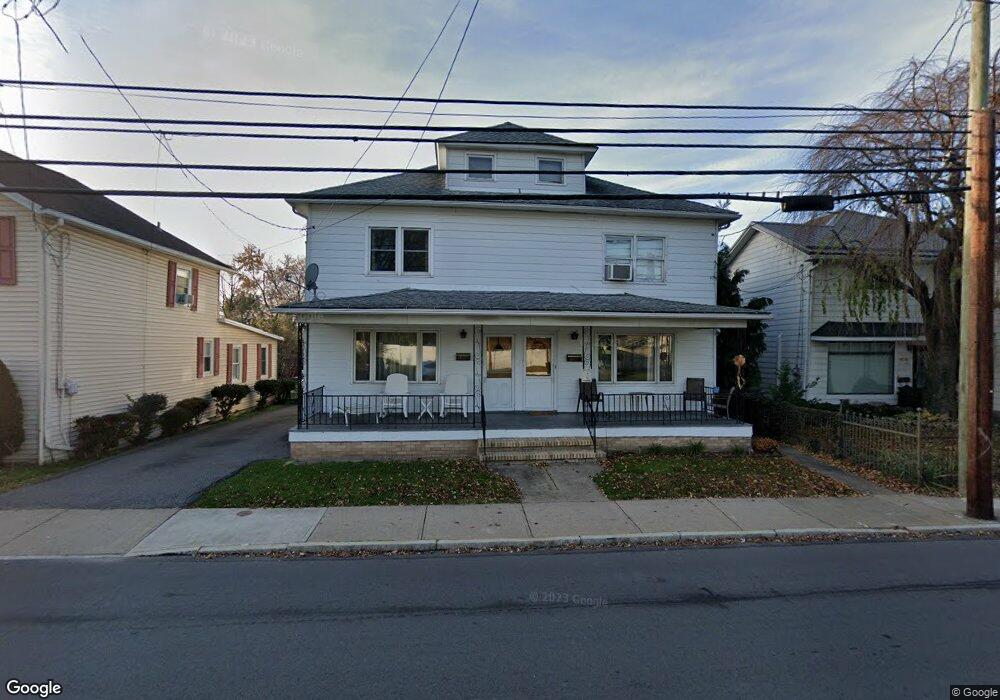
1068 Scott St Wilkes Barre, PA 18705
Estimated Value: $107,290 - $165,000
--
Bed
--
Bath
1,440
Sq Ft
$98/Sq Ft
Est. Value
About This Home
This home is located at 1068 Scott St, Wilkes Barre, PA 18705 and is currently estimated at $140,573, approximately $97 per square foot. 1068 Scott St is a home located in Luzerne County with nearby schools including Leo E. Solomon-Plains Elementary School, Cradock Middle School, and Solomon/Plains Junior High School.
Ownership History
Date
Name
Owned For
Owner Type
Purchase Details
Closed on
Aug 12, 2011
Sold by
Burke Nancy
Bought by
Baird David L
Current Estimated Value
Home Financials for this Owner
Home Financials are based on the most recent Mortgage that was taken out on this home.
Original Mortgage
$67,500
Outstanding Balance
$46,605
Interest Rate
4.51%
Mortgage Type
New Conventional
Estimated Equity
$93,968
Purchase Details
Closed on
Oct 11, 2010
Sold by
Knesis Agnes and Grover Margaret Mary
Bought by
Burke Nancy
Create a Home Valuation Report for This Property
The Home Valuation Report is an in-depth analysis detailing your home's value as well as a comparison with similar homes in the area
Home Values in the Area
Average Home Value in this Area
Purchase History
| Date | Buyer | Sale Price | Title Company |
|---|---|---|---|
| Baird David L | $90,000 | None Available | |
| Burke Nancy | $25,000 | None Available |
Source: Public Records
Mortgage History
| Date | Status | Borrower | Loan Amount |
|---|---|---|---|
| Open | Baird David L | $67,500 |
Source: Public Records
Tax History Compared to Growth
Tax History
| Year | Tax Paid | Tax Assessment Tax Assessment Total Assessment is a certain percentage of the fair market value that is determined by local assessors to be the total taxable value of land and additions on the property. | Land | Improvement |
|---|---|---|---|---|
| 2025 | $7,774 | $46,800 | $17,400 | $29,400 |
| 2024 | $7,774 | $46,800 | $17,400 | $29,400 |
| 2023 | $7,774 | $46,800 | $17,400 | $29,400 |
| 2022 | $7,766 | $46,800 | $17,400 | $29,400 |
| 2021 | $7,766 | $46,800 | $17,400 | $29,400 |
| 2020 | $7,766 | $46,800 | $17,400 | $29,400 |
| 2019 | $8,912 | $46,800 | $17,400 | $29,400 |
| 2018 | $7,710 | $46,800 | $17,400 | $29,400 |
| 2017 | $7,683 | $46,800 | $17,400 | $29,400 |
| 2016 | -- | $46,800 | $17,400 | $29,400 |
| 2015 | -- | $46,800 | $17,400 | $29,400 |
| 2014 | -- | $46,800 | $17,400 | $29,400 |
Source: Public Records
Map
Nearby Homes
- 245 Matson Ave
- 239 Matson Ave
- 24 Oliver St
- 133 Govier St
- 19 Virginia Dr
- 180 Gardner Ave
- 178 Gardner Ave
- 52 Mill St
- 35 Kado St
- 76 Brader Dr
- 31 Harriet St
- 18 Samantha Dr
- 14 Knight St
- 221 E Thomas St
- 1326 N Washington St Unit PORTFOLIO 3 BUILDING
- 330 E Thomas St
- 12 Mayock St
- 11 Mayock St
- 9 Mayock St
- 13 Mayock St
- 1066 Scott St
- 1060 Scott St
- 278-280 George Ave
- 251 Matson Ave
- 387 Matson Ave
- 1054 Scott St
- 256 Matson Ave
- 1075 Scott St
- 278 George Ave
- 288 George Ave
- 254 Matson Ave
- 280 George Ave
- 280 George Ave Unit 1
- 280 George Ave
- 256-258 George Ave
- 250 Matson Ave
- 237 Matson Ave
- 1089 Scott St
- 235 Matson Ave
- 262 George Ave