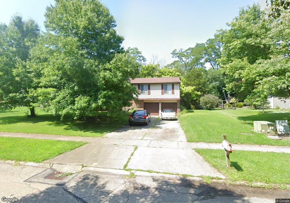
10683 Stonewood Ct Cincinnati, OH 45240
New Burlington NeighborhoodEstimated Value: $233,000 - $264,000
3
Beds
2
Baths
1,300
Sq Ft
$193/Sq Ft
Est. Value
About This Home
This home is located at 10683 Stonewood Ct, Cincinnati, OH 45240 and is currently estimated at $251,548, approximately $193 per square foot. 10683 Stonewood Ct is a home located in Hamilton County with nearby schools including Mt Healthy High School, Hamilton County Mathematics and Science Academy, and Central Montessori Academy.
Ownership History
Date
Name
Owned For
Owner Type
Purchase Details
Closed on
Sep 3, 1997
Sold by
Metz Robert J and Metz Linda C
Bought by
Phomsouvanh Bouasy and Phomsouvanh Khamphiou
Current Estimated Value
Home Financials for this Owner
Home Financials are based on the most recent Mortgage that was taken out on this home.
Original Mortgage
$103,700
Interest Rate
7.65%
Create a Home Valuation Report for This Property
The Home Valuation Report is an in-depth analysis detailing your home's value as well as a comparison with similar homes in the area
Home Values in the Area
Average Home Value in this Area
Purchase History
| Date | Buyer | Sale Price | Title Company |
|---|---|---|---|
| Phomsouvanh Bouasy | $116,500 | -- |
Source: Public Records
Mortgage History
| Date | Status | Borrower | Loan Amount |
|---|---|---|---|
| Previous Owner | Phomsouvanh Bouasy | $103,700 |
Source: Public Records
Tax History Compared to Growth
Tax History
| Year | Tax Paid | Tax Assessment Tax Assessment Total Assessment is a certain percentage of the fair market value that is determined by local assessors to be the total taxable value of land and additions on the property. | Land | Improvement |
|---|---|---|---|---|
| 2024 | $3,721 | $64,544 | $13,230 | $51,314 |
| 2023 | $3,534 | $64,544 | $13,230 | $51,314 |
| 2022 | $3,973 | $52,273 | $12,880 | $39,393 |
| 2021 | $3,867 | $52,273 | $12,880 | $39,393 |
| 2020 | $3,925 | $52,273 | $12,880 | $39,393 |
| 2019 | $3,306 | $41,160 | $10,143 | $31,017 |
| 2018 | $3,325 | $41,160 | $10,143 | $31,017 |
| 2017 | $3,155 | $41,160 | $10,143 | $31,017 |
| 2016 | $2,841 | $36,516 | $9,632 | $26,884 |
| 2015 | $2,863 | $36,516 | $9,632 | $26,884 |
| 2014 | $2,849 | $36,516 | $9,632 | $26,884 |
| 2013 | $3,064 | $40,128 | $10,584 | $29,544 |
Source: Public Records
Map
Nearby Homes
- 1717 Aspenhill Dr
- 1762 Lockbourne Dr
- 1819 Aspenhill Dr
- 10525 Mill Rd
- 10493 Mill Rd
- 10467 Mill Rd
- 1662 Springdale Rd
- 10773 Shadowridge Ln
- 10804 Sprucehill Dr
- 2000 Struble Rd
- 1917 Springdale Rd
- 65 Bayham Dr
- 5 Briarwood Ln
- 2 Brompton Ln
- 51 Damon Rd
- 65 Damon Rd
- 1413 Waycross Rd
- 1429 Waycross Rd
- 7 Dewitt Ct
- 9 Dewitt Ct
- 10691 Stonewood Ct
- 10675 Stonewood Ct
- 10667 Stonewood Ct
- 1681 Aspenhill Dr
- 10699 Stonewood Ct
- 1687 Aspenhill Dr
- 10659 Stonewood Ct
- 10684 Ridgevale Dr
- 10688 Stonewood Ct
- 10676 Stonewood Ct
- 10672 Ridgevale Dr
- 10696 Ridgevale Dr
- 10698 Stonewood Ct
- 10651 Stonewood Ct
- 10664 Stonewood Ct
- 10648 Ridgevale Dr
- 10706 Baronwood Ct
- 10652 Stonewood Ct
- 1686 Aspenhill Dr
- 1658 Aspenhill Dr