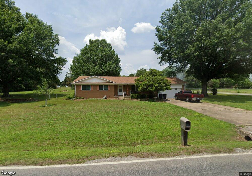
10685 E 530 Rd Claremore, OK 74019
Estimated Value: $224,997 - $286,000
3
Beds
2
Baths
1,678
Sq Ft
$150/Sq Ft
Est. Value
About This Home
This home is located at 10685 E 530 Rd, Claremore, OK 74019 and is currently estimated at $251,499, approximately $149 per square foot. 10685 E 530 Rd is a home located in Rogers County with nearby schools including Catalayah Elementary School, Will Rogers Junior High School, and Claremore High School.
Ownership History
Date
Name
Owned For
Owner Type
Purchase Details
Closed on
May 18, 2011
Sold by
Gallahar Dorothy J
Bought by
Ostrowski Ronald D and Ostrowski Julie A
Current Estimated Value
Home Financials for this Owner
Home Financials are based on the most recent Mortgage that was taken out on this home.
Original Mortgage
$126,424
Outstanding Balance
$87,425
Interest Rate
4.85%
Mortgage Type
New Conventional
Estimated Equity
$164,074
Create a Home Valuation Report for This Property
The Home Valuation Report is an in-depth analysis detailing your home's value as well as a comparison with similar homes in the area
Home Values in the Area
Average Home Value in this Area
Purchase History
| Date | Buyer | Sale Price | Title Company |
|---|---|---|---|
| Ostrowski Ronald D | $120,000 | None Available |
Source: Public Records
Mortgage History
| Date | Status | Borrower | Loan Amount |
|---|---|---|---|
| Open | Ostrowski Ronald D | $126,424 |
Source: Public Records
Tax History
| Year | Tax Paid | Tax Assessment Tax Assessment Total Assessment is a certain percentage of the fair market value that is determined by local assessors to be the total taxable value of land and additions on the property. | Land | Improvement |
|---|---|---|---|---|
| 2025 | $1,557 | $15,109 | $3,599 | $11,510 |
| 2024 | $1,414 | $14,668 | $2,939 | $11,729 |
| 2023 | $1,414 | $14,241 | $2,750 | $11,491 |
| 2022 | $1,350 | $14,024 | $2,750 | $11,274 |
| 2021 | $1,392 | $15,010 | $2,750 | $12,260 |
| 2020 | $1,414 | $14,779 | $2,750 | $12,029 |
| 2019 | $1,390 | $14,413 | $2,750 | $11,663 |
| 2018 | $1,452 | $15,041 | $2,750 | $12,291 |
| 2017 | $1,431 | $14,920 | $2,750 | $12,170 |
| 2016 | $1,421 | $14,555 | $2,750 | $11,805 |
| 2015 | $1,384 | $14,429 | $2,750 | $11,679 |
| 2014 | $1,352 | $14,024 | $2,750 | $11,274 |
Source: Public Records
Map
Nearby Homes
- 10754 E 530 Rd
- 25025 S 4130 Rd
- 24465 S Orange Cove
- 24103 U S Route 66 Unit 74
- 24922 S Heartwood Dr
- 0 S Maple Ln
- 10652 E Birch St
- 10594 E Birch St
- 020078 S 4120 Rd
- 20065 S 4120 Rd
- 20050 S 4120 Rd
- 23090 S Jewell Dr
- 11919 E Southern Hills Rd
- 8671 Hawthorne Dr
- 9800 E 510 Rd
- 2503 Hunters Ct
- 2500 SW Wolf Run Dr
- 8442 Spring Creek Ct
- 2317 SW Quail Run Dr
- 8250 Overlook Trail
- 10692 E 530 Rd
- 10727 E 530 Rd
- 10636 E 530 Rd
- 24834 S Plainview Ave
- 10635 E 530 Rd
- 24825 S Plainview Ave
- 10735 E First St
- 10705 E First St
- 25002 S Elm St
- 10797 E 530 Rd
- 10767 E First St
- 24806 S Plainview Ave
- 10686 E First St
- 10647 E First St
- 10622 E 530 Rd
- 24795 S Plainview Ave
- 10786 E First St
- 10652 E First St
- 10603 E First St
- 10815 E 530 Rd
Your Personal Tour Guide
Ask me questions while you tour the home.