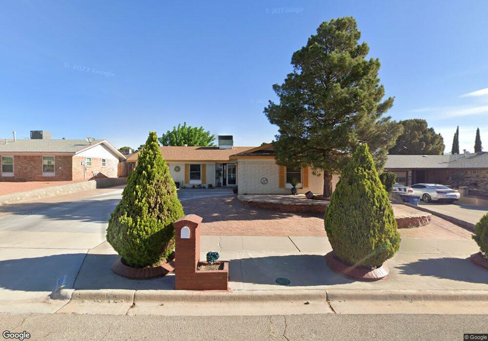
10689 Coralstone Dr El Paso, TX 79935
Pebble Hills NeighborhoodEstimated Value: $226,783 - $255,000
4
Beds
2
Baths
1,520
Sq Ft
$155/Sq Ft
Est. Value
About This Home
This home is located at 10689 Coralstone Dr, El Paso, TX 79935 and is currently estimated at $235,946, approximately $155 per square foot. 10689 Coralstone Dr is a home located in El Paso County with nearby schools including Robbin E L Washington Elementary School, J M Hanks High School, and New World Montessori School.
Ownership History
Date
Name
Owned For
Owner Type
Purchase Details
Closed on
Jun 30, 2008
Sold by
Salcido Isaac and Padilla Salcido Blanca R
Bought by
Gallegos Jose Juan and Gallegos Lucy R
Current Estimated Value
Home Financials for this Owner
Home Financials are based on the most recent Mortgage that was taken out on this home.
Original Mortgage
$127,000
Outstanding Balance
$81,598
Interest Rate
5.99%
Mortgage Type
Purchase Money Mortgage
Estimated Equity
$154,348
Purchase Details
Closed on
Aug 19, 1998
Sold by
Flores Roberto and Flores Angelina
Bought by
Salcido Isaac and Padilla Salcido Blanca R
Home Financials for this Owner
Home Financials are based on the most recent Mortgage that was taken out on this home.
Original Mortgage
$66,800
Interest Rate
6.57%
Create a Home Valuation Report for This Property
The Home Valuation Report is an in-depth analysis detailing your home's value as well as a comparison with similar homes in the area
Home Values in the Area
Average Home Value in this Area
Purchase History
| Date | Buyer | Sale Price | Title Company |
|---|---|---|---|
| Gallegos Jose Juan | -- | Sierra | |
| Salcido Isaac | -- | Alamo Title Company |
Source: Public Records
Mortgage History
| Date | Status | Borrower | Loan Amount |
|---|---|---|---|
| Open | Gallegos Jose Juan | $127,000 | |
| Previous Owner | Salcido Isaac | $66,800 |
Source: Public Records
Tax History Compared to Growth
Tax History
| Year | Tax Paid | Tax Assessment Tax Assessment Total Assessment is a certain percentage of the fair market value that is determined by local assessors to be the total taxable value of land and additions on the property. | Land | Improvement |
|---|---|---|---|---|
| 2025 | $2,274 | $199,907 | -- | -- |
| 2024 | $2,274 | $181,734 | -- | -- |
| 2023 | $2,176 | $165,213 | $0 | $0 |
| 2022 | $4,664 | $150,194 | $0 | $0 |
| 2021 | $4,438 | $141,371 | $21,722 | $119,649 |
| 2020 | $3,921 | $124,127 | $19,382 | $104,745 |
| 2018 | $3,830 | $123,164 | $19,382 | $103,782 |
| 2017 | $3,447 | $112,775 | $19,382 | $93,393 |
| 2016 | $3,447 | $112,775 | $19,382 | $93,393 |
| 2015 | $2,805 | $118,142 | $19,382 | $98,760 |
| 2014 | $2,805 | $118,422 | $19,382 | $99,040 |
Source: Public Records
Map
Nearby Homes
- 3453 Guthrie St
- 3425 Brookrock St
- 3400 Brookrock St
- 3369 Freeport Dr
- 10816 Cardigan Dr
- 10602 Drillstone Dr
- 10649 Islerock Dr
- 10605 Kinross Ave Unit B
- 10905 Sagebrush Way Unit A & B
- 10405 Darin Rd
- 3324 Kilgore Place
- 3213 Isla Cocoa Ln
- 3332 Dungarvan Dr
- 3317 Dungarvan Dr
- 11016 Aqua Ct
- 11025 Sunshine Ct
- 3112 Eads Place
- 10216 Cardigan Dr
- 3345 Wexford Dr
- 3150 N Yarbrough Dr Unit A1
- 10693 Coralstone Dr
- 10685 Coralstone Dr
- 10688 Birthstone Dr
- 10692 Birthstone Dr
- 10684 Birthstone Dr
- 10681 Coralstone Dr
- 10697 Coralstone Dr
- 10688 Coralstone Dr
- 10696 Birthstone Dr
- 10684 Coralstone Dr
- 10680 Birthstone Dr
- 10692 Coralstone Dr
- 10680 Coralstone Dr
- 10677 Coralstone Dr
- 10676 Birthstone Dr
- 10696 Coralstone Dr
- 10676 Coralstone Dr
- 3437 Dial Rock Ln
- 10693 Birthstone Dr
- 10673 Coralstone Dr