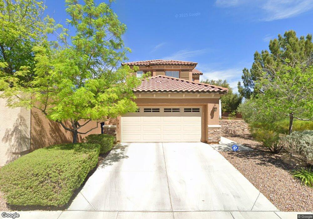
1069 Ambrosia Dr Las Vegas, NV 89138
Estimated Value: $629,471 - $675,000
4
Beds
4
Baths
1,990
Sq Ft
$330/Sq Ft
Est. Value
About This Home
This home is located at 1069 Ambrosia Dr, Las Vegas, NV 89138 and is currently estimated at $656,368, approximately $329 per square foot. 1069 Ambrosia Dr is a home located in Clark County with nearby schools including Linda Rankin Givens Elementary School, Sig Rogich Middle School, and Palo Verde High School.
Ownership History
Date
Name
Owned For
Owner Type
Purchase Details
Closed on
Dec 6, 2010
Sold by
Costales Teresita A and Costales Genaro F
Bought by
Lott David A and Shinozaki Yuko
Current Estimated Value
Home Financials for this Owner
Home Financials are based on the most recent Mortgage that was taken out on this home.
Original Mortgage
$215,494
Outstanding Balance
$144,388
Interest Rate
4.5%
Mortgage Type
FHA
Estimated Equity
$511,980
Purchase Details
Closed on
Sep 27, 2006
Sold by
Ryland Homes Nevada Llc
Bought by
Costales Genaro F and Costales Teresita A
Home Financials for this Owner
Home Financials are based on the most recent Mortgage that was taken out on this home.
Original Mortgage
$388,044
Interest Rate
7.75%
Mortgage Type
Unknown
Create a Home Valuation Report for This Property
The Home Valuation Report is an in-depth analysis detailing your home's value as well as a comparison with similar homes in the area
Home Values in the Area
Average Home Value in this Area
Purchase History
| Date | Buyer | Sale Price | Title Company |
|---|---|---|---|
| Lott David A | $221,100 | Fidelity National Title Las | |
| Costales Genaro F | $473,540 | Ryland Title |
Source: Public Records
Mortgage History
| Date | Status | Borrower | Loan Amount |
|---|---|---|---|
| Open | Lott David A | $215,494 | |
| Previous Owner | Costales Genaro F | $388,044 |
Source: Public Records
Tax History Compared to Growth
Tax History
| Year | Tax Paid | Tax Assessment Tax Assessment Total Assessment is a certain percentage of the fair market value that is determined by local assessors to be the total taxable value of land and additions on the property. | Land | Improvement |
|---|---|---|---|---|
| 2025 | $3,641 | $175,258 | $68,250 | $107,008 |
| 2024 | $3,536 | $175,258 | $68,250 | $107,008 |
| 2023 | $3,536 | $149,760 | $49,000 | $100,760 |
| 2022 | $3,433 | $132,754 | $40,950 | $91,804 |
| 2021 | $3,331 | $126,085 | $38,850 | $87,235 |
| 2020 | $3,231 | $123,435 | $37,100 | $86,335 |
| 2019 | $3,136 | $118,622 | $33,950 | $84,672 |
| 2018 | $3,042 | $109,107 | $28,000 | $81,107 |
| 2017 | $3,604 | $109,757 | $28,000 | $81,757 |
| 2016 | $2,880 | $103,137 | $19,600 | $83,537 |
| 2015 | $2,875 | $86,354 | $18,200 | $68,154 |
| 2014 | $2,785 | $82,226 | $14,000 | $68,226 |
Source: Public Records
Map
Nearby Homes
- 11329 Hedgemont Ave
- 929 Viscanio Place
- 957 Baronet Dr
- 956 Baronet Dr
- 11221 Stanwick Ave
- 1163 Blossom Point St
- 1164 Prospering Creek St
- 1181 Blossom Point St
- 1187 Blossom Point St Unit 36
- 11304 Asilo Bianco Ave
- 11485 Vibrant Heights Dr Unit 32
- 11441 Allerton Park Dr Unit 212
- 11441 Allerton Park Dr Unit 206
- 11441 Allerton Park Dr Unit 213
- 11441 Allerton Park Dr Unit 214
- 11238 Essence Point Ave Unit 208
- 11238 Essence Point Ave Unit 205
- 11250 Hidden Peak Ave Unit 201
- 1247 Rock Hills St Unit 101
- 11250 Hidden Peak Ave Unit 305
- 1068 Oak Fair St
- 1064 Oak Fair St
- 1060 Oak Fair St
- 1065 Ambrosia Dr
- 1040 Baronet Dr
- 1073 Robin Leaf Ct
- 1076 Oak Fair St
- 1061 Ambrosia Dr
- 1056 Oak Fair St
- 1036 Baronet Dr
- 1077 Robin Leaf Ct
- 1080 Oak Fair St
- 1057 Ambrosia Dr
- 1081 Robin Leaf Ct
- 1032 Baronet Dr
- 1069 Oak Fair St
- 1065 Oak Fair St
- 1073 Oak Fair St
- 1084 Oak Fair St
- 1072 Robin Leaf Ct