Estimated Value: $281,000 - $304,000
3
Beds
3
Baths
2,395
Sq Ft
$122/Sq Ft
Est. Value
About This Home
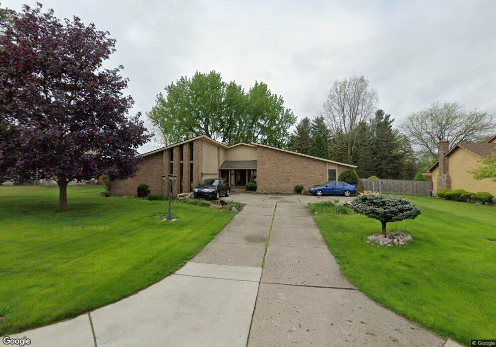
This home is located at 1069 Dyemeadow Ln, Flint, MI 48532 and is currently estimated at $291,954, approximately $121 per square foot. 1069 Dyemeadow Ln is a home located in Genesee County with nearby schools including Carman-Ainsworth High School, Genesee STEM Academy, and Linden Charter Academy.
Ownership History
Date
Name
Owned For
Owner Type
Purchase Details
Closed on
Aug 3, 2023
Sold by
Myatt Michael S and Myatt Kristi L
Bought by
Willis Hosie
Current Estimated Value
Home Financials for this Owner
Home Financials are based on the most recent Mortgage that was taken out on this home.
Original Mortgage
$233,225
Outstanding Balance
$227,536
Interest Rate
6.67%
Mortgage Type
New Conventional
Estimated Equity
$64,418
Purchase Details
Closed on
Dec 3, 2010
Sold by
Myatt Michael S and Myatt Kristi L
Bought by
Myatt Michael S and Myatt Kristi L
Create a Home Valuation Report for This Property
The Home Valuation Report is an in-depth analysis detailing your home's value as well as a comparison with similar homes in the area
Home Values in the Area
Average Home Value in this Area
Purchase History
| Date | Buyer | Sale Price | Title Company |
|---|---|---|---|
| Willis Hosie | $245,500 | Bell Title | |
| Myatt Michael S | -- | Sargents Title Company |
Source: Public Records
Mortgage History
| Date | Status | Borrower | Loan Amount |
|---|---|---|---|
| Open | Willis Hosie | $233,225 |
Source: Public Records
Tax History Compared to Growth
Tax History
| Year | Tax Paid | Tax Assessment Tax Assessment Total Assessment is a certain percentage of the fair market value that is determined by local assessors to be the total taxable value of land and additions on the property. | Land | Improvement |
|---|---|---|---|---|
| 2025 | $5,840 | $129,000 | $0 | $0 |
| 2024 | $3,187 | $142,200 | $0 | $0 |
| 2023 | $3,022 | $128,000 | $0 | $0 |
| 2022 | $1,573 | $106,500 | $0 | $0 |
| 2021 | $3,204 | $94,400 | $0 | $0 |
| 2020 | $1,656 | $94,500 | $0 | $0 |
| 2019 | $1,633 | $93,200 | $0 | $0 |
| 2018 | $2,990 | $84,300 | $0 | $0 |
| 2017 | $2,876 | $84,300 | $0 | $0 |
| 2016 | $2,960 | $72,100 | $0 | $0 |
| 2015 | $2,742 | $72,000 | $0 | $0 |
| 2014 | $1,627 | $68,800 | $0 | $0 |
| 2012 | -- | $67,100 | $67,100 | $0 |
Source: Public Records
Map
Nearby Homes
- 1159 N Linden Rd
- 1090 Cabot Dr
- 1246 Dyemeadow Ln
- 5104 Shady Oak Trail
- 1391 Dye Krest Cir
- 5297 Oaktree Dr
- 5021 Forest Side Dr
- 1193 Normandy Terrace Dr
- 1194 Woodkrest Dr
- 5325 N Dyewood Dr
- 2 Charter Dr
- 2008 Beekman Ct
- 5551 Sugar Bush Ln
- 5345 Birchtree Ct
- 0 Charter Dr Unit 50153638
- 3.9 Acres W Court St
- 1058 Cora Dr
- 6088 Sierra Pass
- 1068 S Graham Rd
- 5411 River Meadow Blvd
- 1079 Dyemeadow Ln
- 1059 Dyemeadow Ln
- 1089 Dyemeadow Ln
- 1068 Dyemeadow Ln
- 1080 Dyemeadow Ln
- 1151 Heatherwoode Rd
- 1099 Dyemeadow Ln
- 1122 Heatherwoode Rd
- 1116 Heatherwoode Rd
- 1090 Dyemeadow Ln
- 1136 Heatherwoode Rd
- 1146 Heatherwoode Rd
- 1102 Dyemeadow Ln
- 1156 Heatherwoode Rd
- 1175 Heatherwoode Ct
- 1115 Heatherwoode Rd
- 1119 Dyemeadow Ln
- 1118 Dyemeadow Ln
- 1129 N Linden Rd
- 1115 N Linden Rd