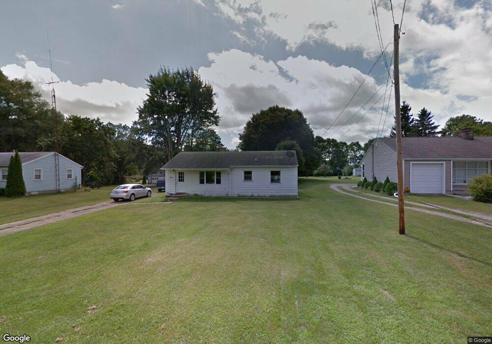
1069 Moore Rd Adrian, MI 49221
Estimated Value: $171,869 - $237,000
3
Beds
1
Bath
1,040
Sq Ft
$182/Sq Ft
Est. Value
About This Home
This home is located at 1069 Moore Rd, Adrian, MI 49221 and is currently estimated at $188,967, approximately $181 per square foot. 1069 Moore Rd is a home located in Lenawee County with nearby schools including Adrian High School, St. Joseph Academy, and St. Joseph's Academy.
Ownership History
Date
Name
Owned For
Owner Type
Purchase Details
Closed on
Oct 27, 2016
Sold by
Schwartz Tammy Sue and Clark Tammy
Bought by
Watson Danielle Lynn
Current Estimated Value
Purchase Details
Closed on
Aug 13, 2008
Sold by
Estate Of Earl B Derbyshire and Sneyd Channing S
Bought by
Watson Danielle
Home Financials for this Owner
Home Financials are based on the most recent Mortgage that was taken out on this home.
Original Mortgage
$53,040
Interest Rate
6.31%
Mortgage Type
New Conventional
Create a Home Valuation Report for This Property
The Home Valuation Report is an in-depth analysis detailing your home's value as well as a comparison with similar homes in the area
Home Values in the Area
Average Home Value in this Area
Purchase History
| Date | Buyer | Sale Price | Title Company |
|---|---|---|---|
| Watson Danielle Lynn | -- | Fidelity National Title | |
| Watson Danielle | $52,000 | None Available |
Source: Public Records
Mortgage History
| Date | Status | Borrower | Loan Amount |
|---|---|---|---|
| Previous Owner | Watson Danielle | $53,040 |
Source: Public Records
Tax History
| Year | Tax Paid | Tax Assessment Tax Assessment Total Assessment is a certain percentage of the fair market value that is determined by local assessors to be the total taxable value of land and additions on the property. | Land | Improvement |
|---|---|---|---|---|
| 2025 | $1,771 | $62,700 | $0 | $0 |
| 2024 | $8 | $60,700 | $0 | $0 |
| 2022 | $705 | $47,400 | $0 | $0 |
| 2021 | $1,583 | $44,400 | $0 | $0 |
| 2020 | $1,553 | $42,400 | $0 | $0 |
| 2019 | $105,986 | $38,400 | $0 | $0 |
| 2018 | $1,487 | $38,396 | $0 | $0 |
| 2017 | $1,447 | $37,649 | $0 | $0 |
| 2016 | $1,440 | $35,453 | $0 | $0 |
| 2014 | -- | $34,630 | $0 | $0 |
Source: Public Records
Map
Nearby Homes
- 1084 Loren Rd
- 4623 N Adrian Hwy
- 3311 N Adrian Hwy
- 1464 Mardan Dr
- 4126 Mckenna Dr
- 3163 Birch Run
- 1826 Oak Leaf Dr
- 2082 Friar Tuck Cir
- 4194 Sauk Trail
- 2000 blk Sutton Rd Unit Parcel B
- 2600 Blk Sutton Rd Unit Parcel C
- 1023 Sutton Rd
- 4587 N Adrian Hwy
- 5679 Catawba Dr
- 3264 N Adrian Hwy
- 2571 E Valley Rd
- 2573 E Valley Rd
- 2577 E Valley Rd
- 4729 Basin St
- 3811 Torin Ln Unit Parcel G
Your Personal Tour Guide
Ask me questions while you tour the home.