$54,000
PENDING

1069 Morgantown Rd McComb, MS 39648

Estimated payment $360/month

Total Views 3,817
9 Acres
$6,000 Price per Acre
392,040 Sq Ft Lot

About This Lot

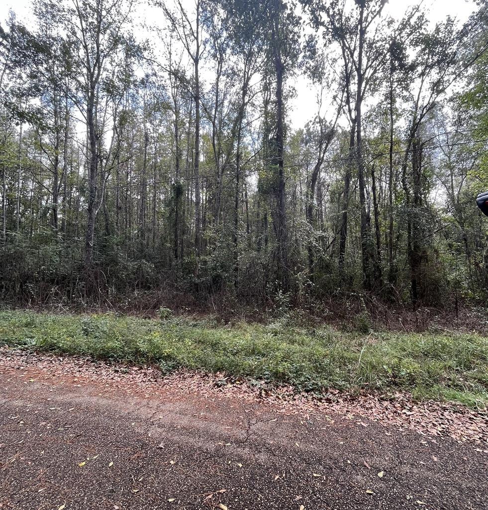
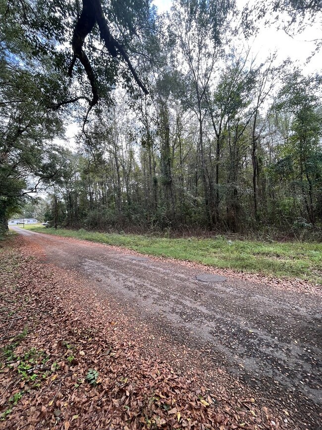
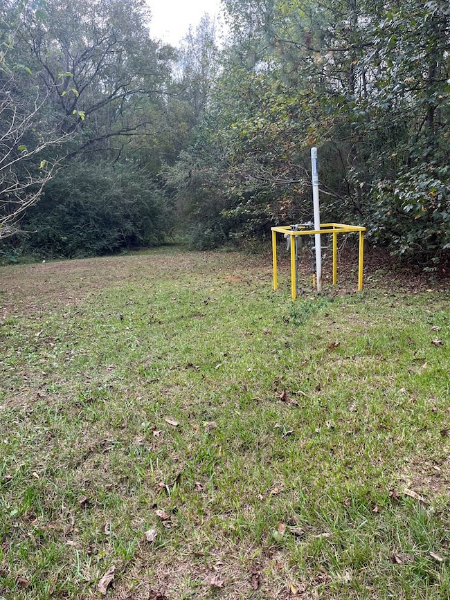
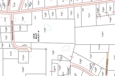
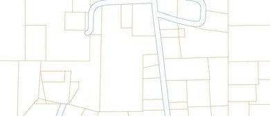
Looking for small acreage in the North Pike School District? This could be it! Ideally situated close to town, this 9 Acre tract offers a mixture of hardwood, pines and open lawn area for a new construction or mobile home. The property has road frontage on both Morgantown Rd and Rosa Peters Ln which enables the property to be easily subdivided. There is electric power, community water, and natural gas on the property. Currently, a mobile home sits on the property that will be moved before closing. It is just minutes from McComb, where there is shopping, restaurants and medical care. Call today for more info!

Listing Agent

TAMMY STRICKLAND

eXp Realty Brokerage Phone: 8556477397 License #22346

eXp Realty

Property Details

Property Type

  • Land

Est. Annual Taxes

  • $706

Year Built

  • 0

Lot Details

  • 9 Acre Lot
  • Many Trees

Utilities

  • Natural Gas Connected
  • Septic Tank

Listing and Financial Details

  • Assessor Parcel Number 811428

Property Details

Property Type

Land

Est. Annual Taxes

$706

Year Built

0

Lot Details

0

Listing Details

  • Attribution Contact: 8556477397
  • Directions: From N Broadway St/Hwy 51, take a Rt on State Street to travel over the East McComb Bridge onto Hwy 44/Pearl River Ave for about 1 mile. Turn right onton Van Norman Curve road and travel .3 miles, then continue straight onto Morgantown Rd. Property will be about .5 miles on the right.
  • Prop. Type: Land
  • Property Sub Type: Unimproved Land
  • Lot Size Acres: 9
  • Lot Size: 9 acres
  • Road Surface Type: Paved, Asphalt
  • Subdivision Name: Other
  • RETS Property Type: Land
  • Property Type: Lots & Land
  • Special Features: None
  • Year Built: 0

Exterior Features

  • Lot Features: Many Trees

Utilities

  • Sewer: Septic Tank
  • Electric: Magnolia EPA
  • Electricity On Property: Yes
  • Utilities: Electricity Connected, Natural Gas Connected
  • Water Source: Community, Friendship
  • Gas Company: Centerpoint

Schools

  • Junior High Dist: North Pike

Lot Info

  • Parcel #: 811428
  • Current Use: Single Family, Mobile Home
  • Lot Size Sq Ft: 392040
  • Farm Land Area Units: Square Feet
  • Zoning Description: None
  • ResoLotSizeUnits: Acres

Tax Info

  • Tax Map Number: 83A07-4

Map

Range of Values:

Collateral Analytics

Collateral Analytics Collateral Analytics AVMs (Automated Valuation Model) employ a number of statistical approaches combined with neighborhood-specific comparable selection guarantees the most up-to-date and precise valuations.

Not Available

Collateral Analytics does not have data for the current month. Please view the chart for historical values.

ICE

ICE Mortgage Technology ICE Mortgage Technology’s AVM (Automated Valuation Model) is a state-of-the-art online residential property valuation tool that provides a quick and accurate estimate of the value of almost any home in the U.S.

Not Available

ICE Mortgage Technology does not have data for the current month. Please view the chart for historical values.

First American

First American First American Data & Analytics’ next-generation AVM combines unrivaled data assets with a blended ensemble of valuation models to produce highly accurate, reliable valuations you can trust.

Not Available

First American does not have data for the current month. Please view the chart for historical values.

Quantarium

Quantarium Quantarium’s valuation service, repeatedly proven the industry’s most accurate and comprehensive, is supercharged with a self-learning and auto-tuning AI engine that continually becomes smarter and more accurate as it processes daily inputs from the industry’s leading RE data lake.

Not Available

Quantarium does not have data for the current month. Please view the chart for historical values.

Average Value
Not Available
List Price
Sold Price
Create a Home Valuation Report for This Property
The Home Valuation Report is an in-depth analysis detailing your home's value as well as a comparison with similar homes in the area

Home Values in the Area

Source: Public Records

Average Home Value in this Area


Source: Public Records

Tax History

Year Tax Paid Tax Assessment Tax Assessment Total Assessment is a certain percentage of the fair market value that is determined by local assessors to be the total taxable value of land and additions on the property. Land Improvement
2024 $706 $5,130 $0 $0
2023 $690 $5,130 $0 $0
2022 $681 $5,130 $0 $0
2021 $679 $5,130 $0 $0
2020 $682 $5,130 $0 $0
2019 $665 $5,130 $0 $0
2018 $661 $5,130 $0 $0
2017 $647 $5,130 $0 $0
2016 $571 $5,130 $0 $0
2015 -- $5,130 $0 $0
2014 -- $5,130 $0 $0
2013 -- $6,137 $0 $0
Source: Public Records

Property History

Date Event Price Change Sq Ft Price
11/29/2024 11/29/24 Pending -- -- --
11/05/2024 11/05/24 For Sale $54,000 -- --
Source: Southwest Mississippi Board of REALTORS®

Deed History

Date Type Sale Price Title Company
Quit Claim Deed -- None Listed On Document
Source: Public Records

Source: Southwest Mississippi Board of REALTORS®

MLS Number: 143510

Southwest Mississippi Board of REALTORS®

APN: 811428