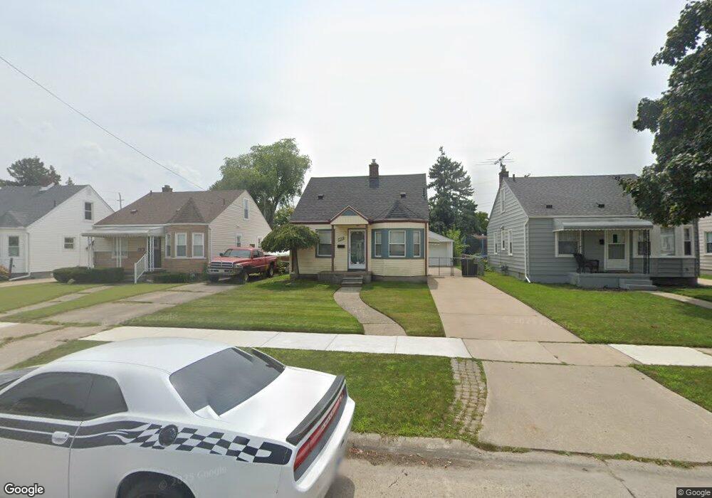
1069 Mulberry St Wyandotte, MI 48192
Estimated Value: $136,000 - $145,705
--
Bed
--
Bath
865
Sq Ft
$161/Sq Ft
Est. Value
About This Home
This home is located at 1069 Mulberry St, Wyandotte, MI 48192 and is currently estimated at $138,926, approximately $160 per square foot. 1069 Mulberry St is a home located in Wayne County with nearby schools including Washington Elementary School, Woodrow Wilson School, and Roosevelt High School.
Ownership History
Date
Name
Owned For
Owner Type
Purchase Details
Closed on
Jul 9, 2025
Sold by
Martindale Christie Lynn and Holezki Kenneth P
Bought by
Raveneye Properties Llc
Current Estimated Value
Purchase Details
Closed on
Jan 27, 2012
Sold by
Holezki Kenneth P
Bought by
Martindale Christie Lynn and Holezki Kenneth P
Purchase Details
Closed on
Mar 16, 2005
Sold by
Holezki Kenneth P
Bought by
Holezki Kenneth P and Kenneth P Holezki Trust
Create a Home Valuation Report for This Property
The Home Valuation Report is an in-depth analysis detailing your home's value as well as a comparison with similar homes in the area
Home Values in the Area
Average Home Value in this Area
Purchase History
| Date | Buyer | Sale Price | Title Company |
|---|---|---|---|
| Raveneye Properties Llc | $135,000 | Capital Title | |
| Raveneye Properties Llc | $135,000 | Capital Title | |
| Martindale Christie Lynn | -- | None Available | |
| Holezki Kenneth P | -- | -- |
Source: Public Records
Tax History Compared to Growth
Tax History
| Year | Tax Paid | Tax Assessment Tax Assessment Total Assessment is a certain percentage of the fair market value that is determined by local assessors to be the total taxable value of land and additions on the property. | Land | Improvement |
|---|---|---|---|---|
| 2025 | $2,064 | $68,100 | $0 | $0 |
| 2024 | $2,064 | $65,500 | $0 | $0 |
| 2023 | $1,968 | $60,800 | $0 | $0 |
| 2022 | $2,739 | $55,300 | $0 | $0 |
| 2021 | $1,854 | $51,200 | $0 | $0 |
| 2020 | $1,829 | $46,100 | $0 | $0 |
| 2019 | $1,803 | $40,700 | $0 | $0 |
| 2018 | $1,440 | $38,200 | $0 | $0 |
| 2017 | $631 | $38,200 | $0 | $0 |
| 2016 | $1,741 | $35,400 | $0 | $0 |
| 2015 | $3,107 | $32,900 | $0 | $0 |
| 2013 | $3,010 | $30,100 | $0 | $0 |
| 2012 | $1,709 | $31,500 | $7,400 | $24,100 |
Source: Public Records
Map
Nearby Homes
- 1077 Mulberry St
- 1063 Mulberry St
- 1085 Mulberry St
- 1055 Mulberry St
- 1093 Mulberry St
- 1045 Mulberry St
- 1070 Mollno St
- 1064 Mollno St
- 1058 Mollno St
- 1076 Mollno St
- 1101 Mulberry St
- 1082 Mollno St
- 1052 Mollno St
- 1088 Mollno St
- 1039 Mulberry St
- 1109 Mulberry St
- 1066 Mulberry St
- 1050 Mulberry St
- 1076 Mulberry St
- 1040 Mollno St