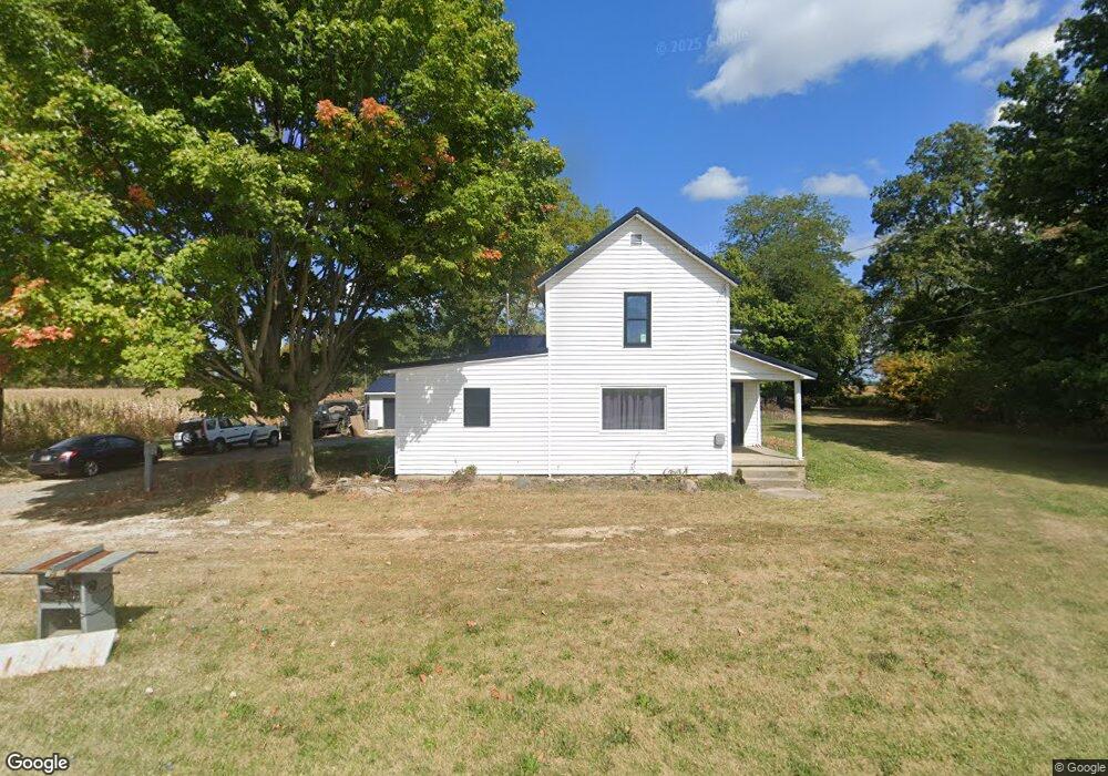
1069 State Route 385 Waynesfield, OH 45896
Estimated Value: $157,000 - $305,000
3
Beds
1
Bath
1,772
Sq Ft
$112/Sq Ft
Est. Value
About This Home
This home is located at 1069 State Route 385, Waynesfield, OH 45896 and is currently estimated at $198,052, approximately $111 per square foot. 1069 State Route 385 is a home located in Hardin County with nearby schools including Upper Scioto Valley Elementary School, Upper Scioto Valley Middle School, and Upper Scioto Valley High School.
Ownership History
Date
Name
Owned For
Owner Type
Purchase Details
Closed on
Sep 19, 2023
Sold by
Kennedy Charles W
Bought by
Holbrook Jason M
Current Estimated Value
Purchase Details
Closed on
Aug 16, 2023
Sold by
Butterman Mckenzie K
Bought by
Kennedy Charles W
Purchase Details
Closed on
Aug 28, 2020
Sold by
Holbrook Farms Family Lp
Bought by
Kennedy Charles W and Butterman Mckenzie K
Home Financials for this Owner
Home Financials are based on the most recent Mortgage that was taken out on this home.
Original Mortgage
$83,565
Interest Rate
2.7%
Mortgage Type
FHA
Purchase Details
Closed on
Apr 1, 1998
Bought by
Holbrook Farms Family Li
Create a Home Valuation Report for This Property
The Home Valuation Report is an in-depth analysis detailing your home's value as well as a comparison with similar homes in the area
Purchase History
| Date | Buyer | Sale Price | Title Company |
|---|---|---|---|
| Holbrook Jason M | $137,000 | None Listed On Document | |
| Kennedy Charles W | -- | None Listed On Document | |
| Kennedy Charles W | $85,107 | Mid American Title Agcy Inc | |
| Holbrook Farms Family Li | -- | -- |
Source: Public Records
Mortgage History
| Date | Status | Borrower | Loan Amount |
|---|---|---|---|
| Previous Owner | Kennedy Charles W | $83,565 |
Source: Public Records
Tax History
| Year | Tax Paid | Tax Assessment Tax Assessment Total Assessment is a certain percentage of the fair market value that is determined by local assessors to be the total taxable value of land and additions on the property. | Land | Improvement |
|---|---|---|---|---|
| 2024 | $1,376 | $36,050 | $4,100 | $31,950 |
| 2023 | $1,378 | $36,050 | $4,100 | $31,950 |
| 2022 | $1,013 | $24,020 | $3,440 | $20,580 |
| 2021 | $1,068 | $24,020 | $3,440 | $20,580 |
| 2020 | $1,082 | $24,020 | $3,440 | $20,580 |
| 2019 | $507 | $20,960 | $3,280 | $17,680 |
| 2018 | $509 | $20,960 | $3,280 | $17,680 |
| 2017 | $509 | $20,960 | $3,280 | $17,680 |
| 2016 | $380 | $18,500 | $2,870 | $15,630 |
| 2015 | $653 | $18,500 | $2,870 | $15,630 |
| 2014 | $207 | $18,500 | $2,870 | $15,630 |
| 2013 | $233 | $19,210 | $2,870 | $16,340 |
Source: Public Records
Map
Nearby Homes
- 15527 State Route 235
- 11475 Township Road 293 Unit 330
- 16235 Maple Ave
- 16074 Buckeye Ave
- 11298 Northlake Dr
- 11262 Northlake Dr
- 14606 Beech Ave
- 11377 Township Road 266 Unit 99
- 11377 Township Road 266 Unit 34
- 11377 Township Road 266 Unit 28
- 11377 Township Road 266 Unit 109
- 11377 Township Rd 266 Unit 66
- 11377 Township Rd 266 Unit 59
- 9151 Gross Dr
- 15848 Barnes Dr
- 9371 Sassafras Dr
- 9246 Elm Dr
- 11065 County Road 293 Unit 13
- 11142 Houser Dr
- 11229 Elm St
- 1040 State Route 385
- 972 State Route 385
- 954 Ohio 385
- 18124 County Road 25
- 1263 State Route 385
- 18259 County Road 25
- 1337 Ohio 385
- 17705 Township Road 17
- 422 State Route 385
- 1732 State Route 385
- 18682 County Road 25
- 17612 Township Road 17
- 17547 Township Road 17
- 17657 Township Road 15
- 1952 Ohio 385
- 1952 State Route 385
- 1983 State Route 385
- 19056 County Road 25
Your Personal Tour Guide
Ask me questions while you tour the home.