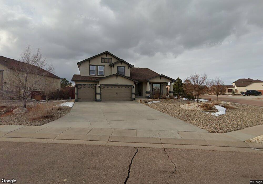
10690 Pictured Rocks Dr Peyton, CO 80831
Falcon NeighborhoodEstimated Value: $680,196 - $769,000
5
Beds
3
Baths
4,684
Sq Ft
$152/Sq Ft
Est. Value
About This Home
This home is located at 10690 Pictured Rocks Dr, Peyton, CO 80831 and is currently estimated at $709,799, approximately $151 per square foot. 10690 Pictured Rocks Dr is a home located in El Paso County with nearby schools including Meridian Ranch Elementary School, Falcon Middle School, and Falcon High School.
Ownership History
Date
Name
Owned For
Owner Type
Purchase Details
Closed on
Aug 22, 2014
Sold by
Forsythe Scott L and Forsythe Tawnie N
Bought by
Klockziem Jeffrey D and Klockziem Jody L
Current Estimated Value
Home Financials for this Owner
Home Financials are based on the most recent Mortgage that was taken out on this home.
Original Mortgage
$412,300
Outstanding Balance
$315,315
Interest Rate
4.19%
Mortgage Type
New Conventional
Estimated Equity
$394,484
Purchase Details
Closed on
Jan 27, 2006
Sold by
Vantage Homes Corp
Bought by
Forsythe Scott L and Forsythe Tawnie N
Home Financials for this Owner
Home Financials are based on the most recent Mortgage that was taken out on this home.
Original Mortgage
$309,026
Interest Rate
6%
Mortgage Type
Fannie Mae Freddie Mac
Create a Home Valuation Report for This Property
The Home Valuation Report is an in-depth analysis detailing your home's value as well as a comparison with similar homes in the area
Home Values in the Area
Average Home Value in this Area
Purchase History
| Date | Buyer | Sale Price | Title Company |
|---|---|---|---|
| Klockziem Jeffrey D | $434,000 | Stewart Title | |
| Forsythe Scott L | $386,300 | Land Title Guarantee Company |
Source: Public Records
Mortgage History
| Date | Status | Borrower | Loan Amount |
|---|---|---|---|
| Open | Klockziem Jeffrey D | $412,300 | |
| Previous Owner | Forsythe Scott L | $309,026 |
Source: Public Records
Tax History
| Year | Tax Paid | Tax Assessment Tax Assessment Total Assessment is a certain percentage of the fair market value that is determined by local assessors to be the total taxable value of land and additions on the property. | Land | Improvement |
|---|---|---|---|---|
| 2025 | $4,531 | $47,100 | -- | -- |
| 2024 | $4,395 | $47,880 | $9,000 | $38,880 |
| 2022 | $3,685 | $36,510 | $7,390 | $29,120 |
| 2021 | $3,818 | $37,550 | $7,600 | $29,950 |
| 2020 | $3,709 | $33,820 | $6,890 | $26,930 |
| 2019 | $3,688 | $33,820 | $6,890 | $26,930 |
| 2018 | $3,671 | $33,320 | $6,300 | $27,020 |
| 2017 | $3,472 | $33,320 | $6,300 | $27,020 |
| 2016 | $3,357 | $32,990 | $6,970 | $26,020 |
| 2015 | $3,359 | $32,990 | $6,970 | $26,020 |
| 2014 | $3,091 | $29,990 | $5,970 | $24,020 |
Source: Public Records
Map
Nearby Homes
- 10803 Greenbelt Dr
- 10467 Pictured Rocks Dr
- 12320 Grand Teton Dr
- 12705 Angelina Dr
- 10488 Cedar Breaks Dr
- 10489 Cedar Breaks Dr
- 10952 Torreys Peak Way
- 10429 Cedar Breaks Dr
- 10603 Ross Lake Dr
- 12534 Angelina Dr
- 10932 Huron Peak Place
- 10476 Ross Lake Dr
- 10952 Checo Way
- 10342 Biscayne Dr
- 11674 Allendale Dr
- 12144 Point Reyes Dr
- 12252 Point Reyes Dr
- 12431 Mount Bross Place
- 12150 Fox Brush Dr
- 12272 Isle Royale Dr
- 10850 Glen Canyon Dr
- 10674 Pictured Rocks Dr
- 10691 Pictured Rocks Dr
- 10675 Pictured Rocks Dr
- 10835 Glen Canyon Dr
- 10658 Pictured Rocks Dr
- 10867 Glen Canyon Dr
- 10819 Glen Canyon Dr
- 10659 Pictured Rocks Dr
- 10730 Greenbelt Dr
- 10712 Greenbelt Dr
- 10856 Klondike Dr
- 10840 Klondike Dr
- 10882 Glen Canyon Dr
- 10647 Pictured Rocks Dr
- 10803 Glen Canyon Dr
- 10824 Klondike Dr
- 10643 Pictured Rocks Dr
- 10642 Pictured Rocks Dr
- 10694 Greenbelt Dr
Your Personal Tour Guide
Ask me questions while you tour the home.