10695 Killdee Ave Central Point, OR 97502
Estimated payment $1,328/month
Highlights
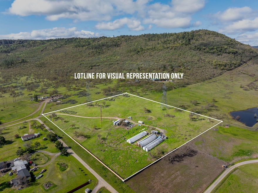
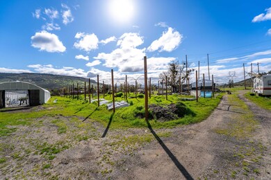
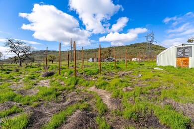
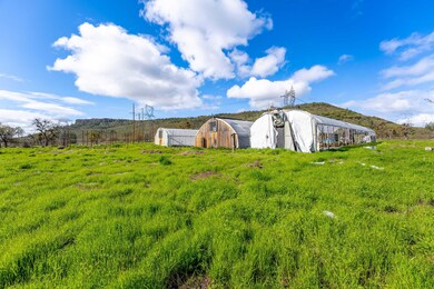
- Greenhouse
- Mountain View
- Wire Fence
- 10.01 Acre Lot
- No HOA
- Level Lot
About This Lot
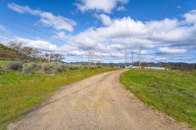
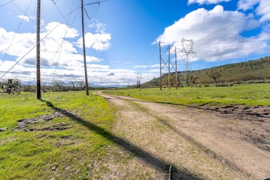
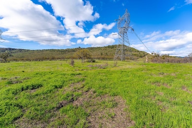
This exceptional 10.01-acre parcel offers 100% usable, level land with breathtaking views of upper and lower Table Rock. Fully fenced and ready for your vision, the property features a robust 250-amp power supply and a strong, high-producing well—ideal for residential, agricultural, or commercial use. Whether you're looking to build your dream home, start a garden, or create a private retreat, this land delivers unmatched utility and potential. With no wasted space, panoramic scenery, and essential infrastructure already in place, it's a rare opportunity to own a slice of Southern Oregon paradise.
Listing Agent
Steve Thomas Group
eXp Realty, LLC License #201221244 Listed on: 01/12/2026
Property Details
Property Type
- Land
Est. Annual Taxes
- $1,138
Lot Details
- 10.01 Acre Lot
- Dirt Road
- Wire Fence
- Level Lot
- Zoning described as EFU
Property Views
- Mountain
- Territorial
Utilities
- Well
Listing and Financial Details
- Tax Lot 316
- Assessor Parcel Number 10638301
Community Details
Overview
- No Home Owners Association
Recreation
- Greenhouse
Map
Tax History
| Year | Tax Paid | Tax Assessment Tax Assessment Total Assessment is a certain percentage of the fair market value that is determined by local assessors to be the total taxable value of land and additions on the property. | Land | Improvement |
|---|---|---|---|---|
| 2026 | $1,065 | $92,080 | -- | -- |
| 2025 | $1,138 | $89,400 | $81,860 | $7,540 |
| 2024 | $1,138 | $86,800 | $79,480 | $7,320 |
| 2023 | $1,102 | $84,280 | $77,170 | $7,110 |
| 2022 | $1,081 | $84,280 | $77,170 | $7,110 |
| 2021 | $1,052 | $81,830 | $74,930 | $6,900 |
| 2020 | $1,023 | $79,450 | $72,750 | $6,700 |
| 2019 | $1,001 | $74,900 | $68,590 | $6,310 |
| 2018 | $972 | $72,720 | $66,590 | $6,130 |
| 2017 | $683 | $72,720 | $66,590 | $6,130 |
| 2016 | $527 | $54,040 | $54,040 | $0 |
| 2015 | $507 | $54,040 | $54,040 | $0 |
| 2014 | $485 | $50,950 | $50,950 | $0 |
Property History
| Date | Event | Price | List to Sale | Price per Sq Ft | Prior Sale |
|---|---|---|---|---|---|
| 03/25/2026 03/25/26 | Price Changed | $229,000 | -2.6% | -- | |
| 02/25/2026 02/25/26 | Price Changed | $235,000 | -2.1% | -- | |
| 02/09/2026 02/09/26 | Price Changed | $240,000 | -4.0% | -- | |
| 01/12/2026 01/12/26 | For Sale | $250,000 | 0.0% | -- | |
| 01/07/2026 01/07/26 | Off Market | $250,000 | -- | -- | |
| 10/17/2025 10/17/25 | For Sale | $250,000 | 0.0% | -- | |
| 10/08/2025 10/08/25 | Off Market | $250,000 | -- | -- | |
| 08/25/2025 08/25/25 | Price Changed | $250,000 | -3.8% | -- | |
| 08/05/2025 08/05/25 | Price Changed | $260,000 | -3.3% | -- | |
| 07/29/2025 07/29/25 | For Sale | $269,000 | 0.0% | -- | |
| 07/28/2025 07/28/25 | Off Market | $269,000 | -- | -- | |
| 06/10/2025 06/10/25 | Price Changed | $269,000 | -2.2% | -- | |
| 05/27/2025 05/27/25 | For Sale | $275,000 | 0.0% | -- | |
| 05/23/2025 05/23/25 | Pending | -- | -- | -- | |
| 05/02/2025 05/02/25 | Price Changed | $275,000 | -8.0% | -- | |
| 04/14/2025 04/14/25 | For Sale | $299,000 | +424.6% | -- | |
| 01/30/2015 01/30/15 | Sold | $57,000 | -36.7% | -- | View Prior Sale |
| 01/10/2015 01/10/15 | Pending | -- | -- | -- | |
| 08/19/2013 08/19/13 | For Sale | $90,000 | -- | -- |
Purchase History
| Date | Type | Sale Price | Title Company |
|---|---|---|---|
| Bargain Sale Deed | $9,500 | Accommodation | |
| Bargain Sale Deed | -- | Accommodation | |
| Warranty Deed | $57,000 | First American | |
| Special Warranty Deed | $28,103 | First American Title Ins | |
| Trustee Deed | $21,000 | -- |
Mortgage History
| Date | Status | Loan Amount | Loan Type |
|---|---|---|---|
| Previous Owner | $32,000 | Seller Take Back |
Source: Oregon Datashare
MLS Number: 220199524
APN: 10638301
Disclaimer: Certain information contained herein is derived from information provided by parties other than Homes.com. All information provided is deemed reliable, but is not guaranteed to be accurate and should be independently verified.
![]() © 2026 Oregon Datashare (KCAR | MLSCO | SOMLS). All rights reserved. The data relating to real estate for sale on this web site comes in part from the Internet Data Exchange Program of the Oregon Datashare. Real estate listings held by IDX Brokerage firms other than Ten-X are marked with the Internet Data Exchange logo or the Internet Data Exchange thumbnail logo and detailed information about them includes the name of the listing Brokers. Information provided is for consumers' personal, non-commercial use and may not be used for any purpose other than to identify prospective properties the viewer may be interested in purchasing. The consumer will not copy, retransmit nor redistribute any of the content from this website. Information provided is deemed reliable, but not guaranteed.
© 2026 Oregon Datashare (KCAR | MLSCO | SOMLS). All rights reserved. The data relating to real estate for sale on this web site comes in part from the Internet Data Exchange Program of the Oregon Datashare. Real estate listings held by IDX Brokerage firms other than Ten-X are marked with the Internet Data Exchange logo or the Internet Data Exchange thumbnail logo and detailed information about them includes the name of the listing Brokers. Information provided is for consumers' personal, non-commercial use and may not be used for any purpose other than to identify prospective properties the viewer may be interested in purchasing. The consumer will not copy, retransmit nor redistribute any of the content from this website. Information provided is deemed reliable, but not guaranteed.
- 10695 Kildee Ave
- 11220 Duggan Rd
- 13290 Table Rock Rd
- 0 Perry Rd
- 395 Robleda Dr
- 0 Duggan Rd Unit 220198974
- 377 Pelton Ln
- 13007 Perry Rd
- 11322 Modoc Rd
- 4413 Merita Terrace
- 7505 Blackwell Rd
- 12940 Highway 234
- 12950 Highway 234
- 8785 Blackwell Rd Unit North Side
- 8785 Blackwell Rd Unit South Side
- 8785 Blackwell Rd
- 6251 Ventura Ln
- 12214 Modoc Rd
- 13327 Highway 234
- 12240 Modoc Rd Unit A
- 459 4th Ave
- 1127 Annalise St
- 700 N Haskell St
- 50 Alta Vista Rd
- 7862 Phaedra Ln
- 70-110 S Haskell St
- 25 Donna Way
- 1335 Sandy Ln
- 1836 Hondeleau Ln
- 283 Berrydale Ave
- 2243 Poplar Dr Unit 1
- 2190 Poplar Dr
- 1801 Poplar Dr
- 237 E McAndrews Rd
- 2055 Campus Dr Unit 2055 Campus Drive Unit 2
- 2586 Tiffin Way
- 645 Royal Ave
- 518 N Riverside Ave
- 520 N Bartlett St
- 2642 W Main St
Ask me questions while you tour the home.