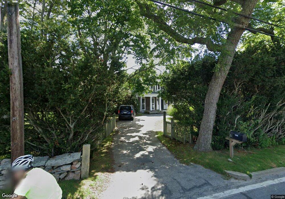
106B Sakonnet Point Rd Little Compton, RI 02837
Estimated Value: $1,313,000 - $2,059,000
3
Beds
2
Baths
1,712
Sq Ft
$1,018/Sq Ft
Est. Value
About This Home
This home is located at 106B Sakonnet Point Rd, Little Compton, RI 02837 and is currently estimated at $1,742,644, approximately $1,017 per square foot. 106B Sakonnet Point Rd is a home located in Newport County with nearby schools including Wilbur & McMahon School.
Ownership History
Date
Name
Owned For
Owner Type
Purchase Details
Closed on
Jul 8, 2008
Sold by
Raish Roslyn A
Bought by
Raish Anne and Kaissar Nir
Current Estimated Value
Home Financials for this Owner
Home Financials are based on the most recent Mortgage that was taken out on this home.
Original Mortgage
$417,000
Outstanding Balance
$265,874
Interest Rate
6.01%
Mortgage Type
Purchase Money Mortgage
Estimated Equity
$1,476,770
Purchase Details
Closed on
May 4, 1994
Sold by
Brooks Robert T and Brooks Rhea
Bought by
Raish David L and Raish Roslyn
Home Financials for this Owner
Home Financials are based on the most recent Mortgage that was taken out on this home.
Original Mortgage
$320,000
Interest Rate
7.7%
Create a Home Valuation Report for This Property
The Home Valuation Report is an in-depth analysis detailing your home's value as well as a comparison with similar homes in the area
Home Values in the Area
Average Home Value in this Area
Purchase History
| Date | Buyer | Sale Price | Title Company |
|---|---|---|---|
| Raish Anne | $914,000 | -- | |
| Raish David L | $400,000 | -- |
Source: Public Records
Mortgage History
| Date | Status | Borrower | Loan Amount |
|---|---|---|---|
| Open | Raish David L | $417,000 | |
| Previous Owner | Raish David L | $320,000 | |
| Previous Owner | Raish David L | $320,000 |
Source: Public Records
Tax History
| Year | Tax Paid | Tax Assessment Tax Assessment Total Assessment is a certain percentage of the fair market value that is determined by local assessors to be the total taxable value of land and additions on the property. | Land | Improvement |
|---|---|---|---|---|
| 2025 | $5,606 | $1,170,400 | $870,300 | $300,100 |
| 2024 | $4,941 | $972,600 | $756,000 | $216,600 |
| 2023 | $4,824 | $972,600 | $756,000 | $216,600 |
| 2022 | $4,766 | $972,600 | $756,000 | $216,600 |
| 2021 | $3,999 | $662,100 | $454,500 | $207,600 |
| 2020 | $3,966 | $662,100 | $454,500 | $207,600 |
| 2019 | $3,926 | $662,100 | $454,500 | $207,600 |
| 2018 | $3,920 | $657,800 | $454,500 | $203,300 |
| 2016 | $3,730 | $657,800 | $454,500 | $203,300 |
| 2015 | $3,620 | $629,600 | $378,600 | $251,000 |
| 2014 | -- | $629,600 | $378,600 | $251,000 |
Source: Public Records
Map
Nearby Homes
- 38 Old Bull Ln
- 141 S Of Commons Rd
- 49 Ocean Dr
- 30 Indian Rd
- 89 S Shore Rd
- 441 W Main Rd
- 128 Maple Ave
- 138 Willow Ave
- 515 Indian Ave
- 0 Willow Ave
- 180 W Main Rd
- 100 Summerfield Ln
- 141 Peckham Rd
- 17 Ferolbink Way
- 505 Long Hwy
- 155 W Main Rd
- 141 Gray Craig Rd
- 0 Indian Ave
- 225 Old Mill Ln
- 255 John Dyer Rd
- 106 Sakonnet Point Rd
- 100 Sakonnet Point Rd
- 114 Sakonnet Point Rd
- 98 Sakonnet Point Rd
- 101A Sakonnet Point Rd
- 101 Sakonnet Point Rd
- 96 Sakonnet Point Rd
- 116 Sakonnet Point Rd
- 109 Sakonnet Point Rd
- 95 Sakonnet Point Rd
- 11 Goodrich Ln
- 90 Sakonnet Point Rd
- 118 Sakonnet Point Rd
- 91 Sakonnet Point Rd
- 115 Sakonnet Point Rd
- 122 Sakonnet Point Rd
- 6 Goodrich Ln
- 127 Sakonnet Point Rd
- 127C Sakonnet Point Rd
- 16 Round Pond Rd
Your Personal Tour Guide
Ask me questions while you tour the home.