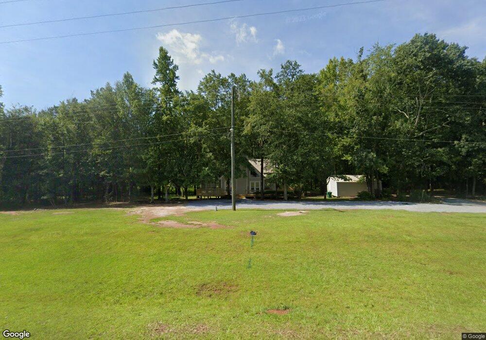
107 Airport Rd NE Unit 6 Milledgeville, GA 31061
Estimated Value: $333,000 - $409,000
3
Beds
2
Baths
2,282
Sq Ft
$158/Sq Ft
Est. Value
About This Home
This home is located at 107 Airport Rd NE Unit 6, Milledgeville, GA 31061 and is currently estimated at $359,416, approximately $157 per square foot. 107 Airport Rd NE Unit 6 is a home located in Baldwin County with nearby schools including Lakeview Primary, Lakeview Academy, and Oak Hill Middle School.
Ownership History
Date
Name
Owned For
Owner Type
Purchase Details
Closed on
Jul 21, 2023
Sold by
Colter Al
Bought by
Graham Jean A
Current Estimated Value
Home Financials for this Owner
Home Financials are based on the most recent Mortgage that was taken out on this home.
Original Mortgage
$270,000
Outstanding Balance
$263,414
Interest Rate
6.67%
Mortgage Type
New Conventional
Estimated Equity
$96,002
Purchase Details
Closed on
Feb 6, 2023
Sold by
Bray James D Jr Estate
Bought by
Dennis Jack and Colter Al
Purchase Details
Closed on
Mar 10, 2021
Sold by
Bertoli Betty K Estate
Bought by
Bray James D
Purchase Details
Closed on
Jan 30, 2013
Sold by
Glass Jeffery M
Bought by
Bertoli Betty K
Purchase Details
Closed on
Jun 15, 1994
Bought by
Glass
Purchase Details
Closed on
Jan 1, 1991
Bought by
Harris Scott
Create a Home Valuation Report for This Property
The Home Valuation Report is an in-depth analysis detailing your home's value as well as a comparison with similar homes in the area
Home Values in the Area
Average Home Value in this Area
Purchase History
| Date | Buyer | Sale Price | Title Company |
|---|---|---|---|
| Graham Jean A | $300,000 | -- | |
| Dennis Jack | $135,000 | -- | |
| Bray James D | -- | -- | |
| Bertoli Betty K | $135,000 | -- | |
| Glass | $102,500 | -- | |
| Harris Scott | $8,500 | -- |
Source: Public Records
Mortgage History
| Date | Status | Borrower | Loan Amount |
|---|---|---|---|
| Open | Graham Jean A | $270,000 |
Source: Public Records
Tax History Compared to Growth
Tax History
| Year | Tax Paid | Tax Assessment Tax Assessment Total Assessment is a certain percentage of the fair market value that is determined by local assessors to be the total taxable value of land and additions on the property. | Land | Improvement |
|---|---|---|---|---|
| 2025 | $2,797 | $114,768 | $6,964 | $107,804 |
| 2024 | $2,797 | $114,768 | $6,964 | $107,804 |
| 2023 | $2,247 | $90,316 | $5,800 | $84,516 |
| 2022 | $2,247 | $91,176 | $5,800 | $85,376 |
| 2021 | $1,359 | $51,720 | $5,800 | $45,920 |
| 2020 | $1,340 | $51,720 | $5,800 | $45,920 |
| 2019 | $1,343 | $51,720 | $5,800 | $45,920 |
| 2018 | $1,351 | $51,720 | $5,800 | $45,920 |
| 2017 | $1,319 | $51,720 | $5,800 | $45,920 |
| 2016 | $1,221 | $45,360 | $5,560 | $39,800 |
| 2015 | $1,223 | $45,360 | $5,560 | $39,800 |
| 2014 | $1,225 | $45,360 | $5,560 | $39,800 |
Source: Public Records
Map
Nearby Homes
- 350 Log Cabin Rd NE
- 165 Log Cabin Rd NE
- 156 Log Cabin Rd NE
- 111 Milledge Commons Dr
- 117 Milledge Commons Dr
- 109 Milledge Commons Dr
- 105 Milledge Commons Dr
- 119 Milledge Commons Dr
- 113 Milledge Commons Dr
- Banneker Plan at Milledge Commons
- Smyrna Plan at Milledge Commons
- Hawkins Plan at Milledge Commons
- 103 Water Ridge Dr
- 241 Southern Walk Dr
- 251 Southern Walk Dr NE
- 107 Airport Rd NE
- 109 Airport Rd NE
- 106 Airport Rd NE
- 111 Airport Rd NE
- 110 Airport Rd NE
- 114 Airport Rd NE
- 114 Airport Rd NE Unit 78
- 113 Airport Rd NE
- 198 Log Cabin Rd NE
- 118 Airport Rd NE
- 0 Log Cabin Rd NE Unit LOT 3 3083920
- 0 Log Cabin Rd NE Unit 7165053
- 0 Log Cabin Rd NE Unit 7028504
- 0 Log Cabin Rd NE Unit 3133344
- 0 Log Cabin Rd NE Unit 8366231
- 0 Log Cabin Rd NE Unit 8554126
- 0 Log Cabin Rd NE Unit 3193384
- 0 Log Cabin Rd NE Unit 7027027
- 0 Log Cabin Rd NE Unit 7556909
- 0 Log Cabin Rd NE Unit 7598950