Estimated Value: $238,144 - $290,000
3
Beds
2
Baths
1,438
Sq Ft
$182/Sq Ft
Est. Value
About This Home
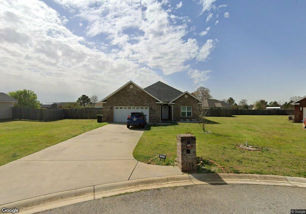
This home is located at 107 Brooke Ct, Byron, GA 31008 and is currently estimated at $261,036, approximately $181 per square foot. 107 Brooke Ct is a home located in Peach County with nearby schools including Kay Road Elementary School, Fort Valley Middle School, and Peach County High School.
Ownership History
Date
Name
Owned For
Owner Type
Purchase Details
Closed on
Dec 9, 2016
Sold by
Keith
Bought by
Barrett Keith and Barrett Lynda
Current Estimated Value
Home Financials for this Owner
Home Financials are based on the most recent Mortgage that was taken out on this home.
Original Mortgage
$155,268
Outstanding Balance
$124,244
Interest Rate
3.57%
Mortgage Type
VA
Estimated Equity
$136,792
Purchase Details
Closed on
Sep 26, 2012
Sold by
The Bank Of Perry
Bought by
Faith Built Llc
Create a Home Valuation Report for This Property
The Home Valuation Report is an in-depth analysis detailing your home's value as well as a comparison with similar homes in the area
Home Values in the Area
Average Home Value in this Area
Purchase History
| Date | Buyer | Sale Price | Title Company |
|---|---|---|---|
| Barrett Keith | $156,200 | -- | |
| Barrett Keith | $156,200 | -- | |
| Faith Built Llc | -- | -- |
Source: Public Records
Mortgage History
| Date | Status | Borrower | Loan Amount |
|---|---|---|---|
| Open | Barrett Keith | $155,268 | |
| Closed | Barrett Keith | $155,268 |
Source: Public Records
Tax History
| Year | Tax Paid | Tax Assessment Tax Assessment Total Assessment is a certain percentage of the fair market value that is determined by local assessors to be the total taxable value of land and additions on the property. | Land | Improvement |
|---|---|---|---|---|
| 2025 | $2,698 | $85,280 | $9,680 | $75,600 |
| 2024 | $2,761 | $82,800 | $10,000 | $72,800 |
| 2023 | $2,705 | $80,720 | $10,000 | $70,720 |
| 2022 | $1,930 | $71,680 | $10,000 | $61,680 |
| 2021 | $1,890 | $60,520 | $10,000 | $50,520 |
| 2020 | $1,941 | $62,160 | $10,000 | $52,160 |
| 2019 | $1,903 | $60,640 | $10,000 | $50,640 |
| 2018 | $1,847 | $58,560 | $10,000 | $48,560 |
| 2017 | $1,856 | $58,560 | $10,000 | $48,560 |
| 2016 | $221 | $7,000 | $7,000 | $0 |
| 2015 | $221 | $7,000 | $7,000 | $0 |
Source: Public Records
Map
Nearby Homes
- 171 Hawks Ridge Trace
- 109 Red Tail Cir
- 124 Hawks Ridge Trace
- 161 Rowland Cir
- 0 Barker Rd Unit 243030
- 0 Barker Rd Unit 14258525
- 0 Barker Rd Unit 175053
- 112 Early Dr
- 0 Housers Mill Rd Unit 5515996
- 450 Jones Rd
- 4682 Housers Mill Rd
- 800 John E Sullivan Rd
- 3563 Housers Mill Rd
- 124 Early Dr
- 120 Early Dr
- 116 Early Dr
- 147 Early Dr
- 19C Crown Ct
- 119 Early Dr
- 3379 Housers Mill Rd
- 105 Brooke Ct
- 110 Ainsley Way
- 109 Brooke Ct
- 113 Ainsley Way
- 103 Brooke Ct
- 110 Brooke Ct
- 108 Ainsley Way
- 108 Ainsley Way Unit 65
- 106 Brooke Ct
- 111 Ainsley Way
- 302 Brandon Way
- 108 Brooke Ct
- 104 Brooke Ct
- 101 Brooke Ct
- 165 Red Tail Cir
- 165 Red Tail Cir Unit LOT 20
- 106 Ainsley Way
- 102 Brooke Ct
- 109 Ainsley Way
- 104 Ainsley Way
Your Personal Tour Guide
Ask me questions while you tour the home.