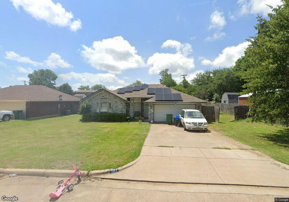
107 Catie Ln Joshua, TX 76058
Osage-North Fisk NeighborhoodEstimated Value: $244,143 - $266,000
3
Beds
2
Baths
1,234
Sq Ft
$208/Sq Ft
Est. Value
About This Home
This home is located at 107 Catie Ln, Joshua, TX 76058 and is currently estimated at $257,286, approximately $208 per square foot. 107 Catie Ln is a home located in Johnson County with nearby schools including A.G. Elder Elementary School, Joshua High School, and Joshua High School - 9th Grade Campus.
Ownership History
Date
Name
Owned For
Owner Type
Purchase Details
Closed on
Jun 26, 2018
Sold by
Maldonado John J and Maldonado Mary
Bought by
West Bradley Allen and West Alexus Lei Lani
Current Estimated Value
Home Financials for this Owner
Home Financials are based on the most recent Mortgage that was taken out on this home.
Original Mortgage
$142,373
Outstanding Balance
$123,387
Interest Rate
4.5%
Mortgage Type
FHA
Estimated Equity
$133,899
Purchase Details
Closed on
Dec 17, 2008
Sold by
Allred Floyd
Bought by
Maldonado John J
Home Financials for this Owner
Home Financials are based on the most recent Mortgage that was taken out on this home.
Original Mortgage
$82,500
Interest Rate
6.15%
Mortgage Type
Purchase Money Mortgage
Create a Home Valuation Report for This Property
The Home Valuation Report is an in-depth analysis detailing your home's value as well as a comparison with similar homes in the area
Home Values in the Area
Average Home Value in this Area
Purchase History
| Date | Buyer | Sale Price | Title Company |
|---|---|---|---|
| West Bradley Allen | -- | None Available | |
| Maldonado John J | -- | None Available |
Source: Public Records
Mortgage History
| Date | Status | Borrower | Loan Amount |
|---|---|---|---|
| Open | West Bradley Allen | $142,373 | |
| Previous Owner | Maldonado John J | $82,500 |
Source: Public Records
Tax History Compared to Growth
Tax History
| Year | Tax Paid | Tax Assessment Tax Assessment Total Assessment is a certain percentage of the fair market value that is determined by local assessors to be the total taxable value of land and additions on the property. | Land | Improvement |
|---|---|---|---|---|
| 2025 | $2,021 | $243,187 | $25,000 | $218,187 |
| 2024 | $3,408 | $140,031 | $0 | $0 |
| 2023 | $1,637 | $140,795 | $25,000 | $115,795 |
| 2022 | $2,904 | $140,795 | $25,000 | $115,795 |
| 2021 | $3,564 | $140,795 | $25,000 | $115,795 |
| 2020 | $2,619 | $95,643 | $25,000 | $70,643 |
| 2019 | $2,830 | $98,361 | $25,000 | $73,361 |
| 2018 | $2,908 | $98,361 | $25,000 | $73,361 |
| 2017 | $2,907 | $98,361 | $25,000 | $73,361 |
| 2016 | $2,747 | $92,952 | $15,000 | $77,952 |
| 2015 | $2,186 | $92,952 | $15,000 | $77,952 |
| 2014 | $2,186 | $92,952 | $15,000 | $77,952 |
Source: Public Records
Map
Nearby Homes
- 312 Comanche Walk
- 414 Dakota Dr
- 304 Comanche Walk
- 520 Palo Duro Dr
- 527 Lone Star St
- 108 Sally St
- 608 W Sheila Cir
- 613 W Sheila Cir
- 200 Wayside St
- 628 E Sheila Cir
- 629 E Sheila Cir
- 205 Greenhill Dr
- 107 E 10th St
- 209 E 8th St
- 102 Carlock St
- 401 Eddy Ave
- 601 Eddy Ave
- 500 N Main St
- 408 Eddy Ave
- 701 Seahawk St
- 105 Catie Ln
- 208 Lone Star St
- 206 Lone Star St
- 103 Catie Ln
- 210 Lone Star St
- 106 Catie Ln
- 204 Lone Star St
- 104 Catie Ln
- 101 Catie Ln
- 102 Catie Ln
- 214 Lone Star St
- 405 McMillain St
- 202 Lone Star St
- 100 Catie Ln
- 215 Thomas St
- 216 Lone Star St
- 318 Comanche Walk
- 603 Dakota Dr
- 321 Comanche Walk
- 605 Dakota Dr