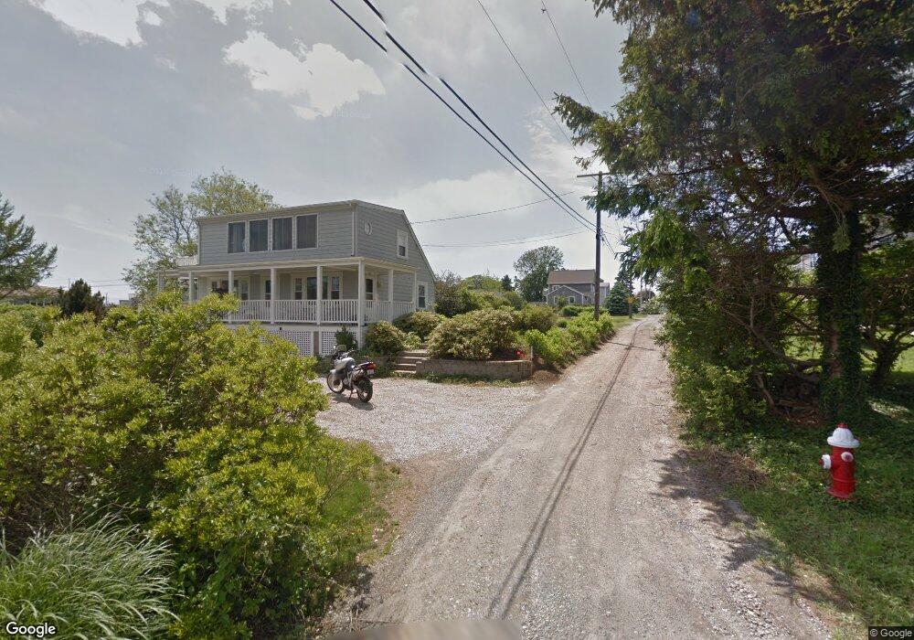
107 Community Dr Wakefield, RI 02879
Estimated Value: $1,161,725 - $1,305,000
3
Beds
3
Baths
2,513
Sq Ft
$484/Sq Ft
Est. Value
About This Home
This home is located at 107 Community Dr, Wakefield, RI 02879 and is currently estimated at $1,216,181, approximately $483 per square foot. 107 Community Dr is a home with nearby schools including South Kingstown High School.
Ownership History
Date
Name
Owned For
Owner Type
Purchase Details
Closed on
Nov 28, 2017
Sold by
Drolet Alfred and Drolet Ruth H
Bought by
Cullen Donald P and Cullen Deanna N
Current Estimated Value
Purchase Details
Closed on
Mar 27, 1987
Bought by
Drolet Alfred and Drolet Ruth H
Create a Home Valuation Report for This Property
The Home Valuation Report is an in-depth analysis detailing your home's value as well as a comparison with similar homes in the area
Home Values in the Area
Average Home Value in this Area
Purchase History
| Date | Buyer | Sale Price | Title Company |
|---|---|---|---|
| Cullen Donald P | $155,000 | -- | |
| Drolet Alfred | -- | -- |
Source: Public Records
Mortgage History
| Date | Status | Borrower | Loan Amount |
|---|---|---|---|
| Open | Drolet Alfred | $435,000 |
Source: Public Records
Tax History Compared to Growth
Tax History
| Year | Tax Paid | Tax Assessment Tax Assessment Total Assessment is a certain percentage of the fair market value that is determined by local assessors to be the total taxable value of land and additions on the property. | Land | Improvement |
|---|---|---|---|---|
| 2025 | $8,291 | $927,400 | $336,100 | $591,300 |
| 2024 | $8,629 | $780,900 | $282,000 | $498,900 |
| 2023 | $8,629 | $780,900 | $282,000 | $498,900 |
| 2022 | $8,551 | $780,900 | $282,000 | $498,900 |
| 2021 | $8,651 | $598,700 | $229,900 | $368,800 |
| 2020 | $8,651 | $598,700 | $229,900 | $368,800 |
| 2019 | $8,651 | $598,700 | $229,900 | $368,800 |
| 2018 | $2,884 | $183,900 | $183,900 | $0 |
| 2017 | $2,816 | $183,900 | $183,900 | $0 |
| 2016 | $2,775 | $183,900 | $183,900 | $0 |
| 2015 | $2,738 | $176,400 | $176,400 | $0 |
| 2014 | $2,731 | $176,400 | $176,400 | $0 |
Source: Public Records
Map
Nearby Homes
- 35 Atlantic Ave
- 854 Matunuck Beach #215 Rd
- 27 Holden Rd
- 854 Matunuck Beach Rd
- 0 Park Ave
- 24 Peninsula Rd
- 277 Prospect Rd
- 14 E Pointe Ct Unit 14
- 691 Succotash Rd
- 689 Succotash Rd
- 550 Cards Pond Rd
- 17 Westside Rd
- 6 MacAlder St
- 83 Gooseberry Rd
- 16 Percy Ln
- 392 Gooseberry Rd
- 18 Beach Row
- 16 High Tides Ln
- 2139 Commodore Oliver Hazard Perry Hwy
- 2321 Post Rd
- 113 Community Dr
- 113 Community Dr Unit 1
- 100 Holden Rd
- 104 Community Dr
- 112 Community Dr
- 91 Community Dr
- 100 Community Dr
- 88 Holden Rd
- 116 Holden Rd
- 92 Community Dr
- 82 Holden Rd
- 101 Holden Rd
- 93 Holden Rd
- 89 Atlantic Ave
- 83 Community Dr
- 103 Atlantic Ave
- 84 Community Dr
- 115 Holden Rd
- 76 Holden Rd
- 87 Holden Rd