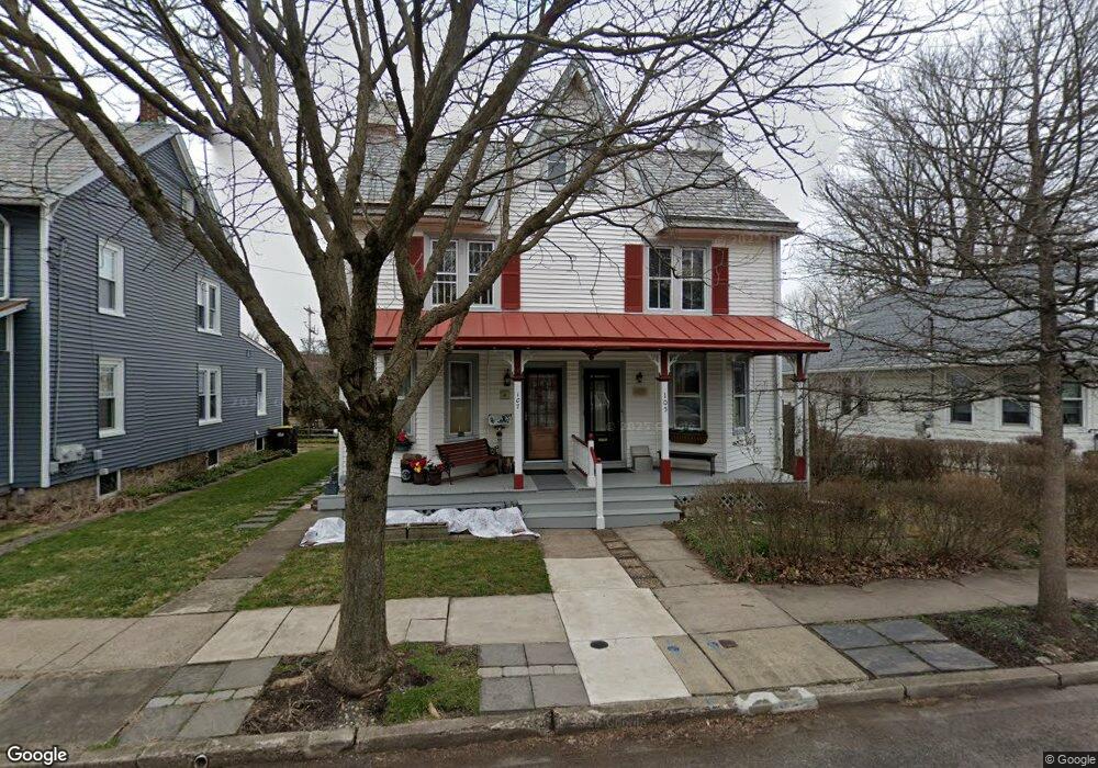
107 Decatur St Doylestown, PA 18901
Estimated Value: $502,000 - $620,000
3
Beds
1
Bath
1,428
Sq Ft
$378/Sq Ft
Est. Value
About This Home
This home is located at 107 Decatur St, Doylestown, PA 18901 and is currently estimated at $540,354, approximately $378 per square foot. 107 Decatur St is a home located in Bucks County with nearby schools including Doyle El School, Lenape Middle School, and Central Bucks High School-West.
Ownership History
Date
Name
Owned For
Owner Type
Purchase Details
Closed on
Mar 5, 1994
Sold by
Livrone Dennis P and Livrone Barbara J
Bought by
Livrone Dennis P and Livrone Barbara J
Current Estimated Value
Purchase Details
Closed on
Aug 27, 1987
Bought by
Livrone Dennis P
Create a Home Valuation Report for This Property
The Home Valuation Report is an in-depth analysis detailing your home's value as well as a comparison with similar homes in the area
Home Values in the Area
Average Home Value in this Area
Purchase History
| Date | Buyer | Sale Price | Title Company |
|---|---|---|---|
| Livrone Dennis P | -- | -- | |
| Livrone Dennis P | $115,000 | -- |
Source: Public Records
Tax History Compared to Growth
Tax History
| Year | Tax Paid | Tax Assessment Tax Assessment Total Assessment is a certain percentage of the fair market value that is determined by local assessors to be the total taxable value of land and additions on the property. | Land | Improvement |
|---|---|---|---|---|
| 2025 | $3,306 | $18,350 | $3,550 | $14,800 |
| 2024 | $3,306 | $18,350 | $3,550 | $14,800 |
| 2023 | $3,149 | $18,350 | $3,550 | $14,800 |
| 2022 | $3,106 | $18,350 | $3,550 | $14,800 |
| 2021 | $3,072 | $18,350 | $3,550 | $14,800 |
| 2020 | $3,038 | $18,350 | $3,550 | $14,800 |
| 2019 | $3,004 | $18,350 | $3,550 | $14,800 |
| 2018 | $2,968 | $18,350 | $3,550 | $14,800 |
| 2017 | $2,936 | $18,350 | $3,550 | $14,800 |
| 2016 | $2,936 | $18,350 | $3,550 | $14,800 |
| 2015 | -- | $18,350 | $3,550 | $14,800 |
| 2014 | -- | $18,350 | $3,550 | $14,800 |
Source: Public Records
Map
Nearby Homes
- 130 N Clinton St
- 37 N Clinton St
- 20 E Court St
- 123 S Franklin St
- 69 E Oakland Ave
- 146 N Church St
- 226 N Main St
- 1 Barnes Ct
- 146 E Court St
- 195 Lafayette St
- 110 E Ashland St
- 155 E Oakland Ave
- 236 Green St
- 6 Edison Ln Unit 1
- 284 E Court St
- 612 N Shady Retreat Rd
- 2-3 Aspen Way Unit 23
- 418 North St
- 89 Homestead Dr
- 0 000 Rd E