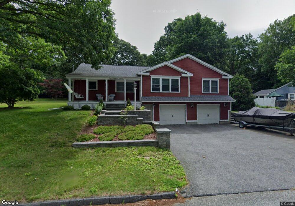
107 Howe Ave Shrewsbury, MA 01545
Estimated Value: $551,000 - $700,000
3
Beds
1
Bath
1,040
Sq Ft
$594/Sq Ft
Est. Value
About This Home
This home is located at 107 Howe Ave, Shrewsbury, MA 01545 and is currently estimated at $617,691, approximately $593 per square foot. 107 Howe Ave is a home located in Worcester County with nearby schools including Sherwood Middle School, Floral Street School, and Oak Middle School.
Ownership History
Date
Name
Owned For
Owner Type
Purchase Details
Closed on
Jun 17, 2003
Sold by
Diverdi Marc A
Bought by
Buteau Denise and Martone Carmen W
Current Estimated Value
Home Financials for this Owner
Home Financials are based on the most recent Mortgage that was taken out on this home.
Original Mortgage
$135,000
Outstanding Balance
$59,094
Interest Rate
5.77%
Mortgage Type
Purchase Money Mortgage
Estimated Equity
$558,597
Purchase Details
Closed on
Jul 30, 1999
Sold by
Trubull Susan M
Bought by
Diverdi Marc A
Purchase Details
Closed on
Aug 1, 1997
Sold by
Buono Paul A and Buono Tina M
Bought by
Trumbull Susan M
Purchase Details
Closed on
Jul 29, 1994
Sold by
Padgett Sean S
Bought by
Buono Paul A and Buono Tina
Purchase Details
Closed on
Feb 27, 1989
Sold by
Cormier Jeffrey
Bought by
Padgett Sean S
Create a Home Valuation Report for This Property
The Home Valuation Report is an in-depth analysis detailing your home's value as well as a comparison with similar homes in the area
Home Values in the Area
Average Home Value in this Area
Purchase History
| Date | Buyer | Sale Price | Title Company |
|---|---|---|---|
| Buteau Denise | $255,000 | -- | |
| Buteau Denise | $255,000 | -- | |
| Diverdi Marc A | $145,000 | -- | |
| Diverdi Marc A | $145,000 | -- | |
| Trumbull Susan M | $132,500 | -- | |
| Trumbull Susan M | $132,500 | -- | |
| Buono Paul A | $118,500 | -- | |
| Buono Paul A | $118,500 | -- | |
| Padgett Sean S | $142,500 | -- |
Source: Public Records
Mortgage History
| Date | Status | Borrower | Loan Amount |
|---|---|---|---|
| Open | Padgett Sean S | $135,000 | |
| Closed | Padgett Sean S | $135,000 |
Source: Public Records
Tax History
| Year | Tax Paid | Tax Assessment Tax Assessment Total Assessment is a certain percentage of the fair market value that is determined by local assessors to be the total taxable value of land and additions on the property. | Land | Improvement |
|---|---|---|---|---|
| 2025 | $74 | $615,000 | $261,300 | $353,700 |
| 2024 | $6,602 | $533,300 | $248,900 | $284,400 |
| 2023 | $6,493 | $494,900 | $248,900 | $246,000 |
| 2022 | $6,640 | $470,600 | $248,900 | $221,700 |
| 2021 | $5,349 | $405,500 | $199,100 | $206,400 |
| 2020 | $4,938 | $396,000 | $199,100 | $196,900 |
| 2019 | $4,755 | $378,300 | $182,800 | $195,500 |
| 2018 | $4,422 | $349,300 | $175,600 | $173,700 |
| 2017 | $4,171 | $325,100 | $158,900 | $166,200 |
| 2016 | $4,141 | $318,500 | $148,900 | $169,600 |
| 2015 | $3,821 | $289,500 | $144,400 | $145,100 |
Source: Public Records
Map
Nearby Homes
- 76 Grove St
- 17 Stone Ave
- 26 Williamsburg Ct Unit 4
- 18 Williamsburg Ct Unit 23
- 629 Grafton St
- 16-18 Fairfax St
- 86 Harriet Ave
- 4 Hancock St
- 40 Adams Farm Rd
- 4 Sterling St
- 190 S Quinsigamond Ave Unit 102
- 44 Shrewsbury Green Dr Unit B
- 151 Hartford Turnpike
- 151 Hartford Turnpike Unit 16
- 42 Shrewsbury Green Dr Unit I
- 57 Harrington Farms Way Unit 57
- 30 Shrewsbury Green Dr Unit K
- 3 Conifer Cir Unit 29
- 15 Conifer Cir Unit 31
- 5 Conifer Cir Unit 28
Your Personal Tour Guide
Ask me questions while you tour the home.