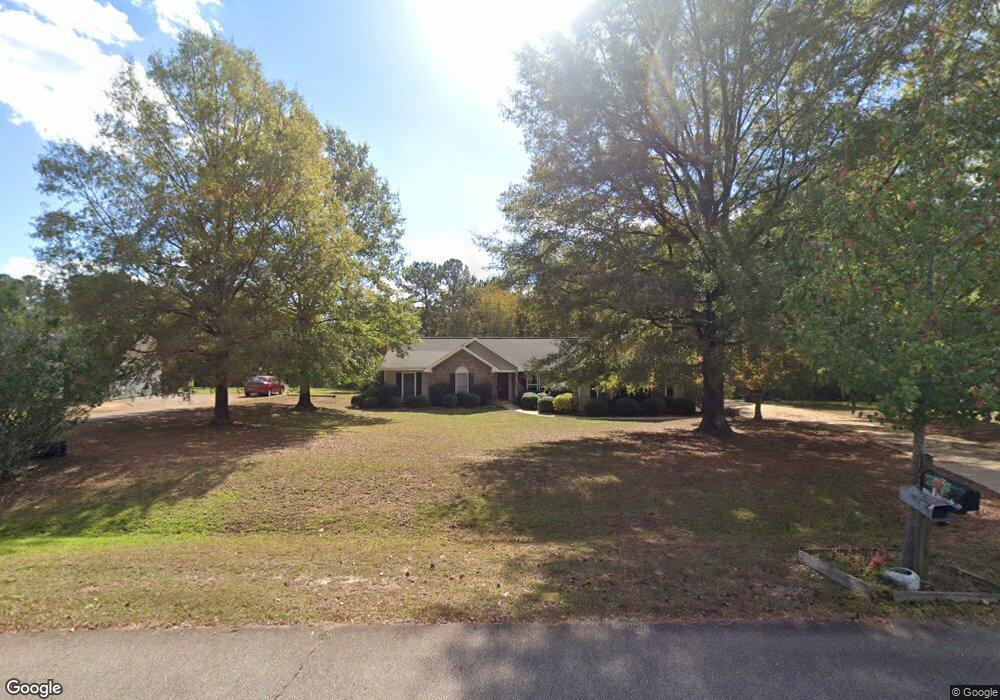
107 Huntington Dr Lagrange, GA 30240
Estimated Value: $282,000 - $340,000
3
Beds
3
Baths
2,368
Sq Ft
$129/Sq Ft
Est. Value
About This Home
This home is located at 107 Huntington Dr, Lagrange, GA 30240 and is currently estimated at $305,546, approximately $129 per square foot. 107 Huntington Dr is a home located in Troup County with nearby schools including Berta Weathersbee Elementary School, Long Cane Elementary School, and Whitesville Road Elementary School.
Ownership History
Date
Name
Owned For
Owner Type
Purchase Details
Closed on
Nov 15, 1990
Sold by
1St Fed Sav
Bought by
Whitley Ernest R
Current Estimated Value
Purchase Details
Closed on
Sep 26, 1989
Sold by
Oak Ridge Dev Corp
Bought by
1St Fed Sav
Purchase Details
Closed on
Sep 1, 1986
Sold by
Lonnie Haralson
Bought by
Oak Ridge Dev Corp
Create a Home Valuation Report for This Property
The Home Valuation Report is an in-depth analysis detailing your home's value as well as a comparison with similar homes in the area
Home Values in the Area
Average Home Value in this Area
Purchase History
| Date | Buyer | Sale Price | Title Company |
|---|---|---|---|
| Whitley Ernest R | $76,500 | -- | |
| 1St Fed Sav | -- | -- | |
| Oak Ridge Dev Corp | -- | -- | |
| Lonnie Haralson | -- | -- |
Source: Public Records
Tax History Compared to Growth
Tax History
| Year | Tax Paid | Tax Assessment Tax Assessment Total Assessment is a certain percentage of the fair market value that is determined by local assessors to be the total taxable value of land and additions on the property. | Land | Improvement |
|---|---|---|---|---|
| 2024 | $1,762 | $91,520 | $14,000 | $77,520 |
| 2023 | $1,101 | $85,160 | $10,000 | $75,160 |
| 2022 | $2,175 | $79,920 | $10,000 | $69,920 |
| 2021 | $1,637 | $56,280 | $8,000 | $48,280 |
| 2020 | $1,637 | $56,280 | $8,000 | $48,280 |
| 2019 | $1,577 | $54,280 | $8,000 | $46,280 |
| 2018 | $1,506 | $51,920 | $8,000 | $43,920 |
| 2017 | $1,506 | $51,920 | $8,000 | $43,920 |
| 2016 | $1,471 | $50,748 | $8,000 | $42,748 |
| 2015 | $1,473 | $50,748 | $8,000 | $42,748 |
| 2014 | $1,441 | $49,613 | $8,000 | $41,613 |
| 2013 | -- | $51,035 | $8,000 | $43,035 |
Source: Public Records
Map
Nearby Homes
- 100 Huntcliff Ct
- 124 Foxdale Dr
- 135 Planters Ridge Dr
- 110 Hawthorne Cir
- 190 Hill Rd
- 105 Hawthorne Cir
- 141 Plymouth Dr
- 103 Hawthorne Cir
- 119 Plymouth Dr
- 102 Franklin Place
- 0 Deming St Unit 10550189
- 509 Connie Dr
- 101 Ivy Springs Dr
- 474 Newton Rd
- 40 River Point Dr
- 808 S Fling Rd
- 709 Vernon Ferry Rd
- 37 Overbrook Dr
- 205 Linda Ln
- LOT 4 Angela Dr
- 105 Huntington Dr
- 109 Huntington Dr
- 111 Huntington Dr
- 106 Huntington Dr
- 108 Huntington Dr
- 103 Huntington Dr
- 660 Teaver Rd
- 645 Teaver Rd
- 674 Teaver Rd
- 630 Teaver Rd
- 113 Huntington Dr
- 104 Huntington Dr Unit 22
- 104 Huntington Dr
- 101 Huntington Dr
- 115 Huntington Dr
- 696 Teaver Rd
- 204 Planters Ridge Ct
- 102 Huntcliff Ct
- 102 Huntington Dr
- 202 Planters Ridge Ct