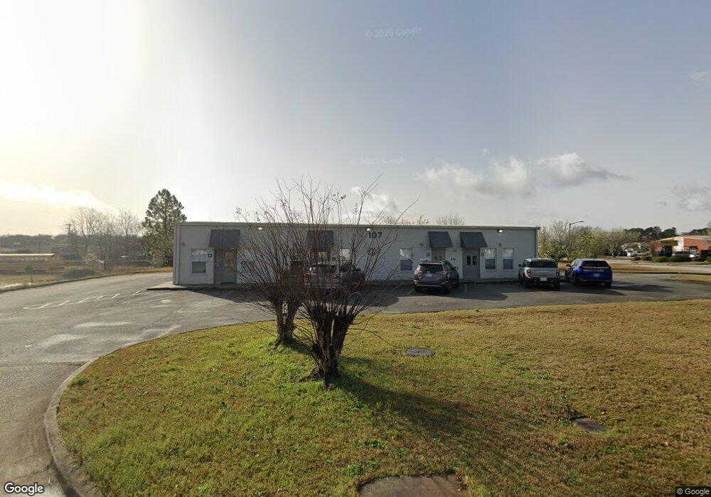
107 Independence Dr Warner Robins, GA 31088
Estimated Value: $557,609
--
Bed
1
Bath
800
Sq Ft
$697/Sq Ft
Est. Value
About This Home
This home is located at 107 Independence Dr, Warner Robins, GA 31088 and is currently estimated at $557,609, approximately $697 per square foot. 107 Independence Dr is a home located in Houston County with nearby schools including Quail Run Elementary School, Thomson Middle School, and Northside High School.
Ownership History
Date
Name
Owned For
Owner Type
Purchase Details
Closed on
Jan 4, 2007
Sold by
Gordon Deborah Ann and Gordon Rood Deborah Ann
Bought by
Filholm Patrick A
Current Estimated Value
Home Financials for this Owner
Home Financials are based on the most recent Mortgage that was taken out on this home.
Original Mortgage
$246,500
Interest Rate
6.1%
Mortgage Type
Commercial
Purchase Details
Closed on
Aug 3, 1995
Bought by
Gordon-Rood Deborah Ann
Create a Home Valuation Report for This Property
The Home Valuation Report is an in-depth analysis detailing your home's value as well as a comparison with similar homes in the area
Home Values in the Area
Average Home Value in this Area
Purchase History
| Date | Buyer | Sale Price | Title Company |
|---|---|---|---|
| Filholm Patrick A | $290,000 | None Available | |
| Gordon-Rood Deborah Ann | $27,600 | -- |
Source: Public Records
Mortgage History
| Date | Status | Borrower | Loan Amount |
|---|---|---|---|
| Closed | Filholm Patrick A | $246,500 |
Source: Public Records
Tax History Compared to Growth
Tax History
| Year | Tax Paid | Tax Assessment Tax Assessment Total Assessment is a certain percentage of the fair market value that is determined by local assessors to be the total taxable value of land and additions on the property. | Land | Improvement |
|---|---|---|---|---|
| 2024 | $3,068 | $93,760 | $34,400 | $59,360 |
| 2023 | $3,092 | $93,760 | $34,400 | $59,360 |
| 2022 | $2,156 | $93,760 | $34,400 | $59,360 |
| 2021 | $2,168 | $93,760 | $34,400 | $59,360 |
| 2020 | $2,178 | $93,760 | $34,400 | $59,360 |
| 2019 | $2,178 | $93,760 | $34,400 | $59,360 |
| 2018 | $1,955 | $84,160 | $23,600 | $60,560 |
| 2017 | $1,957 | $84,160 | $23,600 | $60,560 |
| 2016 | $1,960 | $84,160 | $23,600 | $60,560 |
| 2015 | $0 | $84,160 | $23,600 | $60,560 |
| 2014 | -- | $84,160 | $23,600 | $60,560 |
| 2013 | -- | $84,160 | $23,600 | $60,560 |
Source: Public Records
Map
Nearby Homes
- 215 Deer Track Ct
- 318 Somerset Dr
- 127 N Amanda Place
- 103 Shannon Ln
- 135 Carterwoods Dr
- 319 Smithville Church Rd
- 124 Prestige Dr
- 106 Hampstead Ct
- 713 Pheasant Ridge Dr
- 108 Covey Run Dr
- 105 Maga Ct
- 103 Ashlund Dr
- 504 Pheasant Ridge Dr
- 134 Williamstown Dr
- 313 Clayton Scott St
- 315 Clayton Scott St
- 410 Clayton Scott St
- 104 Constitution Dr
- 209 Independence Dr
- 110 Renoir Ln
- 341 S Houston Lake Rd
- 106 Constitution Dr Unit Suite A
- 106 Constitution Dr
- 101 Grove Ln
- 108 Renoir Ln
- 109 Renoir Ln
- 100 Grove Ln
- 109 Osigian Blvd Unit Suite 400
- 0 Constitution Dr Unit 8228180
- 106 Renoir Ln
- 107 Renoir Ln
- 102 Grove Ln
- 104 Renoir Ln
- 104 Grove Ln
- 105 Renoir Ln
- 107 Grove Ln
- 125 Wisteria