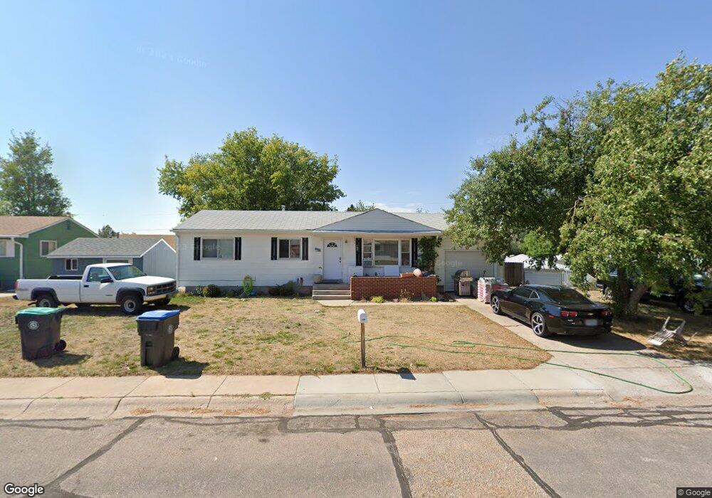
107 J w Ct Cheyenne, WY 82001
Sun Valley NeighborhoodEstimated Value: $304,000 - $345,000
--
Bed
1
Bath
1,008
Sq Ft
$320/Sq Ft
Est. Value
About This Home
This home is located at 107 J w Ct, Cheyenne, WY 82001 and is currently estimated at $322,729, approximately $320 per square foot. 107 J w Ct is a home located in Laramie County with nearby schools including Lebhart Elementary School, Fairview Elementary School, and Johnson Junior High School.
Ownership History
Date
Name
Owned For
Owner Type
Purchase Details
Closed on
Aug 31, 2004
Sold by
Fuqua Lisa M
Bought by
Fuqua Clinton R
Current Estimated Value
Purchase Details
Closed on
Mar 1, 2004
Sold by
Airport Parkway Church Of Christ
Bought by
Fuqua Clinton R and Fuqua Lisa M
Home Financials for this Owner
Home Financials are based on the most recent Mortgage that was taken out on this home.
Original Mortgage
$123,880
Outstanding Balance
$57,815
Interest Rate
5.65%
Mortgage Type
FHA
Estimated Equity
$264,914
Purchase Details
Closed on
Nov 30, 1999
Sold by
Carnes Ben E
Bought by
Airport Parkway Church Of Christ
Create a Home Valuation Report for This Property
The Home Valuation Report is an in-depth analysis detailing your home's value as well as a comparison with similar homes in the area
Home Values in the Area
Average Home Value in this Area
Purchase History
| Date | Buyer | Sale Price | Title Company |
|---|---|---|---|
| Fuqua Clinton R | -- | -- | |
| Fuqua Clinton R | -- | -- | |
| Airport Parkway Church Of Christ | -- | -- |
Source: Public Records
Mortgage History
| Date | Status | Borrower | Loan Amount |
|---|---|---|---|
| Open | Fuqua Clinton R | $123,880 | |
| Closed | Fuqua Clinton R | $4,800 |
Source: Public Records
Tax History Compared to Growth
Tax History
| Year | Tax Paid | Tax Assessment Tax Assessment Total Assessment is a certain percentage of the fair market value that is determined by local assessors to be the total taxable value of land and additions on the property. | Land | Improvement |
|---|---|---|---|---|
| 2025 | $1,725 | $18,893 | $3,547 | $15,346 |
| 2024 | $1,725 | $24,389 | $4,729 | $19,660 |
| 2023 | $1,720 | $24,326 | $4,729 | $19,597 |
| 2022 | $1,655 | $22,935 | $4,729 | $18,206 |
| 2021 | $1,507 | $20,835 | $4,729 | $16,106 |
| 2020 | $1,396 | $19,357 | $4,729 | $14,628 |
| 2019 | $1,298 | $17,983 | $4,729 | $13,254 |
| 2018 | $1,155 | $16,148 | $3,697 | $12,451 |
| 2017 | $1,107 | $15,338 | $2,994 | $12,344 |
| 2016 | $1,004 | $13,904 | $2,944 | $10,960 |
| 2015 | $925 | $12,801 | $2,944 | $9,857 |
| 2014 | $926 | $12,742 | $2,944 | $9,798 |
Source: Public Records
Map
Nearby Homes
- 810 Cahill Dr
- 840 Stevens Dr
- 956 Hillcrest Rd
- 3331 Belaire Ave
- 3428 E 11th St
- 3429 E 12th St
- 711 Monroe Ave
- Lot 2 E 13th St
- 1301 Diamond Ave
- 3002 Homestead Ave
- 4318 E 8th St
- 3251 Fir Dr
- 1426 Adams Ave
- TBD Campstool Rd
- 1175 Long Valley Rd
- 828 Cleveland Ave
- 1442 Monroe Ct
- 1125 Rosebud Rd
- 1330 Cleveland Ave
- 4404 Cottage Ln