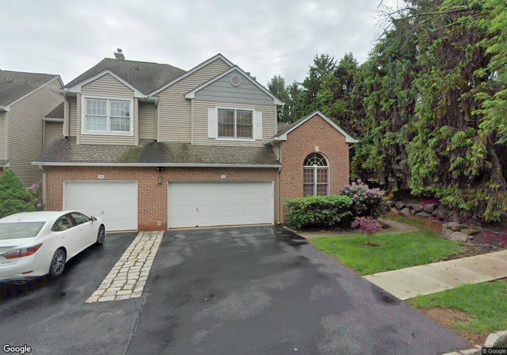
107 Kent Dr Unit C0122 Roseland, NJ 07068
Estimated Value: $704,000 - $895,000
--
Bed
--
Bath
2,152
Sq Ft
$367/Sq Ft
Est. Value
About This Home
This home is located at 107 Kent Dr Unit C0122, Roseland, NJ 07068 and is currently estimated at $789,707, approximately $366 per square foot. 107 Kent Dr Unit C0122 is a home located in Essex County with nearby schools including Lester C. Noecker Elementary School, West Essex Middle School, and West Essex High School.
Ownership History
Date
Name
Owned For
Owner Type
Purchase Details
Closed on
Jun 29, 1999
Sold by
Russo John
Bought by
Abrams David and Abrams Marcia
Current Estimated Value
Home Financials for this Owner
Home Financials are based on the most recent Mortgage that was taken out on this home.
Original Mortgage
$150,000
Outstanding Balance
$42,315
Interest Rate
7.65%
Estimated Equity
$747,392
Purchase Details
Closed on
Oct 7, 1996
Sold by
Bellemead Devel
Bought by
Russo John and Petillo Michael
Home Financials for this Owner
Home Financials are based on the most recent Mortgage that was taken out on this home.
Original Mortgage
$190,000
Interest Rate
8.26%
Create a Home Valuation Report for This Property
The Home Valuation Report is an in-depth analysis detailing your home's value as well as a comparison with similar homes in the area
Home Values in the Area
Average Home Value in this Area
Purchase History
| Date | Buyer | Sale Price | Title Company |
|---|---|---|---|
| Abrams David | $385,000 | -- | |
| Russo John | $328,887 | -- |
Source: Public Records
Mortgage History
| Date | Status | Borrower | Loan Amount |
|---|---|---|---|
| Open | Abrams David | $150,000 | |
| Previous Owner | Russo John | $190,000 |
Source: Public Records
Tax History Compared to Growth
Tax History
| Year | Tax Paid | Tax Assessment Tax Assessment Total Assessment is a certain percentage of the fair market value that is determined by local assessors to be the total taxable value of land and additions on the property. | Land | Improvement |
|---|---|---|---|---|
| 2025 | $11,244 | $633,300 | $260,000 | $373,300 |
| 2024 | $11,244 | $633,300 | $260,000 | $373,300 |
| 2022 | $11,341 | $485,700 | $205,000 | $280,700 |
| 2021 | $11,186 | $485,700 | $205,000 | $280,700 |
| 2020 | $11,147 | $485,700 | $205,000 | $280,700 |
| 2019 | $11,045 | $485,700 | $205,000 | $280,700 |
| 2018 | $10,948 | $485,700 | $205,000 | $280,700 |
| 2017 | $10,943 | $485,700 | $205,000 | $280,700 |
| 2016 | $10,773 | $485,700 | $205,000 | $280,700 |
| 2015 | $10,797 | $485,700 | $205,000 | $280,700 |
| 2014 | $10,496 | $485,700 | $205,000 | $280,700 |
Source: Public Records
Map
Nearby Homes
- 88 Kent Dr Unit C0176
- 26 Kent Dr Unit C0145
- 6 Mulford Ct Unit Address 6
- 6 Mulford Ct Unit C0013
- 18 Harkey Ct Unit 63
- 18 Harkey Ct Unit C0063
- 20 Lenape Dr
- 192 Eagle Rock Ave
- 38 Passaic Ave
- 39 Schweinberg Dr Unit 2039
- 30 Schweinberg Dr
- 144 Passaic Ave
- 4 Williamsburg Dr
- 27 3rd Ave
- 58 Leonard Terrace
- 26 Bovensiepen Ct
- 26 Bovensiepen Ct Unit 3526
- 518 Eagle Rock Ave
- 201 Eagle Rock Ave
- 45 Brandon Ave
- 105 Kent Dr Unit C0121
- 103 Kent Dr Unit C0120
- 101 Kent Dr Unit C0119
- 99 Kent Dr Unit C0118
- 5 Kent Dr Unit C0003
- 1 Kent Dr Unit C0001
- 94 Kent Dr Unit C0123
- 97 Kent Dr Unit C0117
- 108 Kent Dr C0130
- 3 Kent Dr Unit C0002
- 108 Kent Dr Unit C0130
- 96 Kent Dr Unit C0124
- 106 Kent Dr Unit C0129
- 110 Kent Dr Unit C0131
- 112 Kent Dr Unit C0132
- 95 Kent Dr Unit C0116
- 98 Kent Dr Unit C0125
- 93 Kent Dr Unit C0115
- 100 Kent Dr
- 7 Kent Dr Unit C0004