Estimated Value: $227,000 - $278,000
3
Beds
2
Baths
1,700
Sq Ft
$149/Sq Ft
Est. Value
About This Home
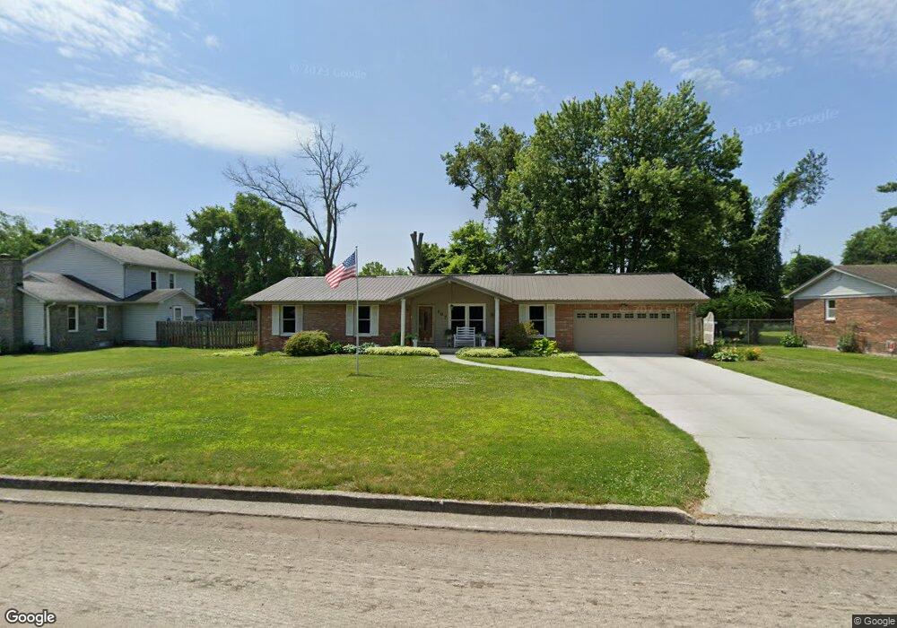
This home is located at 107 Kenton Ave, Berea, KY 40403 and is currently estimated at $253,466, approximately $149 per square foot. 107 Kenton Ave is a home located in Madison County with nearby schools including Berea Community Elementary School, Berea Community Middle School, and Berea Community High School.
Ownership History
Date
Name
Owned For
Owner Type
Purchase Details
Closed on
Aug 17, 2011
Sold by
Holbrook William Todd and Holbrook Erin
Bought by
Nieboer Clyde W
Current Estimated Value
Purchase Details
Closed on
Jun 17, 2005
Sold by
Richardson Barbar
Bought by
Holbrook William Todd
Home Financials for this Owner
Home Financials are based on the most recent Mortgage that was taken out on this home.
Original Mortgage
$121,800
Interest Rate
5.7%
Mortgage Type
New Conventional
Create a Home Valuation Report for This Property
The Home Valuation Report is an in-depth analysis detailing your home's value as well as a comparison with similar homes in the area
Home Values in the Area
Average Home Value in this Area
Purchase History
| Date | Buyer | Sale Price | Title Company |
|---|---|---|---|
| Nieboer Clyde W | $133,000 | None Available | |
| Holbrook William Todd | $121,800 | None Available |
Source: Public Records
Mortgage History
| Date | Status | Borrower | Loan Amount |
|---|---|---|---|
| Previous Owner | Holbrook William Todd | $121,800 |
Source: Public Records
Tax History
| Year | Tax Paid | Tax Assessment Tax Assessment Total Assessment is a certain percentage of the fair market value that is determined by local assessors to be the total taxable value of land and additions on the property. | Land | Improvement |
|---|---|---|---|---|
| 2025 | $1,620 | $185,000 | $0 | $0 |
| 2024 | $1,632 | $185,000 | $0 | $0 |
| 2023 | $1,617 | $170,000 | $0 | $0 |
| 2022 | $1,643 | $170,000 | $0 | $0 |
| 2021 | $1,396 | $144,200 | $0 | $0 |
| 2020 | $1,325 | $140,000 | $0 | $0 |
| 2019 | $1,273 | $133,000 | $0 | $0 |
| 2018 | $1,271 | $133,000 | $0 | $0 |
| 2017 | $1,245 | $133,000 | $0 | $0 |
| 2016 | $1,221 | $133,000 | $0 | $0 |
| 2015 | $1,192 | $96,100 | $0 | $0 |
| 2014 | $1,278 | $133,000 | $0 | $0 |
| 2012 | $1,278 | $133,000 | $133,000 | $0 |
Source: Public Records
Map
Nearby Homes
- 111 Leslie Dr
- 211 Laurel Dr
- 112 Woodford Ave
- 99 Lorraine Ct
- 511 Estill St
- 110 Glade St
- 114 Meadowlark Dr
- 178 Lorraine Ct
- 102 Madison St
- 156 Central Park Ave
- 108 Davis St
- 144 Central Park Ave
- 232 Jackson St
- 145 Central Park Ave
- 318 Jackson St
- 502 N Powell Ave
- 104 Elkin St
- 211 Scruggs St
- 109 Herndon St
- 203 Davis St