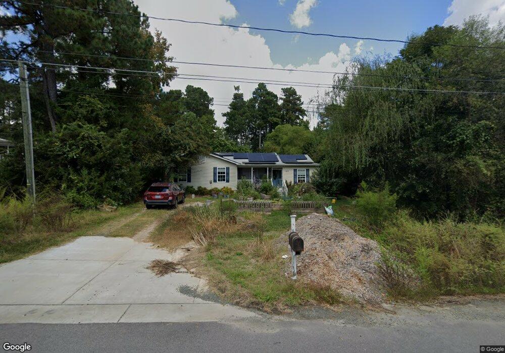
107 Lang St Durham, NC 27703
South Durham NeighborhoodEstimated Value: $355,000 - $395,829
3
Beds
2
Baths
1,568
Sq Ft
$238/Sq Ft
Est. Value
About This Home
This home is located at 107 Lang St, Durham, NC 27703 and is currently estimated at $373,957, approximately $238 per square foot. 107 Lang St is a home located in Durham County with nearby schools including Bethesda Elementary School, John W Neal Middle School, and Southern School of Energy & Sustainability.
Ownership History
Date
Name
Owned For
Owner Type
Purchase Details
Closed on
Jan 14, 2021
Sold by
Vandergrift Joshua Shane and Vandergrift Casi Laine
Bought by
Blew Amy Elizabeth
Current Estimated Value
Home Financials for this Owner
Home Financials are based on the most recent Mortgage that was taken out on this home.
Original Mortgage
$220,000
Outstanding Balance
$196,351
Interest Rate
2.71%
Mortgage Type
New Conventional
Estimated Equity
$177,606
Purchase Details
Closed on
Sep 28, 2012
Sold by
Atwood Reginald and Atwood Brandy
Bought by
Vandergrift Joshua Shane
Home Financials for this Owner
Home Financials are based on the most recent Mortgage that was taken out on this home.
Original Mortgage
$123,717
Interest Rate
3.25%
Mortgage Type
FHA
Purchase Details
Closed on
Aug 3, 2006
Sold by
Atwood Reginald
Bought by
Atwood Reginald and Williams Tracy
Purchase Details
Closed on
Mar 29, 2006
Sold by
Summit Connection Llc
Bought by
Atwood Reginald
Home Financials for this Owner
Home Financials are based on the most recent Mortgage that was taken out on this home.
Original Mortgage
$23,992
Interest Rate
6.25%
Mortgage Type
Fannie Mae Freddie Mac
Create a Home Valuation Report for This Property
The Home Valuation Report is an in-depth analysis detailing your home's value as well as a comparison with similar homes in the area
Home Values in the Area
Average Home Value in this Area
Purchase History
| Date | Buyer | Sale Price | Title Company |
|---|---|---|---|
| Blew Amy Elizabeth | $255,000 | None Available | |
| Vandergrift Joshua Shane | $126,000 | None Available | |
| Atwood Reginald | -- | None Available | |
| Atwood Reginald | $30,000 | None Available |
Source: Public Records
Mortgage History
| Date | Status | Borrower | Loan Amount |
|---|---|---|---|
| Open | Blew Amy Elizabeth | $220,000 | |
| Previous Owner | Vandergrift Joshua Shane | $123,717 | |
| Previous Owner | Atwood Reginald | $23,992 |
Source: Public Records
Tax History
| Year | Tax Paid | Tax Assessment Tax Assessment Total Assessment is a certain percentage of the fair market value that is determined by local assessors to be the total taxable value of land and additions on the property. | Land | Improvement |
|---|---|---|---|---|
| 2025 | $3,607 | $379,479 | $109,500 | $269,979 |
| 2024 | $2,593 | $185,909 | $29,180 | $156,729 |
| 2023 | $2,435 | $185,909 | $29,180 | $156,729 |
| 2022 | $2,379 | $185,909 | $29,180 | $156,729 |
| 2021 | $2,368 | $185,909 | $29,180 | $156,729 |
| 2020 | $2,313 | $185,909 | $29,180 | $156,729 |
| 2019 | $2,313 | $185,909 | $29,180 | $156,729 |
| 2018 | $2,230 | $164,428 | $32,827 | $131,601 |
| 2017 | $2,214 | $164,428 | $32,827 | $131,601 |
| 2016 | $2,139 | $164,428 | $32,827 | $131,601 |
| 2015 | $2,481 | $179,201 | $33,029 | $146,172 |
| 2014 | $2,481 | $179,201 | $33,029 | $146,172 |
Source: Public Records
Map
Nearby Homes
- 111 Lang St
- 913 Wood Chapel Ln
- 909 Wood Chapel Ln
- 910 Wood Meadow Ln
- 4514 Cottendale Dr
- 1222 Flyfish Ave
- 2217 S Miami Blvd
- 1200 Bluewater Way
- 1923 Hinesley Dr
- 4613 Angier Ave
- 1016 Hollis Cir
- 5024 Dragonfly Dr
- 1946 Hinesley Dr
- 1931 Hinesley Dr
- 1937 Hinesley Dr
- 1935 Hinesley Dr
- 1939 Hinesley Dr
- 1936 Hinesley Dr
- 1940 Hinesley Dr
- 1938 Hinesley Dr
- 919 Glenco Rd
- 0 Lang St Unit 719235
- 0 Lang St Unit 719246
- 0 Lang St Unit 719239
- LOT 33 Lang St
- LOTS 33 & Lang St
- LOT 36 Lang St
- LOT 35 Lang St
- 0 Lang St Unit 1783550
- 0 Lang St Unit 1776339
- 0 Lang St Unit 1860043
- 126 Lang St
- 131 Lang St
- 128 Lang St
- 133 Lang St
- 0 Lang St Unit 837851
- 0 Lang St Unit TR2068660
- 0 Lang St Unit 125 1776339
- 0 Lang St Unit 180 1783550
- 0 Lang St Unit 180 1860043
Your Personal Tour Guide
Ask me questions while you tour the home.