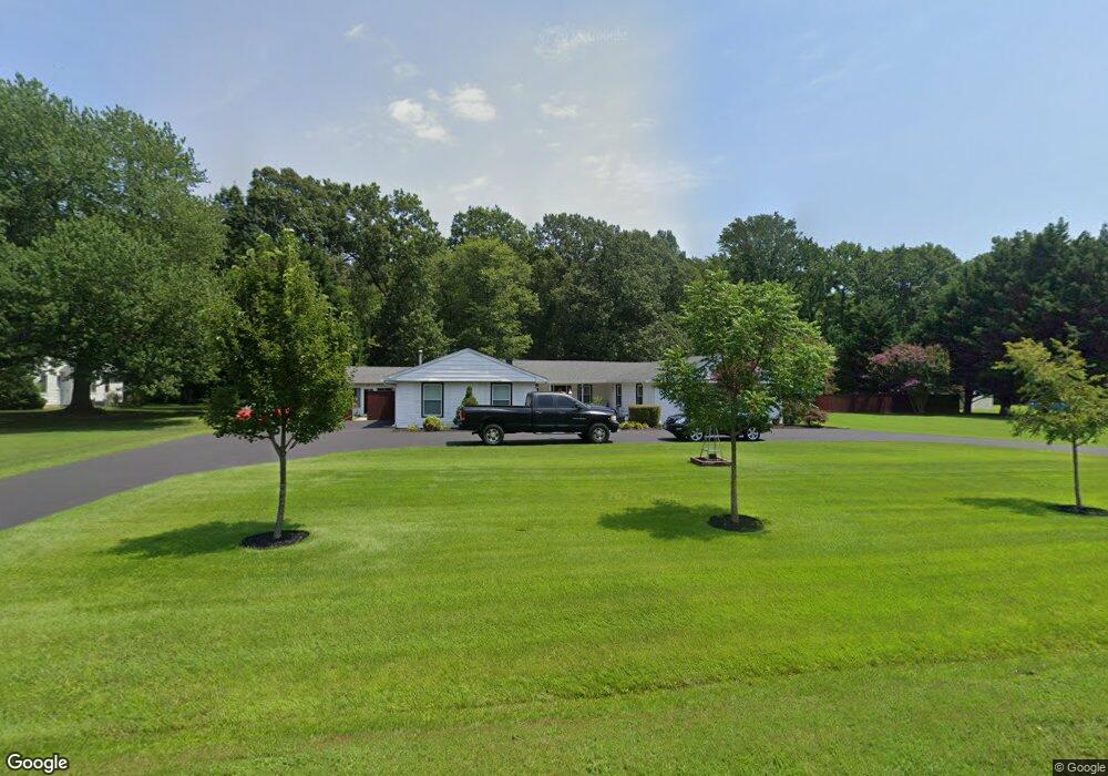
107 Little Neck Rd Stevensville, MD 21666
Estimated Value: $511,000 - $718,000
--
Bed
3
Baths
2,496
Sq Ft
$243/Sq Ft
Est. Value
About This Home
This home is located at 107 Little Neck Rd, Stevensville, MD 21666 and is currently estimated at $606,717, approximately $243 per square foot. 107 Little Neck Rd is a home located in Queen Anne's County with nearby schools including Matapeake Elementary School, Matapeake Middle School, and Kent Island High School.
Ownership History
Date
Name
Owned For
Owner Type
Purchase Details
Closed on
Nov 19, 2003
Sold by
Vandegrift Michael J
Bought by
Vandegrift Michael J and Vandegrift Deena D
Current Estimated Value
Purchase Details
Closed on
Mar 21, 2002
Sold by
Vandegrift Michael J and Vandegrift Karen C
Bought by
Vandegrift Michael J
Purchase Details
Closed on
Oct 15, 1996
Sold by
Cain Dale R and Tucker Elizabeth A
Bought by
Vandegrift Michael J and Vandegrift Karen C
Create a Home Valuation Report for This Property
The Home Valuation Report is an in-depth analysis detailing your home's value as well as a comparison with similar homes in the area
Home Values in the Area
Average Home Value in this Area
Purchase History
| Date | Buyer | Sale Price | Title Company |
|---|---|---|---|
| Vandegrift Michael J | -- | -- | |
| Vandegrift Michael J | -- | -- | |
| Vandegrift Michael J | $179,900 | -- |
Source: Public Records
Mortgage History
| Date | Status | Borrower | Loan Amount |
|---|---|---|---|
| Closed | Vandegrift Michael J | -- |
Source: Public Records
Tax History Compared to Growth
Tax History
| Year | Tax Paid | Tax Assessment Tax Assessment Total Assessment is a certain percentage of the fair market value that is determined by local assessors to be the total taxable value of land and additions on the property. | Land | Improvement |
|---|---|---|---|---|
| 2025 | $4,123 | $434,333 | $0 | $0 |
| 2024 | $3,928 | $412,567 | $0 | $0 |
| 2023 | $3,741 | $390,800 | $180,900 | $209,900 |
| 2022 | $3,706 | $387,033 | $0 | $0 |
| 2021 | $3,700 | $383,267 | $0 | $0 |
| 2020 | $3,700 | $379,500 | $180,900 | $198,600 |
| 2019 | $3,533 | $362,467 | $0 | $0 |
| 2018 | $3,368 | $345,433 | $0 | $0 |
| 2017 | $3,210 | $328,400 | $0 | $0 |
| 2016 | -- | $328,400 | $0 | $0 |
| 2015 | $1,641 | $328,400 | $0 | $0 |
| 2014 | $1,641 | $375,300 | $0 | $0 |
Source: Public Records
Map
Nearby Homes
- 509 Moorings Cir Unit 249
- 312 Topside Dr Unit 223
- 349 Topside Dr
- 736 Moorings Cir Unit 35
- 440 Moorings Cir Unit 85
- 219 Bay City Rd
- 402 Moorings Cir
- 821 Moorings Cir Unit 144
- 423 Victoria Way
- 127 Topside Dr
- 312 William Way
- 858 Moorings Cir Unit 11
- 912 Moorings Cir Unit 8
- 298 Moorings Cir
- 306 Irene Way
- 320 William Way
- 119 Keenan Way
- 260 Moorings Cir Unit 118
- 105 Amanda Frances Ln
- 1000 Chesapeake Dr
- 105 Little Neck Rd
- 109 Little Neck Rd
- 106 Little Neck Rd
- 104 Little Neck Rd
- 103 Little Neck Rd
- 111 Little Neck Rd
- 102 Little Neck Rd
- 101 Little Neck Rd
- 100 Little Neck Rd
- 108 Little Neck Rd
- 115A Little Neck Rd
- 115 Little Neck Rd
- 111 Davidson Dr
- 114 Little Neck Rd
- 117 Little Neck Rd
- 305 Blunt Marsh Ln
- 301 Blunt Marsh Ln
- 114 Davidson Dr
- 107 Davidson Dr
- 112 Davidson Dr