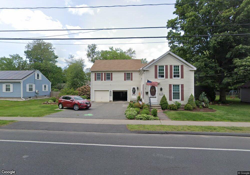
107 Maple St East Longmeadow, MA 01028
Estimated Value: $344,000 - $455,000
4
Beds
2
Baths
2,664
Sq Ft
$155/Sq Ft
Est. Value
About This Home
This home is located at 107 Maple St, East Longmeadow, MA 01028 and is currently estimated at $412,887, approximately $154 per square foot. 107 Maple St is a home located in Hampden County with nearby schools including Meadowbrook Elementary School, Birchland Park Middle School, and East Longmeadow High School.
Ownership History
Date
Name
Owned For
Owner Type
Purchase Details
Closed on
Nov 24, 1998
Sold by
Botta Mark A and Botta Robin H
Bought by
Theberge Rene L and Theberge Marcia A
Current Estimated Value
Home Financials for this Owner
Home Financials are based on the most recent Mortgage that was taken out on this home.
Original Mortgage
$70,000
Interest Rate
6.49%
Mortgage Type
Purchase Money Mortgage
Purchase Details
Closed on
Nov 1, 1989
Sold by
Stewart John T
Bought by
Botta Mark A
Create a Home Valuation Report for This Property
The Home Valuation Report is an in-depth analysis detailing your home's value as well as a comparison with similar homes in the area
Home Values in the Area
Average Home Value in this Area
Purchase History
| Date | Buyer | Sale Price | Title Company |
|---|---|---|---|
| Theberge Rene L | $157,000 | -- | |
| Botta Mark A | $77,000 | -- |
Source: Public Records
Mortgage History
| Date | Status | Borrower | Loan Amount |
|---|---|---|---|
| Open | Botta Mark A | $137,000 | |
| Closed | Botta Mark A | $10,000 | |
| Closed | Botta Mark A | $70,000 | |
| Previous Owner | Botta Mark A | $121,600 |
Source: Public Records
Tax History Compared to Growth
Tax History
| Year | Tax Paid | Tax Assessment Tax Assessment Total Assessment is a certain percentage of the fair market value that is determined by local assessors to be the total taxable value of land and additions on the property. | Land | Improvement |
|---|---|---|---|---|
| 2025 | $6,507 | $352,100 | $106,100 | $246,000 |
| 2024 | $6,179 | $333,300 | $106,100 | $227,200 |
| 2023 | $5,839 | $304,100 | $96,400 | $207,700 |
| 2022 | $5,517 | $271,900 | $87,700 | $184,200 |
| 2021 | $5,425 | $257,600 | $80,900 | $176,700 |
| 2020 | $5,172 | $248,200 | $80,900 | $167,300 |
| 2019 | $4,979 | $242,300 | $78,700 | $163,600 |
| 2018 | $4,799 | $229,200 | $78,700 | $150,500 |
| 2017 | $4,652 | $224,000 | $76,900 | $147,100 |
| 2016 | $4,684 | $221,800 | $74,700 | $147,100 |
| 2015 | $4,596 | $221,800 | $74,700 | $147,100 |
Source: Public Records
Map
Nearby Homes
- 131 Maple St
- 31 Melwood Ave
- 172 Maple St
- 58 Baymor Dr
- Lot 13 Farmer Cir
- Lot 21 Farmer Cir
- 26 High St
- 11 Park Place
- 1 Jeffrey Ln
- LOT 18 Farmer Cir
- Lot 24 Happy Acres Ln
- 109 Somers Rd
- 7 Fields Dr Unit 7
- 19 Fairview St
- 16 Broadleaf Cir
- 13 Feather Reed Ln Unit 13
- 17 Elizabeth St
- 158 Elm St
- 2 Melody Ln
- 49 Fields Dr Unit 49
- 109 Maple St
- 105 Maple St
- 111 Maple St
- 15 Donamor Ln
- 103 Maple St
- 106 Maple St
- 17 Donamor Ln
- 104 Maple St
- 8 Edmund St
- 11 Donamor Ln
- 12 1st St
- 21 Donamor Ln
- 4 Knollwood Dr
- 9 Donamor Ln
- 127 Maple St
- 10 Edmund St
- 14 Edmund St
- 0 Sherry Lane Lot 1 Unit 70745132
- 0 Sherry Lane Lot 1 Unit 70872112
- 0 Sherry Lane Lot 1