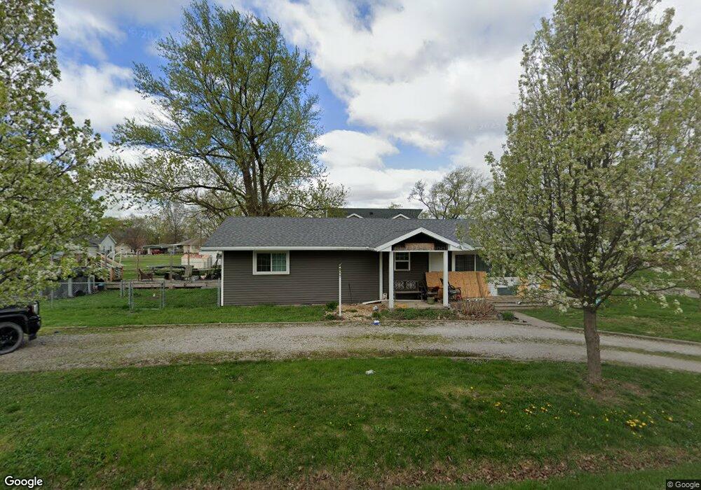
107 N Grove St Middletown, IL 62666
Estimated Value: $88,000 - $126,000
--
Bed
--
Bath
1,352
Sq Ft
$81/Sq Ft
Est. Value
About This Home
This home is located at 107 N Grove St, Middletown, IL 62666 and is currently estimated at $110,166, approximately $81 per square foot. 107 N Grove St is a home located in Logan County with nearby schools including New Holland-Middletown Elementary School and Lincoln Community High School.
Ownership History
Date
Name
Owned For
Owner Type
Purchase Details
Closed on
Apr 25, 2014
Sold by
Tripplett Linda Jane
Bought by
Johnson Paul A and Johnson Chelsea A
Current Estimated Value
Home Financials for this Owner
Home Financials are based on the most recent Mortgage that was taken out on this home.
Original Mortgage
$81,700
Outstanding Balance
$62,381
Interest Rate
4.38%
Mortgage Type
New Conventional
Estimated Equity
$47,785
Create a Home Valuation Report for This Property
The Home Valuation Report is an in-depth analysis detailing your home's value as well as a comparison with similar homes in the area
Home Values in the Area
Average Home Value in this Area
Purchase History
| Date | Buyer | Sale Price | Title Company |
|---|---|---|---|
| Johnson Paul A | $86,000 | -- |
Source: Public Records
Mortgage History
| Date | Status | Borrower | Loan Amount |
|---|---|---|---|
| Open | Johnson Paul A | $81,700 |
Source: Public Records
Tax History Compared to Growth
Tax History
| Year | Tax Paid | Tax Assessment Tax Assessment Total Assessment is a certain percentage of the fair market value that is determined by local assessors to be the total taxable value of land and additions on the property. | Land | Improvement |
|---|---|---|---|---|
| 2024 | $2,342 | $34,200 | $4,480 | $29,720 |
| 2023 | $2,138 | $31,520 | $4,130 | $27,390 |
| 2022 | $2,007 | $29,390 | $3,850 | $25,540 |
| 2021 | $1,894 | $28,260 | $3,700 | $24,560 |
| 2020 | $1,825 | $27,850 | $3,650 | $24,200 |
| 2019 | $1,791 | $27,440 | $3,600 | $23,840 |
| 2018 | $1,814 | $27,440 | $3,600 | $23,840 |
| 2017 | $2,529 | $35,690 | $4,210 | $31,480 |
| 2016 | $2,524 | $35,740 | $4,220 | $31,520 |
| 2015 | $1,796 | $29,560 | $3,670 | $25,890 |
| 2014 | $1,796 | $29,560 | $3,670 | $25,890 |
| 2013 | $1,796 | $27,880 | $3,460 | $24,420 |
| 2012 | $1,796 | $27,790 | $3,450 | $24,340 |
Source: Public Records
Map
Nearby Homes
- 200 N Anson St
- 104 N Logan St
- 204 Logan St
- 16969 Peoria St
- 14 Chicory Dr
- 13 Chicory Dr
- 11-12 Chicory Dr
- 0 Blue Stem Dr
- 305 Kennedy Rd
- 207 E Douglas St
- 137 E Adams St
- 235 W Van Buren St
- 104 E Stahl
- 101 S Bogardus St
- 1598 700th Ave
- 314 S Enterprise St
- 555 W Douglas St
- 3 Governor's Dr
- 1535 E Pine St
- 819 E Chestnut St
- 510 Grove St Unit Grove
- 108 N Anson St
- 700 7th St
- 106 N Groves St
- 106 N Grove St
- 106 N Grove St
- 708 6th St
- 701 W 6th St
- 107 N Anson St
- 107 N Anson St Unit 201 N Anson Street
- 100 S Anson St
- 207 N Groves St
- 208 N Anson St
- 102 S Grove St
- 101 N Anson St
- 102 S Anson St
- 105 S Grove St
- 206 N Grove St
- 103 N Clinton St
- 203 N Clinton St