Estimated Value: $73,000 - $185,000
Studio
1
Bath
1,518
Sq Ft
$80/Sq Ft
Est. Value
About This Home
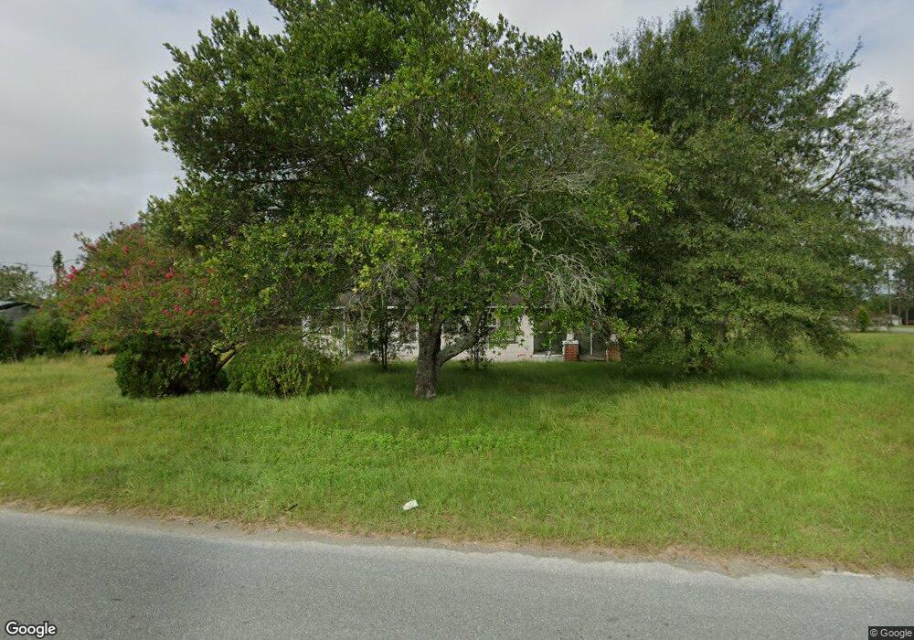
This home is located at 107 Pineview Rd, Alma, GA 31510 and is currently estimated at $121,447, approximately $80 per square foot. 107 Pineview Rd is a home located in Bacon County with nearby schools including Bacon County Primary School, Bacon County Elementary School, and Bacon County Middle School.
Ownership History
Date
Name
Owned For
Owner Type
Purchase Details
Closed on
Feb 11, 2020
Sold by
Rewis Wendell Dewayne
Bought by
Helms David C
Current Estimated Value
Home Financials for this Owner
Home Financials are based on the most recent Mortgage that was taken out on this home.
Original Mortgage
$26,702
Interest Rate
3.6%
Mortgage Type
New Conventional
Purchase Details
Closed on
Jun 27, 1996
Sold by
Spell Audrey R Coth
Bought by
Rewis Wendell Deway
Purchase Details
Closed on
Mar 11, 1996
Sold by
Rewis Thetus
Bought by
Spell Audrey R Coth
Create a Home Valuation Report for This Property
The Home Valuation Report is an in-depth analysis detailing your home's value as well as a comparison with similar homes in the area
Home Values in the Area
Average Home Value in this Area
Purchase History
| Date | Buyer | Sale Price | Title Company |
|---|---|---|---|
| Helms David C | $28,000 | -- | |
| Rewis Wendell Deway | -- | -- | |
| Spell Audrey R Coth | -- | -- |
Source: Public Records
Mortgage History
| Date | Status | Borrower | Loan Amount |
|---|---|---|---|
| Closed | Helms David C | $26,702 |
Source: Public Records
Tax History
| Year | Tax Paid | Tax Assessment Tax Assessment Total Assessment is a certain percentage of the fair market value that is determined by local assessors to be the total taxable value of land and additions on the property. | Land | Improvement |
|---|---|---|---|---|
| 2025 | $517 | $21,680 | $6,240 | $15,440 |
| 2024 | $492 | $18,840 | $4,240 | $14,600 |
| 2023 | $475 | $17,440 | $4,000 | $13,440 |
| 2022 | $379 | $13,920 | $4,000 | $9,920 |
| 2021 | $305 | $12,200 | $4,000 | $8,200 |
| 2020 | $473 | $18,557 | $3,905 | $14,652 |
| 2019 | $669 | $18,557 | $3,905 | $14,652 |
| 2018 | $633 | $17,728 | $3,905 | $13,823 |
| 2017 | $509 | $17,728 | $3,905 | $13,823 |
| 2016 | $623 | $17,728 | $3,905 | $13,823 |
| 2015 | $575 | $17,566 | $3,905 | $13,662 |
| 2014 | $478 | $17,566 | $3,905 | $13,662 |
| 2013 | $478 | $13,267 | $3,230 | $10,037 |
Source: Public Records
Map
Nearby Homes
- 1813 W 12th St
- 596 Teakwood Rd
- 2148 Georgia 32
- 1608 W 4th St
- 600 Teakwood Rd
- 598 Teakwood Rd
- 0 W 4th Street Extension Unit 10650393
- 220 Lakeshore Dr
- 220 Lake Shore Dr
- 166 Grace Loop Unit 1
- 198 Meadow Rd
- 1109 W 4th Street Extension
- 113 Brite Blue Dr
- 0 Lake Lure Dr
- 701 Smallee St
- 606 W 7th St
- 117 Grace Loop Unit 1
- 122 Grace Loop Unit 1
- 108 Daughtry Rd
- 403 S Ware St
- 1930 Ga Highway 32 W
- 1919 Ga Highway 32 W
- 1932 Ga Highway 32 W
- 1936 Ga Highway 32 W
- 1929 Georgia 32
- 1939 Georgia 32
- 1952 Ga Highway 32 W
- 1945 Ga Highway 32 W
- 1911 Ga Highway 32 W
- 145 Pineview Rd Unit 2C
- 145 Pineview Rd
- 1959 Ga Highway 32 W
- 1962 Ga Highway 32 W
- 1963 Georgia 32
- 1963 Ga Highway 32 W
- 123 Industrial Dr
- 1971 Ga Highway 32 W
- 376 Cypress Cir
- 1977 Ga Highway 32 W
- 368 Cypress Cir
Your Personal Tour Guide
Ask me questions while you tour the home.