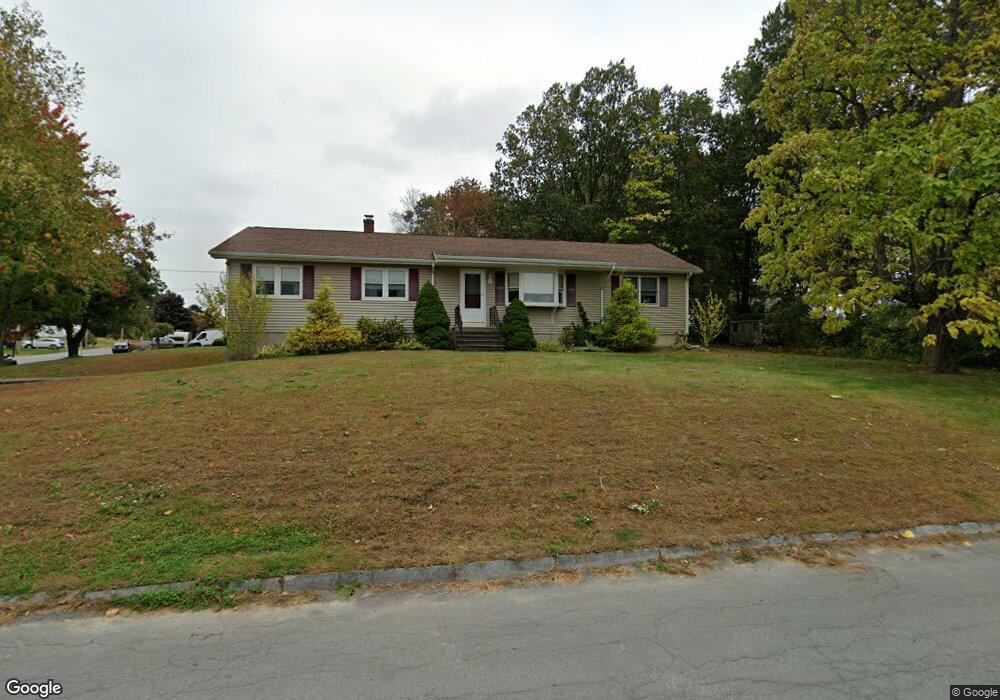
107 Pitman St Methuen, MA 01844
The East End NeighborhoodEstimated Value: $615,135 - $688,000
3
Beds
3
Baths
2,525
Sq Ft
$258/Sq Ft
Est. Value
About This Home
This home is located at 107 Pitman St, Methuen, MA 01844 and is currently estimated at $652,284, approximately $258 per square foot. 107 Pitman St is a home located in Essex County with nearby schools including Methuen High School, Community Day Charter Public School - Gateway, and Esperanza Academy School of Hope.
Ownership History
Date
Name
Owned For
Owner Type
Purchase Details
Closed on
Apr 18, 2023
Sold by
Dagata Richard A and Dagata Donna M
Bought by
107 Pleasant Valley Rt and Dagata
Current Estimated Value
Purchase Details
Closed on
Sep 29, 1986
Bought by
Dagata Richard A and Dagata Donna M
Create a Home Valuation Report for This Property
The Home Valuation Report is an in-depth analysis detailing your home's value as well as a comparison with similar homes in the area
Home Values in the Area
Average Home Value in this Area
Purchase History
| Date | Buyer | Sale Price | Title Company |
|---|---|---|---|
| 107 Pleasant Valley Rt | -- | None Available | |
| 107 Pleasant Valley Rt | -- | None Available | |
| 107 Pleasant Valley Rt | -- | None Available | |
| Dagata Richard A | $152,800 | -- |
Source: Public Records
Mortgage History
| Date | Status | Borrower | Loan Amount |
|---|---|---|---|
| Previous Owner | Dagata Richard A | $153,000 | |
| Previous Owner | Dagata Richard A | $40,000 | |
| Previous Owner | Dagata Richard A | $103,000 | |
| Previous Owner | Dagata Richard A | $108,000 |
Source: Public Records
Tax History
| Year | Tax Paid | Tax Assessment Tax Assessment Total Assessment is a certain percentage of the fair market value that is determined by local assessors to be the total taxable value of land and additions on the property. | Land | Improvement |
|---|---|---|---|---|
| 2025 | $5,560 | $525,500 | $222,200 | $303,300 |
| 2024 | $5,606 | $516,200 | $202,600 | $313,600 |
| 2023 | $5,281 | $451,400 | $180,100 | $271,300 |
| 2022 | $5,070 | $388,500 | $150,100 | $238,400 |
| 2021 | $4,743 | $359,600 | $142,600 | $217,000 |
| 2020 | $4,723 | $351,400 | $142,600 | $208,800 |
| 2019 | $4,355 | $306,900 | $127,600 | $179,300 |
| 2018 | $4,240 | $297,100 | $127,600 | $169,500 |
| 2017 | $4,090 | $279,200 | $127,600 | $151,600 |
| 2016 | $3,902 | $263,500 | $120,100 | $143,400 |
| 2015 | $3,776 | $258,600 | $120,100 | $138,500 |
Source: Public Records
Map
Nearby Homes
- 16 Christopher Dr Unit 38
- 45 Christopher Dr Unit 106
- 17 Ferry Rd
- 6 Ferry Rd
- 10 Fenwick Cir
- 51 Ford St Unit A
- 5 Pilgrim Cir Unit C
- 29 Bradstreet Ave
- 27 Russell Farm Dr
- 183 Farrwood Dr
- 30 Anderson Dr
- 414 Farrwood Dr Unit 414
- 524 Merrimack St
- 128 Pleasant Valley St
- 396 Oak St
- 201 Aberdeen Rd
- 68 Ashford St
- 1 Riverview Blvd Unit 8-203
- 1 Riverview Blvd Unit 1:209
- 1 Riverview Blvd Unit 4-203
Your Personal Tour Guide
Ask me questions while you tour the home.