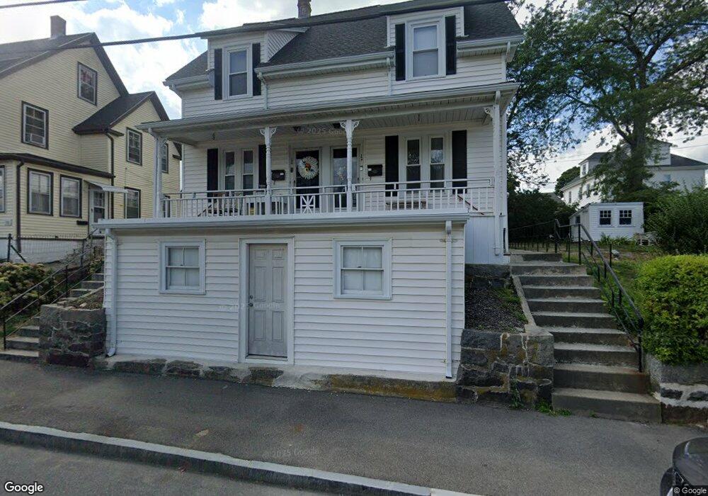
107 Roberts St Quincy, MA 02169
South Quincy NeighborhoodEstimated Value: $813,337 - $918,000
6
Beds
2
Baths
1,950
Sq Ft
$444/Sq Ft
Est. Value
About This Home
This home is located at 107 Roberts St, Quincy, MA 02169 and is currently estimated at $865,084, approximately $443 per square foot. 107 Roberts St is a home located in Norfolk County with nearby schools including South West Middle School, Lincoln-Hancock Community School, and Quincy High School.
Ownership History
Date
Name
Owned For
Owner Type
Purchase Details
Closed on
Sep 24, 2020
Sold by
Darcy Bernard F
Bought by
Anshewitz Joseph J and Anshewitz Labelle-Michelangelo C
Current Estimated Value
Home Financials for this Owner
Home Financials are based on the most recent Mortgage that was taken out on this home.
Original Mortgage
$586,690
Outstanding Balance
$521,829
Interest Rate
2.9%
Mortgage Type
FHA
Estimated Equity
$343,255
Purchase Details
Closed on
Aug 5, 1993
Sold by
Tuffo Extrx Alma G
Bought by
Darcy Bernard F and Darcy Leslie A
Home Financials for this Owner
Home Financials are based on the most recent Mortgage that was taken out on this home.
Original Mortgage
$135,900
Interest Rate
7.29%
Mortgage Type
Purchase Money Mortgage
Create a Home Valuation Report for This Property
The Home Valuation Report is an in-depth analysis detailing your home's value as well as a comparison with similar homes in the area
Home Values in the Area
Average Home Value in this Area
Purchase History
| Date | Buyer | Sale Price | Title Company |
|---|---|---|---|
| Anshewitz Joseph J | $620,000 | None Available | |
| Darcy Bernard F | $151,000 | -- |
Source: Public Records
Mortgage History
| Date | Status | Borrower | Loan Amount |
|---|---|---|---|
| Open | Anshewitz Joseph J | $586,690 | |
| Previous Owner | Darcy Bernard F | $135,900 |
Source: Public Records
Tax History Compared to Growth
Tax History
| Year | Tax Paid | Tax Assessment Tax Assessment Total Assessment is a certain percentage of the fair market value that is determined by local assessors to be the total taxable value of land and additions on the property. | Land | Improvement |
|---|---|---|---|---|
| 2025 | $8,275 | $717,700 | $303,200 | $414,500 |
| 2024 | $7,797 | $691,800 | $288,700 | $403,100 |
| 2023 | $7,407 | $665,500 | $262,400 | $403,100 |
| 2022 | $7,222 | $602,800 | $218,700 | $384,100 |
| 2021 | $6,863 | $565,300 | $218,700 | $346,600 |
| 2020 | $7,190 | $578,400 | $218,700 | $359,700 |
| 2019 | $6,390 | $509,200 | $206,400 | $302,800 |
| 2018 | $6,234 | $467,300 | $191,100 | $276,200 |
| 2017 | $6,422 | $453,200 | $181,900 | $271,300 |
| 2016 | $5,701 | $397,000 | $158,300 | $238,700 |
| 2015 | $5,605 | $383,900 | $158,300 | $225,600 |
| 2014 | $4,896 | $329,500 | $158,300 | $171,200 |
Source: Public Records
Map
Nearby Homes
- 203 Centre St
- 21 Totman St Unit 204
- 21 Totman St Unit 202
- 21 Totman St Unit 309
- 21 Totman St Unit 306
- 21 Totman St Unit 410
- 21 Totman St Unit Model-1
- 21 Totman St Unit 2
- 347 Centre St
- 56 Town Hill St Unit 56
- 94 Brook Rd Unit 3
- 36 Greystone St Unit 36
- 64 Garfield St Unit B
- 21 Arthur St
- 72 Centre St Unit J
- 55 Station St Unit 1
- 57 Buckley St
- 33 Brook Rd
- 72 Federal Ave
- 8 Jackson St Unit B2
- 111-113 Roberts St
- 111 Roberts St Unit 111
- 111 Roberts St
- 113 Roberts St
- 18 Piper St
- 97 Roberts St
- 97 Roberts St
- 97 Roberts St Unit 1
- 97 Roberts St Unit 97
- 115 Roberts St Unit 2
- 14 Piper St
- 14 Piper St Unit 3
- 14 Piper St Unit 2
- 95 Roberts St Unit 95
- 95 Roberts St
- 106 Roberts St
- 117 Roberts St
- 117 Roberts St Unit 2
- 117 Roberts St Unit 1
- 117 Roberts St Unit 3