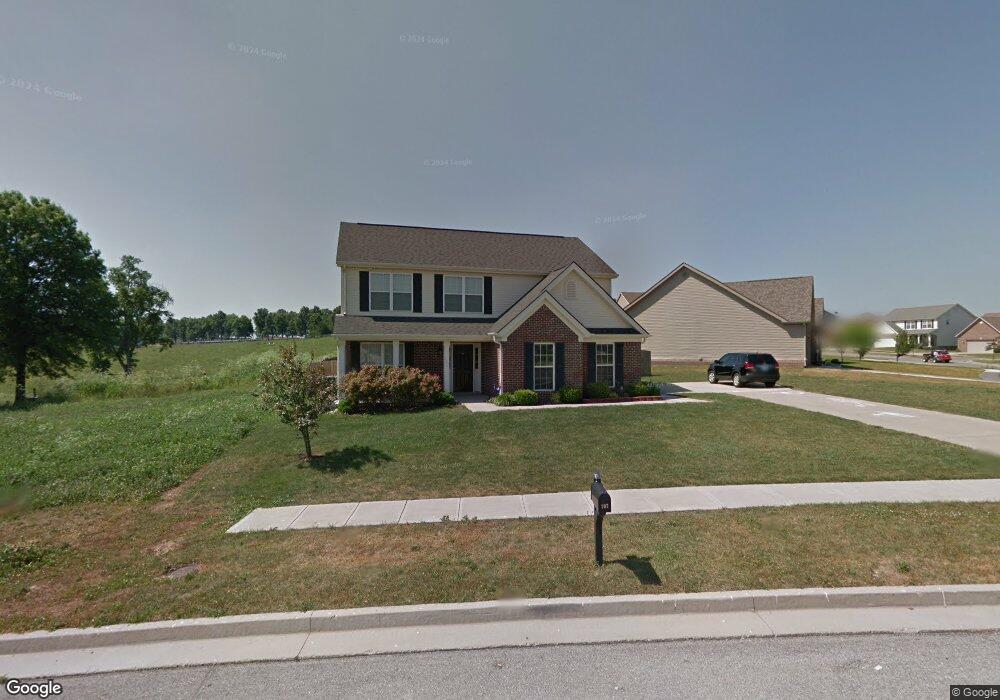
107 Swilcan Bridge Way Georgetown, KY 40324
Estimated Value: $350,356 - $396,000
4
Beds
3
Baths
1,939
Sq Ft
$190/Sq Ft
Est. Value
About This Home
This home is located at 107 Swilcan Bridge Way, Georgetown, KY 40324 and is currently estimated at $367,589, approximately $189 per square foot. 107 Swilcan Bridge Way is a home located in Scott County with nearby schools including Western Elementary School, Royal Spring Middle School, and Scott County High School.
Ownership History
Date
Name
Owned For
Owner Type
Purchase Details
Closed on
Dec 12, 2008
Sold by
Commonwealth Designs Inc
Bought by
Marcum Michael S and Marcum Selena
Current Estimated Value
Home Financials for this Owner
Home Financials are based on the most recent Mortgage that was taken out on this home.
Original Mortgage
$139,500
Interest Rate
6.1%
Mortgage Type
Purchase Money Mortgage
Purchase Details
Closed on
Feb 21, 2008
Sold by
Canewood Llc
Bought by
Commonwealth Designs Inc
Home Financials for this Owner
Home Financials are based on the most recent Mortgage that was taken out on this home.
Original Mortgage
$2,800,000
Interest Rate
5.46%
Mortgage Type
Construction
Create a Home Valuation Report for This Property
The Home Valuation Report is an in-depth analysis detailing your home's value as well as a comparison with similar homes in the area
Purchase History
| Date | Buyer | Sale Price | Title Company |
|---|---|---|---|
| Marcum Michael S | $174,375 | None Available | |
| Commonwealth Designs Inc | $82,000 | None Available |
Source: Public Records
Mortgage History
| Date | Status | Borrower | Loan Amount |
|---|---|---|---|
| Closed | Marcum Michael S | $139,500 | |
| Previous Owner | Commonwealth Designs Inc | $2,800,000 |
Source: Public Records
Tax History
| Year | Tax Paid | Tax Assessment Tax Assessment Total Assessment is a certain percentage of the fair market value that is determined by local assessors to be the total taxable value of land and additions on the property. | Land | Improvement |
|---|---|---|---|---|
| 2025 | $2,445 | $274,500 | $0 | $0 |
| 2024 | $2,469 | $274,500 | $0 | $0 |
| 2023 | $2,366 | $260,900 | $48,000 | $212,900 |
| 2022 | $1,945 | $228,700 | $40,000 | $188,700 |
| 2021 | $2,018 | $214,200 | $40,000 | $174,200 |
| 2020 | $1,674 | $194,800 | $40,000 | $154,800 |
| 2019 | $1,616 | $185,100 | $0 | $0 |
| 2018 | $1,530 | $176,355 | $0 | $0 |
| 2017 | $1,538 | $176,355 | $0 | $0 |
| 2016 | $1,392 | $172,920 | $0 | $0 |
| 2015 | $1,360 | $170,000 | $0 | $0 |
| 2014 | $1,409 | $170,000 | $0 | $0 |
| 2011 | $107 | $173,100 | $0 | $0 |
Source: Public Records
Map
Nearby Homes
- 110 Sea Pines Way
- 135 Shinnecock Hill Dr
- 98 Delissa Dr
- 305 Glass Cir
- 111 Hillside Dr
- 110 Hannsons Path
- 102 Hansons Path
- 111 Paul Revere Dr
- 131 Spring Bluff Dr
- 149 McClelland Springs Dr
- 214 Sturbridge Dr
- 1010 Walker Way
- 208 Montgomery Ave
- 100 Winding Creek Dr
- 144 Winding Creek Dr
- 306 N Water St
- 117 Dale Hollow Dr
- 402 Hiawatha Trail
- 164 Stapleton Way
- 251 W Showalter Dr
- 228 Paynes Landing Blvd
- 105 Swilcan Bridge Way
- 226 Paynes Landing Blvd
- 103 Swilcan Bridge Way Unit 6
- 152 Swilcan Bridge Way
- 104 Swilcan Bridge Way
- 106 Swilcan Bridge Way
- 224 Paynes Landing Blvd
- 102 Swilcan Bridge Way
- 108 Swilcan Bridge Way
- 101 Belvoir Park
- 222 Paynes Landing Blvd
- 222 Paynes Landing Blvd Unit Upstairs
- 100 Swilcan Bridge Way
- 103 Amen Corner Way
- 110 Swilcan Bridge Way
- 105 Amen Corner Way
- 220 Paynes Landing Blvd
- 225 Paynes Landing Blvd
- 107 Amen Corner Way
Your Personal Tour Guide
Ask me questions while you tour the home.