
Seller's Agent in 2025
Timothy Cheney
RE/MAX
(207) 200-3637
1 in this area
68 Total Sales
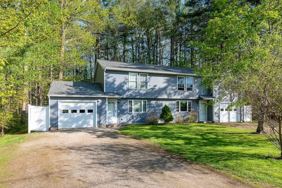
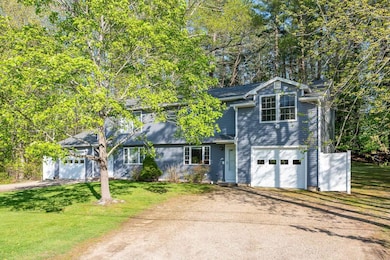
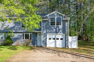
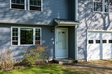
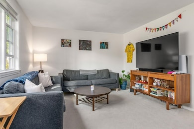
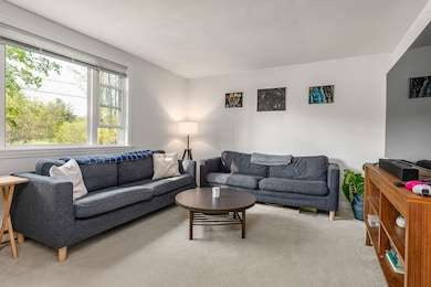
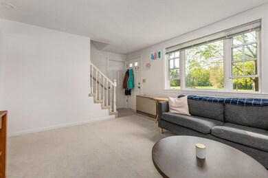
Are you looking for a perfect blend of privacy and tranquility without sacrificing convenience to shopping, entertainment, and commuting routes? With easy access to Dover, the Naval Shipyard, Portsmouth, and I-95, this townhouse style duplex is a great option for anyone looking to owner occupy or have a low maintenance investment property with great cash flow. On the first floor, both units have spacious living rooms along with a large eat-in kitchen and half bath with laundry. In the 3 bedroom unit (107B), you'll find a massive primary that has two closets including a walk-in, two large bedrooms, and a full bath. In the 2 bedroom unit (107A), you'll find a similar layout upstairs with two large bedrooms and full bath. Both units have a private patio to enjoy the serene setting in the private backyard. There's always plenty of parking for residents and their guests since each unit has an attached one car garage and private driveway. Split utilities minimize operating expenses maximizing cash flow. PRE-INSPECTION Report available after viewing the property. Property is occupied so 24 hour notice for all showings.
| Date | Type | Sale Price | Title Company |
|---|---|---|---|
| Warranty Deed | -- | None Available | |
| Warranty Deed | -- | None Available | |
| Warranty Deed | -- | None Available | |
| Warranty Deed | -- | -- | |
| Warranty Deed | -- | -- | |
| Warranty Deed | -- | -- |
| Date | Status | Loan Amount | Loan Type |
|---|---|---|---|
| Open | $485,925 | VA | |
| Previous Owner | $200,000 | New Conventional |
| Date | Event | Price | List to Sale | Price per Sq Ft |
|---|---|---|---|---|
| 07/10/2025 07/10/25 | Sold | $679,900 | -2.2% | $320 / Sq Ft |
| 05/26/2025 05/26/25 | Price Changed | $695,000 | -2.1% | $328 / Sq Ft |
| 05/20/2025 05/20/25 | For Sale | $710,000 | -- | $335 / Sq Ft |
| Year | Tax Paid | Tax Assessment Tax Assessment Total Assessment is a certain percentage of the fair market value that is determined by local assessors to be the total taxable value of land and additions on the property. | Land | Improvement |
|---|---|---|---|---|
| 2024 | $5,492 | $463,500 | $159,300 | $304,200 |
| 2023 | $4,999 | $408,100 | $126,600 | $281,500 |
| 2022 | $4,938 | $408,100 | $126,600 | $281,500 |
| 2021 | $4,595 | $340,400 | $106,400 | $234,000 |
| 2020 | $4,804 | $326,800 | $101,300 | $225,500 |
| 2019 | $4,198 | $285,600 | $101,300 | $184,300 |
| 2018 | $4,198 | $285,600 | $101,300 | $184,300 |
| 2017 | $4,084 | $285,600 | $101,300 | $184,300 |
| 2016 | $4,013 | $285,600 | $101,300 | $184,300 |
| 2015 | $3,998 | $285,600 | $101,300 | $184,300 |
| 2014 | $3,941 | $285,600 | $101,300 | $184,300 |
| 2013 | $3,761 | $285,600 | $101,300 | $184,300 |
Seller's Agent in 2025
Timothy Cheney
RE/MAX
(207) 200-3637
1 in this area
68 Total Sales
Seller Co-Listing Agent in 2025
Marcel Bartley
RE/MAX
(207) 252-1252
7 in this area
56 Total Sales
Buyer's Agent in 2025
Terri Brunette
Carey Giampa, LLC/Rye
(603) 964-7000
3 in this area
14 Total Sales
Source: PrimeMLS
MLS Number: 5041868
APN: ELIO-000070-000018
Disclaimer: Certain information contained herein is derived from information provided by parties other than Homes.com. All information provided is deemed reliable, but is not guaranteed to be accurate and should be independently verified.
![]() Copyright 2025 PrimeMLS, Inc. All rights reserved. This information is deemed reliable, but not guaranteed. The data relating to real estate displayed on this display comes in part from the IDX Program of PrimeMLS. The information being provided is for consumers’ personal, non-commercial use and may not be used for any purpose other than to identify prospective properties consumers may be interested in purchasing.
Copyright 2025 PrimeMLS, Inc. All rights reserved. This information is deemed reliable, but not guaranteed. The data relating to real estate displayed on this display comes in part from the IDX Program of PrimeMLS. The information being provided is for consumers’ personal, non-commercial use and may not be used for any purpose other than to identify prospective properties consumers may be interested in purchasing.