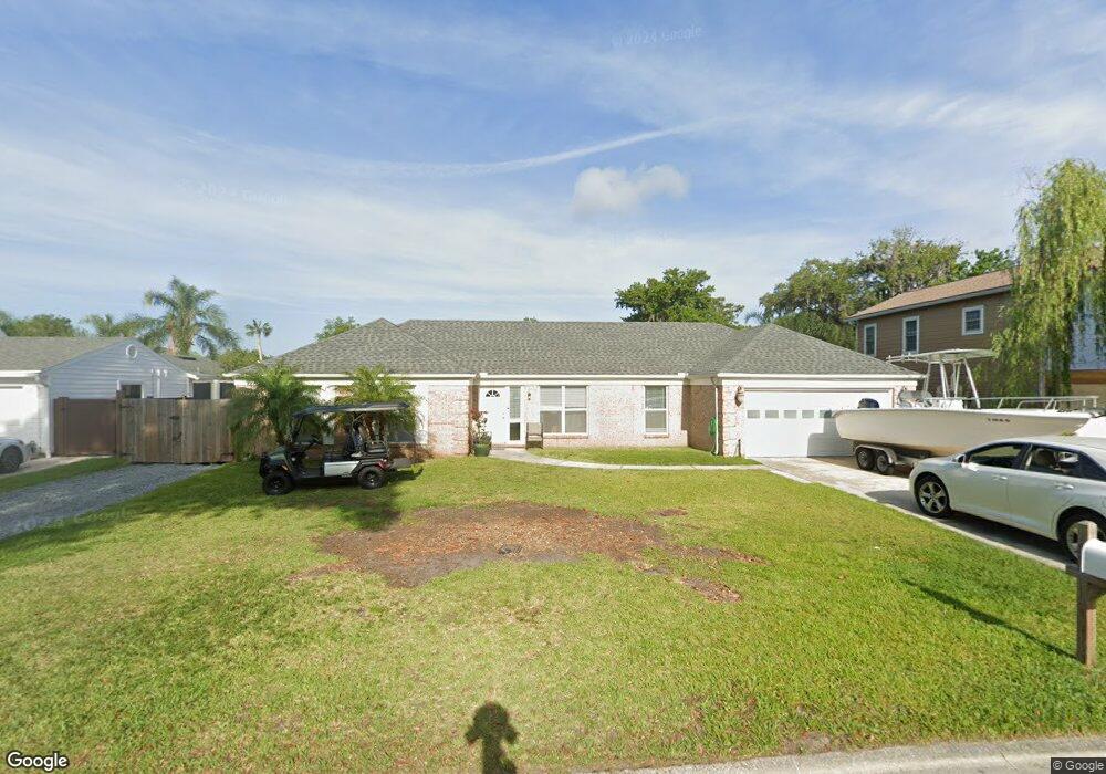
107 Trudee Dee Ln Jacksonville Beach, FL 32250
Estimated Value: $613,000 - $652,976
4
Beds
2
Baths
1,723
Sq Ft
$366/Sq Ft
Est. Value
About This Home
This home is located at 107 Trudee Dee Ln, Jacksonville Beach, FL 32250 and is currently estimated at $629,994, approximately $365 per square foot. 107 Trudee Dee Ln is a home located in Duval County with nearby schools including Seabreeze Elementary School, Duncan U. Fletcher Middle School, and Duncan U. Fletcher High School.
Ownership History
Date
Name
Owned For
Owner Type
Purchase Details
Closed on
Jun 1, 2016
Sold by
Falk Harry Robert
Bought by
Milstead Clinton and Milstead Eva
Current Estimated Value
Home Financials for this Owner
Home Financials are based on the most recent Mortgage that was taken out on this home.
Original Mortgage
$275,000
Outstanding Balance
$223,590
Interest Rate
4.25%
Mortgage Type
Adjustable Rate Mortgage/ARM
Estimated Equity
$406,404
Purchase Details
Closed on
Jul 17, 2001
Sold by
Huber Craig M and Huber Victoria J
Bought by
Falk Harry Robert
Home Financials for this Owner
Home Financials are based on the most recent Mortgage that was taken out on this home.
Original Mortgage
$153,900
Interest Rate
7.1%
Create a Home Valuation Report for This Property
The Home Valuation Report is an in-depth analysis detailing your home's value as well as a comparison with similar homes in the area
Home Values in the Area
Average Home Value in this Area
Purchase History
| Date | Buyer | Sale Price | Title Company |
|---|---|---|---|
| Milstead Clinton | $275,000 | Attorney | |
| Falk Harry Robert | $162,000 | -- |
Source: Public Records
Mortgage History
| Date | Status | Borrower | Loan Amount |
|---|---|---|---|
| Open | Milstead Clinton | $275,000 | |
| Previous Owner | Falk Harry Robert | $153,900 |
Source: Public Records
Tax History Compared to Growth
Tax History
| Year | Tax Paid | Tax Assessment Tax Assessment Total Assessment is a certain percentage of the fair market value that is determined by local assessors to be the total taxable value of land and additions on the property. | Land | Improvement |
|---|---|---|---|---|
| 2025 | $3,817 | $283,046 | -- | -- |
| 2024 | $3,703 | $247,025 | -- | -- |
| 2023 | $3,703 | $239,831 | $0 | $0 |
| 2022 | $3,380 | $232,846 | $0 | $0 |
| 2021 | $3,358 | $226,454 | $0 | $0 |
| 2020 | $3,322 | $223,328 | $0 | $0 |
| 2019 | $3,279 | $218,307 | $0 | $0 |
| 2018 | $3,233 | $214,237 | $0 | $0 |
| 2017 | $3,189 | $209,831 | $0 | $0 |
| 2016 | $4,630 | $242,806 | $0 | $0 |
| 2015 | $4,717 | $241,947 | $0 | $0 |
| 2014 | $3,039 | $194,231 | $0 | $0 |
Source: Public Records
Map
Nearby Homes
- 10 Quail Ln
- 1673 Westwind Dr
- 1645 Westwind Dr
- 1692 Westwind Dr
- 2600 America Ave
- 1420 Constitution Place
- 240 10th St S
- 2950 St Johns Ave Unit 10
- 904 15th Ave S
- 21 Fairway Ln
- 2480 S Beach Pkwy
- 1886 Mourning Dove Ln
- 3421 Sanctuary Blvd
- 776 Bonaire Cir
- 4300 S South Beach Pkwy Unit 3222
- 4300 S South Beach Pkwy Unit 3318
- 4300 S South Beach Pkwy Unit 3217
- 719 14th Ave S
- 1691 Marshside Dr
- 11 Burling Way
- 109 Trudee Dee Ln
- 108 Rita Rae Ln
- 110 Rita Rae Ln
- 106 Rita Rae Ln
- 108 Trudee Dee Ln
- 106 Trudee Dee Ln
- 110 Trudee Dee Ln
- 122 Seagrape Dr
- 104 Rita Rae Ln
- 104 Trudee Dee Ln
- 101 Trudee Dee Ln
- 124 Seagrape Dr
- 120 Seagrape Dr
- 102 Rita Rae Ln
- 126 Seagrape Dr
- 107 Seagrape Dr
- 102 Trudee Dee Ln
- 107 Rita Rae Ln
- 105 Seagrape Dr
- 109 Rita Rae Ln Unit 4