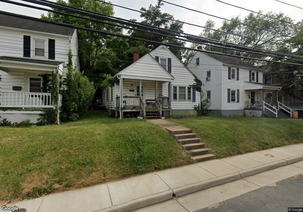
107 W Whitlock Ave Winchester, VA 22601
Estimated Value: $277,052 - $339,000
3
Beds
1
Bath
1,320
Sq Ft
$233/Sq Ft
Est. Value
About This Home
This home is located at 107 W Whitlock Ave, Winchester, VA 22601 and is currently estimated at $307,263, approximately $232 per square foot. 107 W Whitlock Ave is a home located in Winchester City with nearby schools including Garland R. Quarles Elementary School, Daniel Morgan Middle School, and John Handley High School.
Ownership History
Date
Name
Owned For
Owner Type
Purchase Details
Closed on
Aug 31, 2015
Sold by
Stotler Llc
Bought by
Bright Morning Star Properties Llc
Current Estimated Value
Purchase Details
Closed on
Sep 29, 2014
Sold by
Ruth Crum Stotler Investments Llc
Bought by
Stotler Llc
Purchase Details
Closed on
Nov 20, 2012
Sold by
Brill Chad E and Brill Tiffany D
Bought by
Lwc Partners Llc
Create a Home Valuation Report for This Property
The Home Valuation Report is an in-depth analysis detailing your home's value as well as a comparison with similar homes in the area
Home Values in the Area
Average Home Value in this Area
Purchase History
| Date | Buyer | Sale Price | Title Company |
|---|---|---|---|
| Bright Morning Star Properties Llc | -- | None Available | |
| Stotler Llc | -- | None Available | |
| Lwc Partners Llc | $78,000 | None Available |
Source: Public Records
Tax History
| Year | Tax Paid | Tax Assessment Tax Assessment Total Assessment is a certain percentage of the fair market value that is determined by local assessors to be the total taxable value of land and additions on the property. | Land | Improvement |
|---|---|---|---|---|
| 2025 | $1,902 | $239,300 | $60,000 | $179,300 |
| 2024 | $1,785 | $215,100 | $60,000 | $155,100 |
| 2023 | $1,785 | $215,100 | $60,000 | $155,100 |
| 2022 | $1,500 | $161,300 | $60,000 | $101,300 |
| 2021 | $1,500 | $161,300 | $60,000 | $101,300 |
| 2020 | $1,372 | $147,500 | $60,000 | $87,500 |
| 2019 | $1,372 | $147,500 | $60,000 | $87,500 |
| 2018 | $1,259 | $138,300 | $60,000 | $78,300 |
| 2017 | $1,259 | $138,300 | $60,000 | $78,300 |
| 2016 | $1,133 | $124,500 | $60,000 | $64,500 |
| 2015 | $1,133 | $124,500 | $60,000 | $64,500 |
| 2014 | $1,052 | $110,700 | $60,000 | $50,700 |
Source: Public Records
Map
Nearby Homes
- 31 W Whitlock Ave
- 1400 Valley Ave
- 25 W Southwerk St
- 106 W Southwerk St
- 227 Miller St
- 1610 S Loudoun St
- 20 E Hart St
- 1025 S Loudoun St
- 1004 S Cameron St
- 407 Jefferson St
- 19 W Germain St
- 703 S Loudoun St
- 21 E Germain St
- 431 Jefferson St
- 425 Briarmont Dr
- 234 Monteith Dr
- 501 Jefferson St
- 17 E Leicester St
- 601 Hollingsworth Dr
- 414 S Cameron St
- 109 W Whitlock Ave
- 105 W Whitlock Ave
- 111 W Whitlock Ave
- 103 W Whitlock Ave
- 113 W Whitlock Ave
- 101 W Whitlock Ave
- 101 1/2 W Whitlock Ave
- 114 Montague Ave
- 118 Montague Ave
- 110 Montague Ave
- 115 W Whitlock Ave
- 126 Montague Ave
- 102 Montague Ave
- 112-116 W Whitlock Ave
- 130 Montague Ave
- 117 W Whitlock Ave
- 35 W Whitlock Ave
- 134 Montague Ave
- 118 W Whitlock Ave
- 119 W Whitlock Ave
Your Personal Tour Guide
Ask me questions while you tour the home.