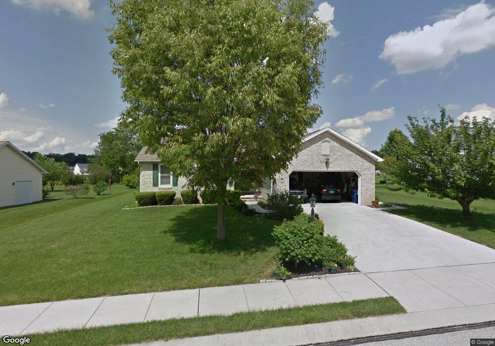
107 Wheaton Dr Unit 127 Littlestown, PA 17340
Estimated Value: $373,334 - $418,000
3
Beds
2
Baths
1,830
Sq Ft
$217/Sq Ft
Est. Value
About This Home
This home is located at 107 Wheaton Dr Unit 127, Littlestown, PA 17340 and is currently estimated at $396,334, approximately $216 per square foot. 107 Wheaton Dr Unit 127 is a home located in Adams County with nearby schools including Rolling Acres El School, Maple Avenue Middle School, and Littlestown Senior High School.
Ownership History
Date
Name
Owned For
Owner Type
Purchase Details
Closed on
Jul 29, 2005
Sold by
Harkiness Mary Ann and Rubin Ruth H
Bought by
Hynson Richard E and Hynson Sandra L
Current Estimated Value
Home Financials for this Owner
Home Financials are based on the most recent Mortgage that was taken out on this home.
Original Mortgage
$203,900
Outstanding Balance
$106,905
Interest Rate
5.63%
Mortgage Type
New Conventional
Estimated Equity
$289,429
Create a Home Valuation Report for This Property
The Home Valuation Report is an in-depth analysis detailing your home's value as well as a comparison with similar homes in the area
Home Values in the Area
Average Home Value in this Area
Purchase History
| Date | Buyer | Sale Price | Title Company |
|---|---|---|---|
| Hynson Richard E | $254,900 | -- |
Source: Public Records
Mortgage History
| Date | Status | Borrower | Loan Amount |
|---|---|---|---|
| Open | Hynson Richard E | $203,900 |
Source: Public Records
Tax History Compared to Growth
Tax History
| Year | Tax Paid | Tax Assessment Tax Assessment Total Assessment is a certain percentage of the fair market value that is determined by local assessors to be the total taxable value of land and additions on the property. | Land | Improvement |
|---|---|---|---|---|
| 2025 | $4,844 | $255,900 | $47,300 | $208,600 |
| 2024 | $4,630 | $255,900 | $47,300 | $208,600 |
| 2023 | $4,538 | $255,900 | $47,300 | $208,600 |
| 2022 | $4,536 | $255,900 | $47,300 | $208,600 |
| 2021 | $4,376 | $255,900 | $47,300 | $208,600 |
| 2020 | $4,313 | $255,900 | $47,300 | $208,600 |
| 2019 | $4,221 | $255,900 | $47,300 | $208,600 |
| 2018 | $4,129 | $255,900 | $47,300 | $208,600 |
| 2017 | $3,987 | $255,900 | $47,300 | $208,600 |
| 2016 | -- | $255,900 | $47,300 | $208,600 |
| 2015 | -- | $255,900 | $47,300 | $208,600 |
| 2014 | -- | $255,900 | $47,300 | $208,600 |
Source: Public Records
Map
Nearby Homes
- 41 Smith Cir
- 1 Hickory Ln
- 567 Lumber St
- 559 Lumber St
- 535 Lumber St
- 43 Ashfield Dr Unit 14
- 211 E King St
- 162 Newark St
- 106 E King St
- 61 E King St
- 440 N Queen St
- 140 Apple Grove Ln Unit 425
- 115 Charles St
- 117 Charles St
- 241 M St
- 0 Locust Dr Unit PAAD2015910
- 20c Locust Dr
- 129 W King St
- 22 Rita Marie Ave
- 58 Windsor Ct
- 109 Wheaton Dr Unit 128
- 108 Wheaton Dr Unit 134
- 103 Wheaton Dr Unit 125
- 110 Wheaton Dr Unit 133
- 111 Wheato Drive
- 111 Wheaton Dr Unit 129
- 106 Wheaton Dr Unit 135
- 112 Wheaton Dr Unit 132
- 104 Wheaton Dr Unit 136
- 101 Wheaton Dr Unit 83
- 706 Parkway Dr Unit 177
- 134 Wheaton Dr Unit 122
- 708 Parkway Dr Unit 178
- 132 Wheaton Dr Unit 121
- 113 Wheaton Dr Unit 130
- 710 Parkway Dr Unit 179
- 136 Wheaton Dr Unit 123
- 102 Wheaton Dr Unit 84
- 130 Wheaton Dr Unit 120
- 138 Wheaton Dr Unit 124