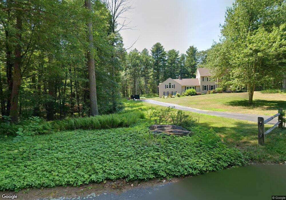
107 Woodbine Rd Carlisle, MA 01741
Estimated Value: $1,256,000 - $2,321,000
4
Beds
3
Baths
3,145
Sq Ft
$518/Sq Ft
Est. Value
About This Home
This home is located at 107 Woodbine Rd, Carlisle, MA 01741 and is currently estimated at $1,630,604, approximately $518 per square foot. 107 Woodbine Rd is a home located in Middlesex County with nearby schools including Carlisle School and Middlesex School.
Ownership History
Date
Name
Owned For
Owner Type
Purchase Details
Closed on
May 5, 1995
Sold by
Cd Associated Bldrs
Bought by
Flynn Sean M and Rusling Kimberly
Current Estimated Value
Create a Home Valuation Report for This Property
The Home Valuation Report is an in-depth analysis detailing your home's value as well as a comparison with similar homes in the area
Home Values in the Area
Average Home Value in this Area
Purchase History
| Date | Buyer | Sale Price | Title Company |
|---|---|---|---|
| Flynn Sean M | $482,363 | -- | |
| Flynn Sean M | $482,363 | -- |
Source: Public Records
Mortgage History
| Date | Status | Borrower | Loan Amount |
|---|---|---|---|
| Open | Flynn Sean M | $240,500 | |
| Closed | Flynn Sean M | $300,000 | |
| Closed | Flynn Sean M | $251,275 |
Source: Public Records
Tax History Compared to Growth
Tax History
| Year | Tax Paid | Tax Assessment Tax Assessment Total Assessment is a certain percentage of the fair market value that is determined by local assessors to be the total taxable value of land and additions on the property. | Land | Improvement |
|---|---|---|---|---|
| 2025 | $14,936 | $1,133,200 | $608,600 | $524,600 |
| 2024 | $14,403 | $1,080,500 | $564,900 | $515,600 |
| 2023 | $13,825 | $977,000 | $529,000 | $448,000 |
| 2022 | $14,124 | $856,000 | $472,900 | $383,100 |
| 2021 | $13,936 | $856,000 | $472,900 | $383,100 |
| 2020 | $14,055 | $765,500 | $368,300 | $397,200 |
| 2019 | $13,803 | $754,700 | $368,300 | $386,400 |
| 2018 | $13,713 | $754,700 | $368,300 | $386,400 |
| 2017 | $5,177 | $754,600 | $368,300 | $386,300 |
| 2016 | $12,979 | $754,600 | $368,300 | $386,300 |
| 2015 | $13,201 | $694,800 | $368,300 | $326,500 |
| 2014 | $12,951 | $694,800 | $368,300 | $326,500 |
Source: Public Records
Map
Nearby Homes
- 8 Kay's Walk Unit 13
- 14 Kay's Walk
- 6 Kay's Walk Unit 6
- 6 Kay's Walk
- 2 Kay's Walk Unit 18
- 4 Kay's Walk Unit 15
- 225 Lowell St
- 3 Kay's Walk
- 15 Kay's Walk
- 1 Kay's Walk Unit 1
- 1 Kay's Walk
- 13 Kay's Walk
- 15 Kay's Walk Unit 4
- 3 Kay's Walk Unit 3
- 383 E Riding Dr
- 373 E Riding Dr
- 282 Brook St
- 12 Martin St
- 1056 Curve St
- 232 Baldwin Rd
- 121 Woodbine Rd
- 398 Lowell St
- 10 Rocky Point
- 5 Rocky Point
- 10 Rocky Point Unit 10
- 93 Woodbine Rd
- 288 Lowell St
- 8 Rocky Point
- 6 Rocky Point
- 8 Rocky Point Unit F
- 3 Rocky Point
- 1 Rocky Point
- 210 Litchfield Dr
- 82 Hillside Rd
- 133 Partridge Ln
- 84 Woodbine Rd
- 114 Woodbine Rd
- 96 Litchfield Dr
- 2 Rocky Point
- 4 Rocky Point Unit II