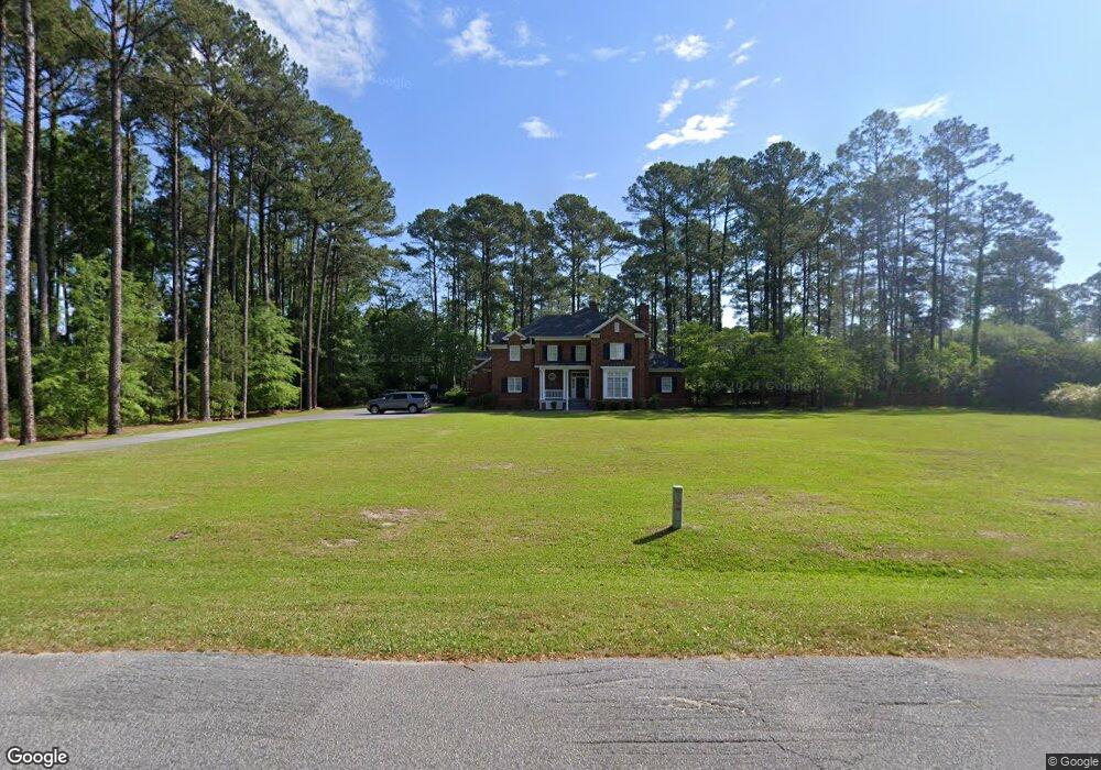
107 Wyandot St Darlington, SC 29532
Estimated Value: $542,848
4
Beds
--
Bath
4,039
Sq Ft
$134/Sq Ft
Est. Value
About This Home
This home is located at 107 Wyandot St, Darlington, SC 29532 and is currently estimated at $542,848, approximately $134 per square foot. 107 Wyandot St is a home located in Darlington County with nearby schools including J.L. Cain Elementary School, J. L. Cain Elementary, and Brunson-Dargan Elementary School.
Ownership History
Date
Name
Owned For
Owner Type
Purchase Details
Closed on
Jul 29, 2024
Sold by
Nesbet Lynn Ervin and Ervin Travis Leigh
Bought by
Jackson William Russell and Jackson Jeanne Denise
Current Estimated Value
Purchase Details
Closed on
Aug 23, 2021
Sold by
Clanton Robert D
Bought by
Thomas Andre Rashad and Thomas Kristian
Home Financials for this Owner
Home Financials are based on the most recent Mortgage that was taken out on this home.
Original Mortgage
$430,000
Interest Rate
2.9%
Mortgage Type
VA
Create a Home Valuation Report for This Property
The Home Valuation Report is an in-depth analysis detailing your home's value as well as a comparison with similar homes in the area
Home Values in the Area
Average Home Value in this Area
Purchase History
| Date | Buyer | Sale Price | Title Company |
|---|---|---|---|
| Jackson William Russell | $25,000 | None Listed On Document | |
| Thomas Andre Rashad | $430,000 | None Available |
Source: Public Records
Mortgage History
| Date | Status | Borrower | Loan Amount |
|---|---|---|---|
| Previous Owner | Thomas Andre Rashad | $430,000 |
Source: Public Records
Tax History Compared to Growth
Tax History
| Year | Tax Paid | Tax Assessment Tax Assessment Total Assessment is a certain percentage of the fair market value that is determined by local assessors to be the total taxable value of land and additions on the property. | Land | Improvement |
|---|---|---|---|---|
| 2024 | $80 | $0 | $0 | $0 |
| 2023 | $4,473 | $0 | $0 | $0 |
| 2022 | $4,473 | $0 | $0 | $0 |
| 2021 | $4,473 | $17,890 | $2,600 | $15,290 |
| 2020 | $2,938 | $17,890 | $2,600 | $15,290 |
| 2019 | $3,029 | $17,890 | $2,600 | $15,290 |
| 2018 | $2,468 | $16,760 | $2,600 | $14,160 |
| 2017 | $2,228 | $16,760 | $2,600 | $14,160 |
| 2016 | $2,172 | $16,760 | $2,600 | $14,160 |
| 2014 | $2,340 | $16,760 | $2,600 | $14,160 |
| 2013 | $2,448 | $16,160 | $4,000 | $12,160 |
Source: Public Records
Map
Nearby Homes
- 108 Wyandot St
- 213 Green Dr
- TBD Green Dr
- 13 Tee Cir
- 14 Tee Cir
- 9 Country Club Rd
- 54 Country Club Rd
- 56 Country Club Rd
- 58 Country Club Rd
- 55 Country Club Rd
- 57 Country Club Rd
- 59 Country Club Rd
- 303 Wyandot St
- 601 Cashua Ferry Rd
- 103 Fulton Rd
- 111 Brittain Rd
- 416 S Warley St
- 106 Lincoln Blvd
- 708 E Hampton St
- 215 S Ervin St
- 111 Wyandot St
- 104 Wyandot St
- 101 Wyandot St
- 102 Wyandot St
- 100 Wyandot St
- 113 Wyandot St
- 110 Wyandot St
- 102 Arapaho Cir
- 226 Country Club Rd
- 112 Wyandot St
- 104 Arapaho Cir
- 224 Country Club Rd
- 105 Arapaho Cir
- 222 Country Club Rd
- 106 Arapaho Cir
- 114 Wyandot St
- Lot 1 Wyandot St
- 117 Wyandot St
- 220 Country Club Rd
- 216 Fairway Dr