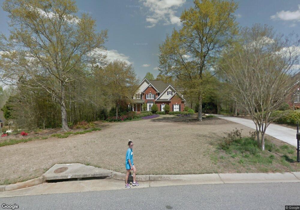
1070 Colorado Bend Bogart, GA 30622
Estimated Value: $818,319 - $901,000
--
Bed
--
Bath
3,521
Sq Ft
$246/Sq Ft
Est. Value
About This Home
This home is located at 1070 Colorado Bend, Bogart, GA 30622 and is currently estimated at $866,080, approximately $245 per square foot. 1070 Colorado Bend is a home located in Oconee County with nearby schools including Malcom Bridge Elementary School, Malcom Bridge Middle School, and North Oconee High School.
Ownership History
Date
Name
Owned For
Owner Type
Purchase Details
Closed on
May 21, 2021
Sold by
Kenneke John F
Bought by
An Dong and Zhu Yingzi
Current Estimated Value
Home Financials for this Owner
Home Financials are based on the most recent Mortgage that was taken out on this home.
Original Mortgage
$399,750
Outstanding Balance
$301,506
Interest Rate
2.9%
Mortgage Type
New Conventional
Estimated Equity
$564,574
Purchase Details
Closed on
Oct 1, 2003
Sold by
Tommy Cruce Construction Co Llc
Bought by
Kenneke John F
Create a Home Valuation Report for This Property
The Home Valuation Report is an in-depth analysis detailing your home's value as well as a comparison with similar homes in the area
Home Values in the Area
Average Home Value in this Area
Purchase History
| Date | Buyer | Sale Price | Title Company |
|---|---|---|---|
| An Dong | $615,000 | -- | |
| Kenneke John F | $360,000 | -- |
Source: Public Records
Mortgage History
| Date | Status | Borrower | Loan Amount |
|---|---|---|---|
| Open | An Dong | $399,750 |
Source: Public Records
Tax History Compared to Growth
Tax History
| Year | Tax Paid | Tax Assessment Tax Assessment Total Assessment is a certain percentage of the fair market value that is determined by local assessors to be the total taxable value of land and additions on the property. | Land | Improvement |
|---|---|---|---|---|
| 2024 | $5,234 | $280,192 | $30,240 | $249,952 |
| 2023 | $5,234 | $261,388 | $23,520 | $237,868 |
| 2022 | $5,006 | $231,651 | $23,520 | $208,131 |
| 2021 | $4,163 | $180,263 | $20,160 | $160,103 |
| 2020 | $4,148 | $179,371 | $20,160 | $159,211 |
| 2019 | $4,067 | $175,862 | $20,160 | $155,702 |
| 2018 | $4,144 | $175,448 | $20,160 | $155,288 |
| 2017 | $3,944 | $167,016 | $18,480 | $148,536 |
| 2016 | $3,841 | $162,648 | $18,480 | $144,168 |
| 2015 | $3,545 | $149,851 | $18,480 | $131,371 |
| 2014 | $3,507 | $144,923 | $18,480 | $126,443 |
| 2013 | -- | $144,488 | $23,520 | $120,968 |
Source: Public Records
Map
Nearby Homes
- 1110 Colorado Bend
- 1191 Arizona Bend
- 1700 Jimmy Daniel Rd
- 1102 Blackstone Ct
- 123 Red Maple Dr
- 1930 New Jimmie Daniel Rd Unit Lot 3
- 1930 New Jimmie Daniel Rd Unit LOT 2
- 310 Marlborough Downs Rd
- 337 Ridge Pointe Dr
- 333 Ridge Pointe Dr
- 353 Ridge Pointe Dr
- 357 Ridge Pointe Dr
- 321 Ridge Pointe Dr
- 361 Ridge Pointe Dr
- 365 Ridge Pointe Dr
- 2080 Orchard Walk
- 1070 Colorado Bend
- 1080 Colorado Bend
- 1060 Colorado Bend
- 1050 Colorado Bend
- 1100 Colorado Bend
- 1100 Colorado Bend
- 1071 Colorado Bend
- 0 Colorado Bend
- 1040 Colorado Bend
- 1040 Colorado Bend
- 1110 Colorado Bend
- 1041 Colorado Bend
- 1030 Colorado Bend
- 1120 Colorado Bend
- 1111 Colorado Bend
- 1101 Colorado Bend
- 1740 Jimmy Daniel Rd
- 1151 Arizona Bend
- 1161 Arizona Bend
- 1131 Arizona Bend