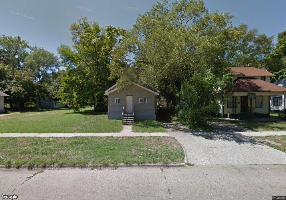
1070 Columbus Ave Benton Harbor, MI 49022
Estimated Value: $78,000 - $107,000
3
Beds
1
Bath
964
Sq Ft
$89/Sq Ft
Est. Value
About This Home
This home is located at 1070 Columbus Ave, Benton Harbor, MI 49022 and is currently estimated at $85,996, approximately $89 per square foot. 1070 Columbus Ave is a home located in Berrien County with nearby schools including Fair Plain Middle School, Benton Harbor High School, and Benton Harbor Charter School Academy.
Ownership History
Date
Name
Owned For
Owner Type
Purchase Details
Closed on
Dec 16, 2024
Sold by
Garrett Darnell
Bought by
Foster Hebony and Garrett Darnell
Current Estimated Value
Purchase Details
Closed on
Jun 17, 2024
Sold by
Garrett Darnell
Bought by
Berrien County Treasurer
Purchase Details
Closed on
Jun 13, 2023
Sold by
Darnell Garrett
Bought by
Berrien County Treasurer
Purchase Details
Closed on
Dec 11, 2008
Sold by
Lane Craig A and Lane Susan
Bought by
Wells Fargo Bank Na
Purchase Details
Closed on
Aug 7, 2003
Sold by
Valentine Willie Edward
Bought by
The Bank Of New York and Ace Securities Corp Home Equity Loan Tru
Purchase Details
Closed on
Jan 9, 1998
Purchase Details
Closed on
Feb 7, 1996
Create a Home Valuation Report for This Property
The Home Valuation Report is an in-depth analysis detailing your home's value as well as a comparison with similar homes in the area
Home Values in the Area
Average Home Value in this Area
Purchase History
| Date | Buyer | Sale Price | Title Company |
|---|---|---|---|
| Foster Hebony | -- | None Listed On Document | |
| Foster Hebony | -- | None Listed On Document | |
| Berrien County Treasurer | -- | -- | |
| Berrien County Treasurer | -- | -- | |
| Wells Fargo Bank Na | $28,900 | None Available | |
| The Bank Of New York | $45,095 | -- | |
| -- | $30,000 | -- | |
| -- | -- | -- |
Source: Public Records
Tax History Compared to Growth
Tax History
| Year | Tax Paid | Tax Assessment Tax Assessment Total Assessment is a certain percentage of the fair market value that is determined by local assessors to be the total taxable value of land and additions on the property. | Land | Improvement |
|---|---|---|---|---|
| 2025 | $1,635 | $21,400 | $0 | $0 |
| 2024 | $568 | $18,800 | $0 | $0 |
| 2023 | $455 | $11,600 | $0 | $0 |
| 2022 | $516 | $8,600 | $0 | $0 |
| 2021 | $1,547 | $11,400 | $700 | $10,700 |
| 2020 | $642 | $11,600 | $0 | $0 |
| 2019 | $986 | $10,400 | $0 | $0 |
| 2018 | $627 | $9,800 | $0 | $0 |
| 2017 | $887 | $14,100 | $0 | $0 |
| 2016 | $1,212 | $14,200 | $0 | $0 |
| 2015 | $855 | $13,700 | $0 | $0 |
| 2014 | $927 | $16,600 | $0 | $0 |
Source: Public Records
Map
Nearby Homes
- 361 E May St
- 1097 Pearl St
- 972 Pearl St
- 349 E Empire Ave
- 1219 Ogden Ave
- 960 Jennings Ave
- 1129 Jennings Ave
- 1267 Broadway
- 833 Pearl St
- 1142 Bishop Ave
- 979 Lavette Ave
- 1301 Superior St
- 1332 Columbus Ave
- 872 Mcalister Ave
- 1045 Broadway
- 171 E Empire Ave
- 960 Union Ave
- 941 Colfax Ave
- 1235 Colfax Ave
- 730 Superior St
- 1078 Columbus Ave
- 1060 Columbus Ave
- 1056 Columbus Ave
- 1086 Columbus Ave
- 1061 Columbus Ave
- 1063 Columbus Ave
- 1081 Columbus Ave
- 1089 Columbus Ave
- 1096 Columbus Ave
- 1050 Columbus Ave
- 1049 Columbus Ave
- 1093 Columbus Ave
- 1040 Columbus Ave
- 361 W May St
- 1073 Pearl St
- 1081 Pearl St
- 1061 Pearl St
- 1039 Columbus Ave
- 1057 Pearl St
- 1089 Pearl St