Estimated Value: $636,000 - $784,000
4
Beds
3
Baths
4,011
Sq Ft
$182/Sq Ft
Est. Value
About This Home
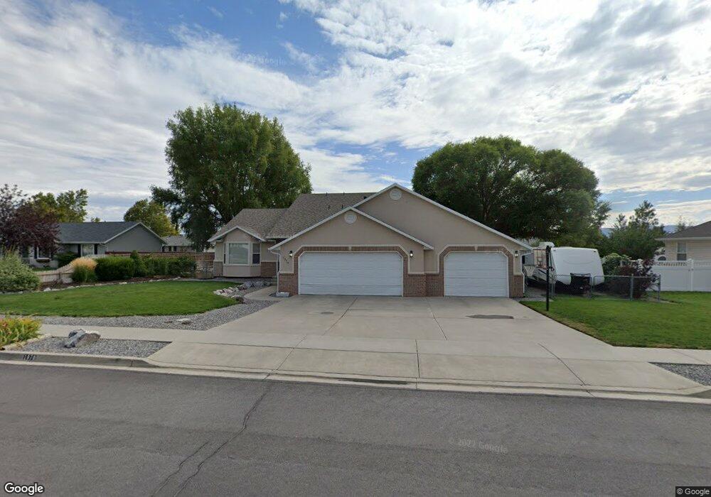
This home is located at 1070 E 2180 N, Lehi, UT 84043 and is currently estimated at $730,645, approximately $182 per square foot. 1070 E 2180 N is a home located in Utah County with nearby schools including Freedom Elementary School, Lehi Junior High School, and Skyridge High School.
Ownership History
Date
Name
Owned For
Owner Type
Purchase Details
Closed on
Mar 21, 2001
Sold by
Ceigler Michael W and Ceigler Bobbelise
Bought by
Day Brian C and Day Paula L
Current Estimated Value
Home Financials for this Owner
Home Financials are based on the most recent Mortgage that was taken out on this home.
Original Mortgage
$183,900
Outstanding Balance
$66,713
Interest Rate
6.97%
Estimated Equity
$663,932
Purchase Details
Closed on
May 25, 1999
Sold by
Lakatos Michael R and Lakatos Michelle C
Bought by
Ceigler Michael W and Ceigler Bobbelise
Home Financials for this Owner
Home Financials are based on the most recent Mortgage that was taken out on this home.
Original Mortgage
$140,200
Interest Rate
6.86%
Purchase Details
Closed on
Apr 6, 1998
Sold by
Bean Robert Benjamin
Bought by
Lakatos Michael R and Lakatos Michelle C
Home Financials for this Owner
Home Financials are based on the most recent Mortgage that was taken out on this home.
Original Mortgage
$204,250
Interest Rate
7.07%
Create a Home Valuation Report for This Property
The Home Valuation Report is an in-depth analysis detailing your home's value as well as a comparison with similar homes in the area
Home Values in the Area
Average Home Value in this Area
Purchase History
| Date | Buyer | Sale Price | Title Company |
|---|---|---|---|
| Day Brian C | -- | First American Title Ins Age | |
| Ceigler Michael W | -- | First American Title Ins Co | |
| Lakatos Michael R | -- | -- |
Source: Public Records
Mortgage History
| Date | Status | Borrower | Loan Amount |
|---|---|---|---|
| Open | Day Brian C | $183,900 | |
| Previous Owner | Ceigler Michael W | $140,200 | |
| Previous Owner | Lakatos Michael R | $204,250 |
Source: Public Records
Tax History
| Year | Tax Paid | Tax Assessment Tax Assessment Total Assessment is a certain percentage of the fair market value that is determined by local assessors to be the total taxable value of land and additions on the property. | Land | Improvement |
|---|---|---|---|---|
| 2025 | $2,847 | $379,555 | -- | -- |
| 2024 | $2,847 | $333,190 | $0 | $0 |
| 2023 | $2,628 | $333,905 | $0 | $0 |
| 2022 | $2,816 | $346,940 | $0 | $0 |
| 2021 | $2,533 | $471,800 | $139,200 | $332,600 |
| 2020 | $2,389 | $439,700 | $128,900 | $310,800 |
| 2019 | $2,298 | $439,700 | $128,900 | $310,800 |
| 2018 | $2,399 | $434,100 | $123,300 | $310,800 |
| 2017 | $2,137 | $205,535 | $0 | $0 |
| 2016 | $2,205 | $196,790 | $0 | $0 |
| 2015 | $2,215 | $187,605 | $0 | $0 |
| 2014 | $1,984 | $167,090 | $0 | $0 |
Source: Public Records
Map
Nearby Homes
- 10365 N 6960 W
- 6756 W 10050 N
- 975 E 2850 N
- 4233 N 325 E Unit 1415
- 1370 N Cedar Hollow Blvd
- 9967 N 6670 W
- 2539 N 300 E
- 1272 N Cedar Hollow Blvd
- 878 E 3050 N
- 1117 N Cedar Hollow Blvd
- 6576 W 9810 N
- 9932 N 6520 W Unit 40
- 9435 N Aspen Hollow Cir
- 2139 N Banbury Ct
- 3239 N 620 E
- 1602 E Center Pointe Dr
- 1610 E Center Pointe Dr
- 1175 E 900 N
- 1618 E Center Pointe Dr
- 3368 N 700 E
- 1044 E 2180 N
- 1092 E 2180 N
- 1067 E Airport Dr
- 1051 E Airport Dr
- 1051 Airport Dr
- 1085 E Airport Dr
- 1085 E Airport Dr
- 1069 E 2180 N
- 1033 E Airport Dr
- 1033 Airport Dr
- 1022 E 2180 N
- 1104 E 2180 N
- 1043 E 2180 N
- 2148 N 1000 E
- 1101 E Airport Dr
- 1091 E 2180 N
- 1101 E Airport Dr
- 1103 E 2180 N
- 1019 E 2180 N
- 2109 N 1100 E
Your Personal Tour Guide
Ask me questions while you tour the home.