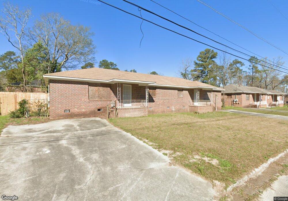
1070 Forsyth Ave Macon, GA 31217
Estimated Value: $71,110 - $150,000
4
Beds
2
Baths
2,100
Sq Ft
$52/Sq Ft
Est. Value
About This Home
This home is located at 1070 Forsyth Ave, Macon, GA 31217 and is currently estimated at $108,528, approximately $51 per square foot. 1070 Forsyth Ave is a home located in Bibb County with nearby schools including Martin Luther King Jr. Elementary School, Appling Middle School, and Northeast High School.
Ownership History
Date
Name
Owned For
Owner Type
Purchase Details
Closed on
Jul 23, 2020
Sold by
Barron Property Group Llc
Bought by
Smith Gregory F and Smith Chaundra D
Current Estimated Value
Purchase Details
Closed on
Feb 25, 2020
Sold by
Macon Bibb County Land Bank Authority
Bought by
Barron Property Group Llc
Purchase Details
Closed on
Jan 9, 2020
Sold by
County Of Bibb
Bought by
Macon Bibb County Land Bank Authority
Purchase Details
Closed on
Jun 30, 1998
Sold by
Perdue Anita Renee
Bought by
Scott Vickie Perdue
Create a Home Valuation Report for This Property
The Home Valuation Report is an in-depth analysis detailing your home's value as well as a comparison with similar homes in the area
Home Values in the Area
Average Home Value in this Area
Purchase History
| Date | Buyer | Sale Price | Title Company |
|---|---|---|---|
| Smith Gregory F | $18,500 | None Available | |
| Barron Property Group Llc | $3,500 | None Available | |
| Macon Bibb County Land Bank Authority | $23,860 | None Available | |
| Scott Vickie Perdue | -- | -- |
Source: Public Records
Tax History Compared to Growth
Tax History
| Year | Tax Paid | Tax Assessment Tax Assessment Total Assessment is a certain percentage of the fair market value that is determined by local assessors to be the total taxable value of land and additions on the property. | Land | Improvement |
|---|---|---|---|---|
| 2025 | $1,568 | $63,796 | $3,476 | $60,320 |
| 2024 | $428 | $16,865 | $898 | $15,967 |
| 2023 | $428 | $16,865 | $898 | $15,967 |
| 2022 | $496 | $16,864 | $3,000 | $13,864 |
| 2021 | $281 | $7,400 | $974 | $6,426 |
| 2020 | $404 | $10,413 | $1,500 | $8,913 |
| 2019 | $440 | $11,237 | $1,334 | $9,903 |
| 2018 | $1,034 | $11,237 | $1,334 | $9,903 |
| 2017 | $872 | $23,285 | $1,334 | $21,951 |
| 2016 | $806 | $23,284 | $1,334 | $21,951 |
| 2015 | $1,140 | $23,284 | $1,334 | $21,951 |
| 2014 | $1,311 | $23,284 | $1,334 | $21,951 |
Source: Public Records
Map
Nearby Homes
- 1030 Forsyth Ave
- 1008 Sunnydale Dr
- 1213 Eastview Ave
- 1209 Eastview Ave
- 909 Johnson St
- 769 Bowman St
- 747 Bowman St
- 1024 Clarks Ln
- 684 Reese St
- 837 Artic Cir
- 875 Artic Place
- 972 Norris St
- 845 Norris St
- 1818 Kinder Kare Dr
- 1840 Kinder Kare Dr
- 857 Mitchell St
- 1204 Norris St
- 725 Schaeffer Place
- 875 Artic Cir
- 4436 Jeffersonville Rd
- 1040 Forsyth Ave
- 1085 Magnolia Dr
- 1340 Payton St
- 1340 Payton St Unit A
- 1116 Forsyth Ave
- 1340 Payton St
- 1109 Magnolia Dr
- 1059 Magnolia Dr
- 1341 Payton St
- 1348 Payton St
- 1347 Payton St
- 1125 Forsyth Ave
- 1025 Forsyth Ave
- 1135 Magnolia Dr
- 1140 Magnolia Dr
- 1080 Magnolia Dr
- 1011 Magnolia Dr
- 1336 Dublin Ave
- 1342 Dublin Ave
- 1060 Magnolia Dr