Estimated Value: $252,200 - $332,000
3
Beds
2
Baths
1,667
Sq Ft
$179/Sq Ft
Est. Value
About This Home
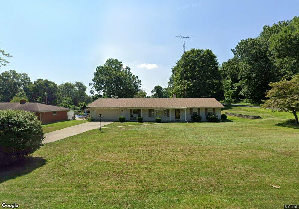
This home is located at 1070 Marquette Rd, Niles, MI 49120 and is currently estimated at $298,800, approximately $179 per square foot. 1070 Marquette Rd is a home located in Berrien County with nearby schools including Ballard Elementary School, Oak Manor Sixth Grade Center, and Ring Lardner Middle School.
Ownership History
Date
Name
Owned For
Owner Type
Purchase Details
Closed on
Apr 11, 2018
Sold by
Teeter Sammy D and Teeter Janette M
Bought by
Hibberd Monica L
Current Estimated Value
Home Financials for this Owner
Home Financials are based on the most recent Mortgage that was taken out on this home.
Original Mortgage
$80,000
Outstanding Balance
$58,156
Interest Rate
4.43%
Mortgage Type
New Conventional
Estimated Equity
$240,644
Purchase Details
Closed on
Aug 26, 2002
Purchase Details
Closed on
Jul 27, 1999
Create a Home Valuation Report for This Property
The Home Valuation Report is an in-depth analysis detailing your home's value as well as a comparison with similar homes in the area
Home Values in the Area
Average Home Value in this Area
Purchase History
| Date | Buyer | Sale Price | Title Company |
|---|---|---|---|
| Hibberd Monica L | $169,000 | Meridian Title Corporation | |
| -- | $100 | -- | |
| -- | $100 | -- |
Source: Public Records
Mortgage History
| Date | Status | Borrower | Loan Amount |
|---|---|---|---|
| Open | Hibberd Monica L | $80,000 |
Source: Public Records
Tax History Compared to Growth
Tax History
| Year | Tax Paid | Tax Assessment Tax Assessment Total Assessment is a certain percentage of the fair market value that is determined by local assessors to be the total taxable value of land and additions on the property. | Land | Improvement |
|---|---|---|---|---|
| 2025 | $2,274 | $126,100 | $0 | $0 |
| 2024 | $1,245 | $124,100 | $0 | $0 |
| 2023 | $1,186 | $108,600 | $0 | $0 |
| 2022 | $1,130 | $91,200 | $0 | $0 |
| 2021 | $1,997 | $84,900 | $6,200 | $78,700 |
| 2020 | $1,971 | $87,500 | $0 | $0 |
| 2019 | $1,936 | $71,700 | $3,700 | $68,000 |
| 2018 | $1,614 | $71,700 | $0 | $0 |
| 2017 | $1,595 | $70,700 | $0 | $0 |
| 2016 | $1,550 | $70,600 | $0 | $0 |
| 2015 | $1,545 | $69,300 | $0 | $0 |
| 2014 | $699 | $64,900 | $0 | $0 |
Source: Public Records
Map
Nearby Homes
- 1695 Signal Point Dr
- 2019 S 3rd St
- 1630 S 3rd St
- 2120 S 3rd St
- 1010 Tomahawk Ln
- V/L Wesaw Rd
- 1640 Forest St
- 1950 S 13th St Unit lot 213
- 1610 Whitetail Cir
- 1831 S 12th St
- 1639 Sioux Trail
- 1680 River Bend Blvd
- 1670 River Bend Blvd
- 1650 Whitetail Cir
- 1225 Country Club Dr
- 1108 Brandywine St
- 1410 Oakdale Ave
- 2710 Weaver Rd
- 1920 S 15th St
- 242 Higgins St
- 1060 Marquette Rd
- 1075 Allouez Dr
- 1065 Allouez Dr
- 1050 Marquette Rd
- 1075 Marquette Rd
- 1715 W River Rd
- 1745 W River Rd
- 1785 W River Rd
- 1775 W River Rd
- 1765 W River Rd
- 1735 W River Rd
- 1475 W River Rd
- 1065 Marquette Rd
- 1055 Allouez Dr
- 1040 Marquette Rd
- 1055 Marquette Rd
- 1045 Allouez Dr
- 1035 Marquette Rd
- 1070 Allouez Dr
- 1060 Allouez Dr